
 Akshay Dinesh
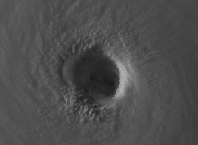
A hurricane’s most violent weather is usually wrapped around a surprisingly organized center. The calm eye may get attention because it looks dramatic on satellite images, but the ring of thunderstorms around it is where the strongest winds and heaviest rain often live. That ring is the eyewall. In the most powerful hurricanes, the eyewall is not always permanent. A storm can build a second ring outside the first, weaken its original core, and reorganize around a larger center.
This process is called an eyewall replacement cycle, and it helps explain why hurricane strength can change in confusing ways. A storm may weaken for a while even though it remains extremely dangerous. Its peak wind speed may fall, yet damaging winds may spread over a wider area. For forecasters, emergency managers, and coastal communities, that distinction matters. A hurricane is not only a number on the Saffir-Simpson scale; it is a moving structure whose size, wind field, rainfall, and timing can shift as the inner core rearranges itself.
The Eyewall Is the Hurricane’s Engine Room
A mature hurricane is powered by warm ocean water, moist rising air, and a pressure pattern that pulls air inward near the surface. As air spirals toward the center, it rises in deep thunderstorms and releases heat as water vapor condenses. The strongest upward motion and tightest pressure gradient often occur in the eyewall, so that is where the most destructive winds tend to be concentrated. The eye itself can be relatively calm because air sinks there, but just outside it, the atmosphere is rising, rotating, and condensing with tremendous force.
The eyewall is not a solid wall. It is a ring of storms, rain, wind, and turbulence, constantly fed by inflow from below and outflow aloft. When that ring is compact and well organized, a hurricane can intensify quickly if the surrounding environment cooperates. Warm water, low wind shear, and a moist atmosphere can help the inner core tighten. But intense hurricanes also create their own internal complications. The same circulation that builds one eyewall can help organize new bands of storms farther out from the center.
That outer organization is the beginning of the replacement problem. Rainbands are normal parts of a hurricane, but under certain conditions one of those bands can wrap nearly all the way around the center and strengthen into a secondary eyewall. NOAA’s Atlantic Oceanographic and Meteorological Laboratory has described this as a second ring of strong winds and heavy rain forming around the main eyewall. Once that outer ring becomes strong enough, it begins competing with the inner eyewall for the storm’s energy supply.
How a Second Eyewall Takes Over
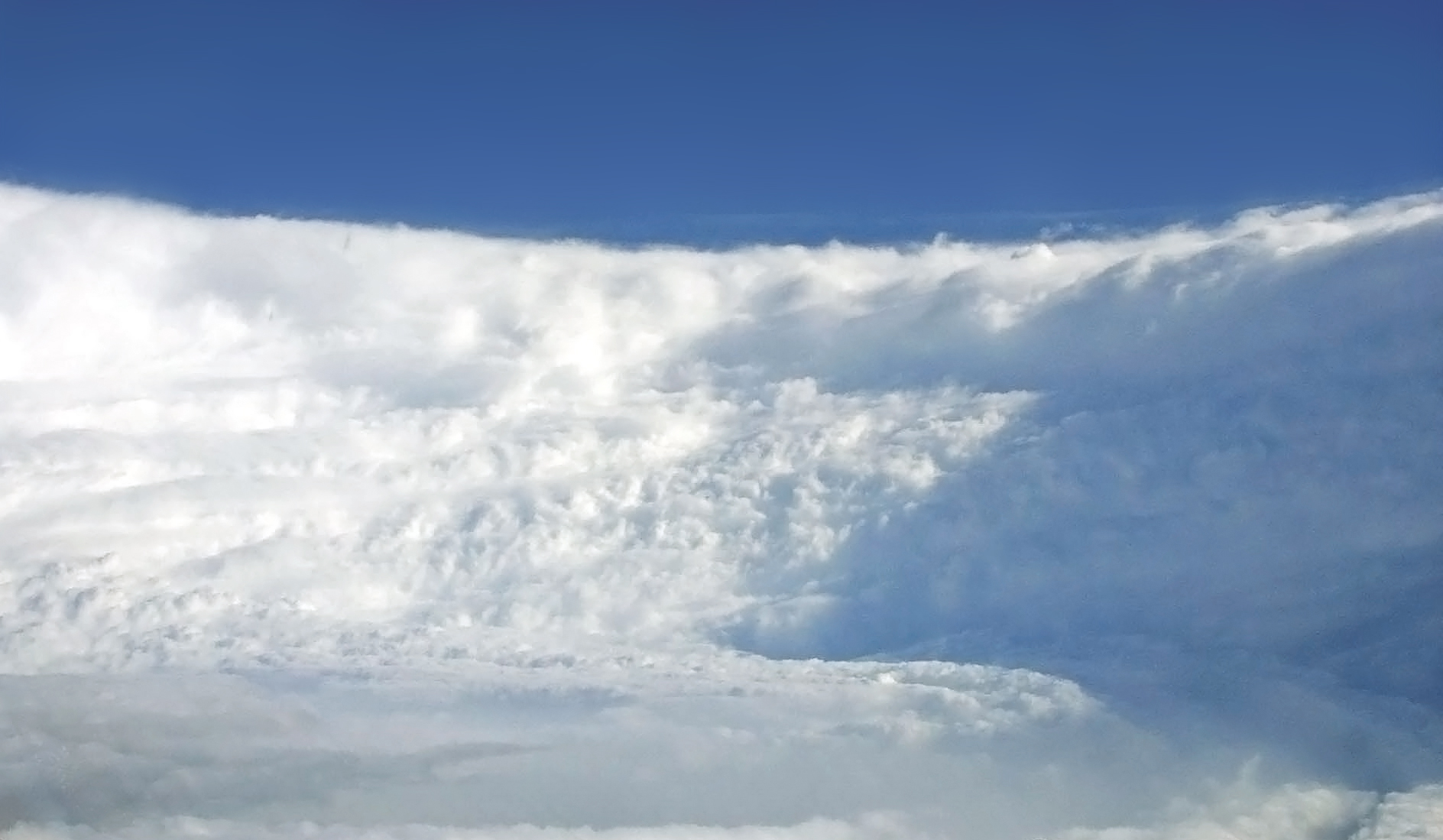
An eyewall replacement cycle usually begins when an outer ring of thunderstorms becomes better organized around an intense tropical cyclone. The new ring may form from rainbands that are already rotating around the storm. At first, the original eyewall is still the main wind maximum. The storm may have a small, tight eye with its fastest winds near the center, while the outer ring is still developing. As the secondary eyewall strengthens, the hurricane briefly has two competing centers of concentrated wind and convection.
The outer eyewall then starts to cut off the inner eyewall’s fuel. Surface air that once spiraled all the way into the original eyewall increasingly rises in the newer, larger ring. The inner eyewall loses some of the moisture and angular momentum it needs to maintain its strongest winds. It weakens, breaks apart, or collapses. Meanwhile, the outer eyewall contracts inward and becomes the new main eyewall. The hurricane has not disappeared; it has reorganized around a larger core.
This explains why a storm’s maximum sustained wind can temporarily drop during the cycle. The tight inner wind maximum is being disrupted before the outer eyewall fully takes over. Yet that weakening can be misleading if people hear only the category change. The hurricane may still be producing destructive winds, heavy rain, storm surge, and dangerous seas. In some cases, the area of hurricane-force or tropical-storm-force winds expands, raising the risk for places farther from the exact center.
The cycle can also set up later re-intensification. Once the outer eyewall becomes dominant, the hurricane may strengthen again if the environment remains favorable. That is why a temporary dip in wind speed does not always mean a storm is becoming harmless. It may be going through a messy internal handoff, then emerging with a broader or newly organized eyewall.
Why Forecasting the Cycle Is So Hard
Eyewall replacement cycles are difficult to predict because they depend on fine details inside the storm. A forecast model has to represent the hurricane’s inner-core structure, the surrounding rainbands, the wind field at different heights, ocean heat below the surface, and the larger atmosphere around the storm. Small errors in any of those pieces can change the timing of a secondary eyewall. The difference of a few hours can matter if a hurricane is approaching land.
NOAA researchers have emphasized that the process is not explained by one simple trigger. Studies using radar from Hurricane Hunter aircraft have shown that different eyewall replacement cycles can form in different ways, even within the same storm. Hurricane Irma in 2017 went through back-to-back replacement cycles in roughly a day to a day and a half, and NOAA analysis found that each cycle had its own contributing factors. That kind of behavior is a reminder that powerful hurricanes are not machines following a single script.
Vertical wind shear can also affect where and how an outer eyewall begins to organize. In one NOAA-supported study, researchers found that a second eyewall could start forming when low-level jets of inward-moving air reached the outer part of the hurricane where rainbands were located. The new eyewall’s first strong winds developed in relation to the direction of the surrounding vertical wind shear. That does not turn every hurricane with shear into a double-eyewall storm, but it shows why forecasters watch both the storm’s internal structure and its environment.
What Changes During a Replacement Cycle
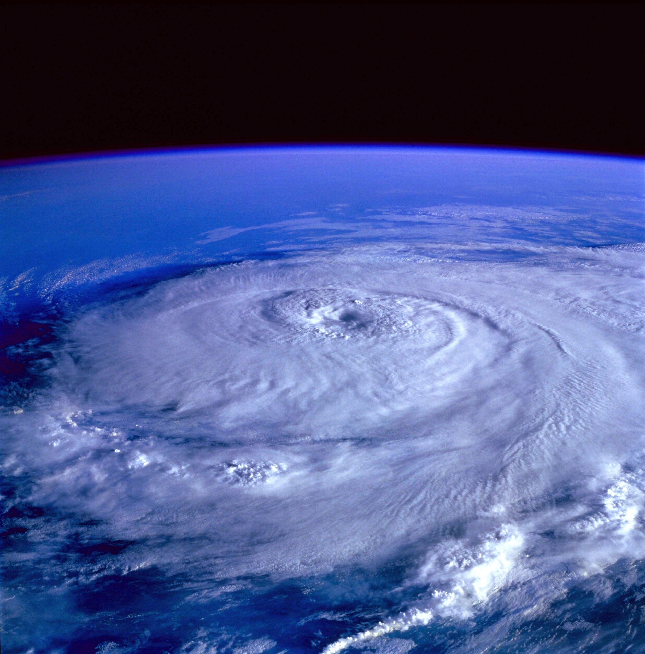
The most obvious change is the location of the strongest winds. Before the cycle, the maximum winds may be packed close to a small eye. During the cycle, that tight wind maximum weakens while the outer eyewall grows stronger. After the cycle, the strongest winds may sit farther from the center than they did before. A storm’s official intensity may fall while its wind field expands, which can change the kind of danger people face.
A larger eyewall can push damaging winds over a broader region. It can also affect storm surge because surge depends not only on peak wind speed, but also on wind duration, storm size, forward speed, coastal shape, and seafloor slope. A wider wind field can move more water toward the coast over a larger area. That is one reason a hurricane that has weakened from an extreme category may still produce life-threatening coastal flooding.
Rainfall patterns can shift too. The eyewall is not the only source of rain in a hurricane, but changes in the inner core can affect where intense bands set up and how long they persist. If the storm slows down, interacts with land, or pulls in extra moisture, flooding can become severe even when wind speeds are no longer increasing. The replacement cycle is only one part of the hazard picture, but it can change the storm’s shape enough to make the forecast more complicated.
There is also a communication challenge. People often hear that a hurricane has weakened and assume the danger has dropped in the same simple proportion. An eyewall replacement cycle can make that assumption wrong. A lower peak wind number may hide a larger area of strong winds. The safest reading is to look at the full forecast: wind extent, surge warnings, rainfall outlook, track uncertainty, timing, and local evacuation guidance.
How Scientists Observe Eyewall Replacement
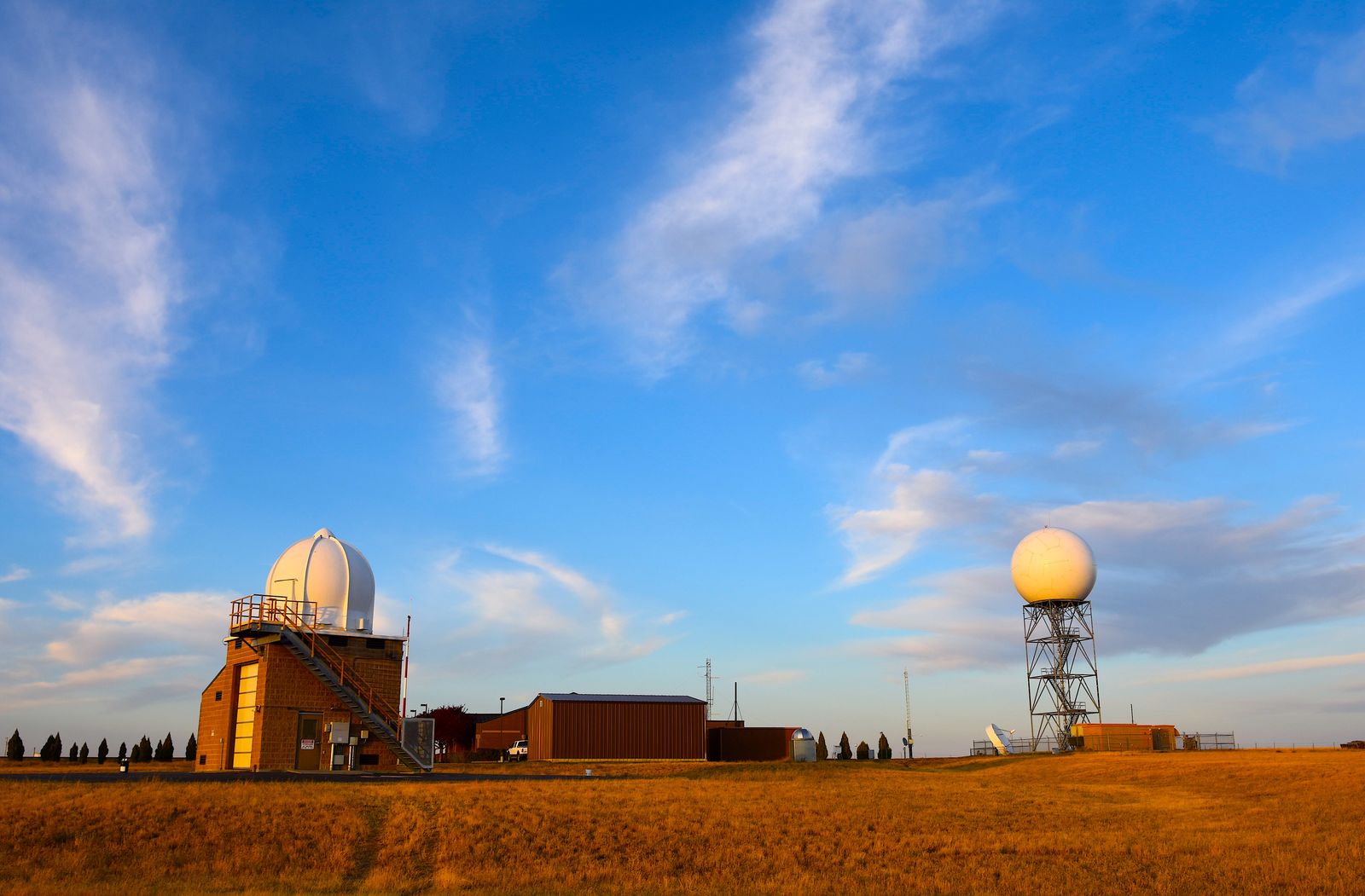
Forecasters rely on several tools to detect replacement cycles. Satellites can show whether a hurricane’s eye is becoming ragged, whether an outer ring of cold cloud tops is wrapping around the center, and whether the storm is developing a double-eyewall appearance. Microwave satellite imagery can sometimes see through upper cloud layers and reveal rings of precipitation that visible images miss. Radar becomes especially valuable when the storm is near land or when aircraft collect inner-core measurements over the ocean.
Hurricane Hunter aircraft add another layer of evidence. NOAA and Air Force Reserve crews can fly through hurricanes and measure pressure, wind, temperature, humidity, and radar structure. Dropsondes released from the aircraft fall through the storm and report vertical profiles of the atmosphere. These observations help forecasters see whether a secondary wind maximum is forming, whether the inner eyewall is weakening, and how the strongest winds are moving outward.
Numerical models are improving, but direct observations remain crucial because eyewall replacement happens at scales that are hard to capture perfectly. NOAA’s Hurricane Research Division works on observations, data assimilation, and modeling so forecasts can better represent the life cycle of tropical cyclones. The practical goal is not just to understand an elegant atmospheric process. It is to give people better warning when a storm’s danger is changing in ways a single category number cannot explain.
The Bigger Lesson Inside the Storm
Eyewall replacement cycles show why hurricanes should be understood as evolving systems, not fixed objects. A storm can weaken and become wider. It can reorganize and strengthen again. Its highest winds can move outward, its surge threat can remain serious, and its rainbands can keep producing dangerous flooding. The name of the process sounds technical, but the effect is practical: the storm’s most dangerous weather may shift while the hurricane is still on the move.
That is why official forecasts include more than a category. Wind-speed categories are useful, but they cannot summarize every hazard. A Category 2 hurricane with a broad wind field, high surge potential, and heavy rain can be more dangerous for some communities than a smaller storm with a higher peak wind somewhere offshore. When an eyewall replacement cycle is underway, the details become even more important.
The eye of a hurricane may look simple from space, a round center inside a spiral. Inside the storm, the structure is far more restless. Eyewalls form, compete, collapse, and rebuild as the atmosphere and ocean exchange energy. Learning that pattern makes hurricane forecasts easier to read with care. A changing number is only one clue; the storm’s structure tells the deeper story.





Add comment