
 Akshay Dinesh
A weather map can make rain look local, as if clouds simply gather over one place and let go. Atmospheric rivers reveal a larger story. Some of the heaviest rain and mountain snow begin far away over the ocean, where warm air gathers water vapor and winds organize that moisture into a long, narrow stream. By the time that stream reaches land, it can deliver enough precipitation to refill reservoirs, build snowpack, swell rivers, close roads, and test the limits of drainage systems.
The phrase sounds dramatic, but it is a practical description. NOAA describes atmospheric rivers as long, narrow regions of the atmosphere that transport water vapor outside the tropics. They are not rivers made of liquid water. They are moving corridors of moist air, often guided by large storm systems and fast winds, carrying invisible vapor until cooling, lifting, and condensation turn that vapor into rain or snow.
A River Made of Vapor, Not Liquid Water
Water is always moving through the air, even on days without clouds. Evaporation lifts water molecules from oceans, lakes, soil, and plants into the atmosphere. Most of the time that moisture is spread out, but certain weather patterns can concentrate it. An atmospheric river forms when winds gather a strong band of water vapor and push it across the ocean or along the edge of a large low-pressure system.
NOAA’s Physical Sciences Laboratory notes that a strong atmospheric river can transport water vapor roughly equal to many times the average flow of liquid water at the mouth of the Mississippi River. That comparison is not meant to say a sky river would fill a channel like a stream on land. It helps show how much moisture can be moving overhead before any of it falls.
These systems often stretch more than 1,000 miles while staying only a few hundred miles wide. That shape matters. A broad storm can spread rain over a huge region, but an atmospheric river can focus moisture into a narrower path for many hours. If that path stalls or repeatedly crosses the same watershed, precipitation totals can rise quickly.
Why Oceans and Winds Build the Moisture Stream
Atmospheric rivers usually draw much of their moisture from warm ocean regions, where evaporation is strong. Warm air can hold more water vapor than cold air, so a moist air mass over the ocean can become a large reservoir of invisible water. Winds then do the transporting. Instead of flowing downhill like a land river, the atmospheric river moves with the air around storm systems.
One well-known version that affects the West Coast is often called the Pineapple Express, a nickname for atmospheric-river events that carry moisture from the central Pacific near Hawaii toward North America. Not every atmospheric river follows that path, and they occur in many parts of the world, but the nickname helps explain the basic ingredients: a warm moisture source, strong winds, and a path toward land.
Scientists often measure atmospheric rivers using integrated vapor transport, or IVT. The term sounds technical, but the idea is simple: it combines how much water vapor is in the air with how strongly the wind is moving that vapor. A humid air mass with weak winds may not deliver much moisture to a coast. Strong winds with little moisture may not produce much rain. IVT looks at the combination that matters for transport.
This is why satellite observations, weather balloons, aircraft measurements, and forecast models are all useful. Satellites can show long plumes of water vapor over the ocean. Forecast models estimate where winds will steer the plume. Measurements inside and near the system help forecasters judge whether the moisture stream is likely to weaken, shift, or aim directly at a vulnerable region.
Mountains Turn Moist Air Into Heavy Rain and Snow
An atmospheric river does not automatically produce extreme precipitation everywhere it travels. The most dramatic effects often happen when moist air is forced upward. Mountain ranges are especially important because they act like ramps. When the moisture stream hits coastal mountains or inland ranges, the air rises, expands, and cools. Cooler air cannot hold as much water vapor, so condensation increases and precipitation begins.
This process, called orographic lifting, is one reason atmospheric rivers are so important for places such as California, Oregon, Washington, British Columbia, Chile, New Zealand, and parts of western Europe. The same plume that looks like a narrow band over the ocean can become heavy coastal rain, deep mountain snow, or both, depending on temperature and elevation.
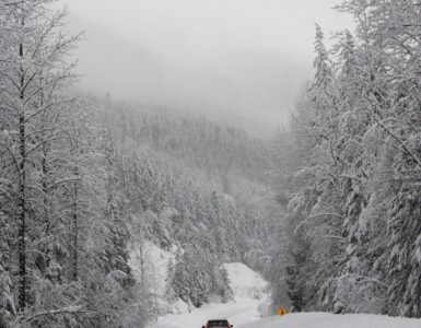
Temperature makes a major difference. If the freezing level is low, much of the water may fall as snow in the mountains, adding to snowpack that can melt gradually later. If the freezing level is high, rain can fall where snow would normally collect. Rain falling on existing snow can speed melting and increase runoff. That is one reason forecasters watch not only how much precipitation is coming, but also where the rain-snow line will sit.
The duration of the event also matters. A short burst may bring useful precipitation with limited damage. A long-lasting atmospheric river can keep feeding moisture into the same slopes and watersheds, raising the risk of landslides, river flooding, road washouts, and overwhelmed storm drains.
Why Atmospheric Rivers Can Be Helpful and Hazardous
Atmospheric rivers are not simply bad weather. In many regions, they provide a large share of annual precipitation. They can ease drought, refill reservoirs, recharge soils, and build mountain snowpack that supports rivers during warmer months. For water managers, farmers, hydropower systems, and ecosystems, a well-timed atmospheric river can be valuable.
The challenge is that the same feature can become dangerous when too much water arrives too quickly. A dry region may need rain, but hard rain on steep slopes, burned land, saturated soil, or paved city surfaces can create fast runoff. Rivers can rise before people expect it. Hillsides can lose stability. Small streams, culverts, and road crossings can become dangerous even when the larger storm looks ordinary from a distance.
This two-sided nature is why researchers at the Center for Western Weather and Water Extremes helped develop an atmospheric-river scale. The scale ranks events from AR1 to AR5 using moisture transport and duration, with lower levels often described as mostly beneficial and higher levels more likely to be hazardous. The categories are not a perfect prediction of local damage, but they give forecasters and the public a clearer way to talk about strength.
Local conditions still decide the real outcome. An AR2 after a dry stretch may be manageable. A similar event after several wet storms may create greater flood risk because the ground and rivers are already loaded with water. Burn scars, steep terrain, tide timing, snow levels, and reservoir operations can all change how the same broad weather pattern affects people on the ground.
How Forecasts Turn a Sky River Into Actionable Information
Forecasting atmospheric rivers has improved because scientists can now observe and model moisture transport more clearly than in the past. Water-vapor satellite imagery helps reveal the plume. Numerical weather models estimate where it may go. Specialized observations over the ocean, including aircraft-based measurements during some events, help reduce uncertainty before the storm reaches land.
Still, small shifts matter. If the core of an atmospheric river moves north or south by even a modest distance, the heaviest precipitation can fall in a different watershed. If the storm slows down, totals may climb. If the freezing level rises, snow storage can turn into faster runoff. Forecast updates are not just changing numbers; they are signs that the water pathway is moving, strengthening, weakening, or changing form.
For readers, the useful lesson is to treat atmospheric-river forecasts as water-cycle forecasts, not just rain forecasts. The key questions are where the moisture stream will aim, how long it will last, how warm the storm will be, and whether the ground, rivers, and drainage systems are already under stress. That is why a forecast may mention rain totals, snow levels, wind, flood watches, river forecasts, and travel impacts all in the same discussion.
The Bigger Water-Cycle Lesson
Atmospheric rivers make the water cycle feel less abstract. Water leaves the ocean as vapor, rides the wind, rises over land, falls as rain or snow, then moves through slopes, rivers, reservoirs, streets, soils, and ecosystems. A single event can connect ocean evaporation to mountain snowpack and city flooding within a few days.
They also show why weather hazards are rarely caused by one factor alone. Moisture matters, but so do wind direction, mountains, temperature, storm speed, soil moisture, land cover, and human infrastructure. Calling the system a river in the sky is memorable, but the real value of the phrase is that it helps people picture movement. The water that falls in one place may have started far across the ocean, carried by winds that turned invisible vapor into one of the most important precipitation engines on Earth.



Add comment