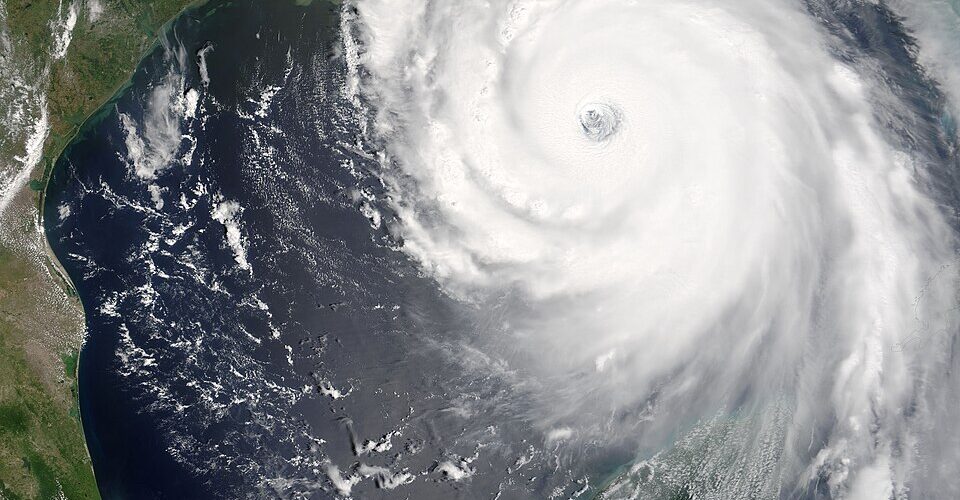
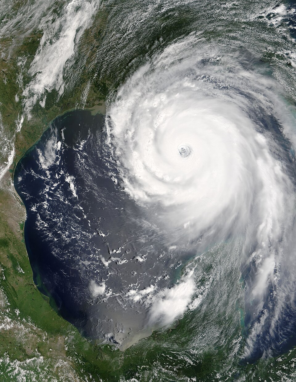
A hurricane may look like one spinning storm on a satellite image, but it is really a tall, organized column of thunderstorms. Air near the ocean surface spirals inward, rises through the storm, releases heat as water vapor condenses, and flows outward high above the clouds. When that column stays stacked, the storm can use warm ocean water efficiently. When winds at different heights push in different directions, the column starts to lean, and the engine runs badly.
That difference in wind speed or wind direction with height is called vertical wind shear. It is one of the main reasons some tropical storms struggle even when ocean water is warm enough for development. NOAA’s 2026 Atlantic hurricane outlook pointed to expected El Nino conditions as one reason for a below-normal season, because El Nino often increases wind shear across parts of the Atlantic and Caribbean. The larger idea is useful far beyond one forecast: hurricanes need more than warm water. They also need an atmosphere that lets them stand upright.
Wind shear is the atmosphere pulling in different directions
Wind shear does not mean the wind is simply strong. A windy day at one level of the atmosphere can still be fairly uniform. Shear appears when the wind changes from one layer to another: perhaps low-level winds move from east to west while upper-level winds race from west to east, or winds at high altitude are much faster than winds near the surface.
For tropical cyclones, forecasters pay special attention to vertical wind shear because a storm reaches high into the troposphere. A developing hurricane is not a flat swirl on the ocean surface. Its thunderstorms may tower tens of thousands of feet upward, and the circulation has to remain connected from bottom to top. If the lower part of the storm is being steered one way while the upper part is being blown another way, the system becomes tilted.
The National Hurricane Center’s mariner guidance lists low vertical wind shear as one of the ingredients that supports tropical cyclone formation. That does not mean a storm must have perfectly calm air above it. Real storms are messy, and some can survive moderate shear for a while. But strong shear makes it much harder for thunderstorms near the center to stay organized, and organization is what separates a loose cluster of storms from a strengthening tropical cyclone.
A hurricane works best when its heat engine stays stacked
Hurricanes are often described as heat engines because they draw energy from warm, moist ocean air. Air near the surface flows inward, rises in deep thunderstorms, and cools as it climbs. Water vapor condenses into cloud droplets and rain, releasing latent heat. That heat helps lower pressure near the center and encourages more air to flow inward, which can increase the storm’s winds.
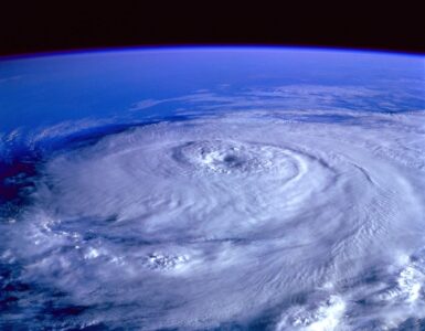
For that cycle to become powerful, the deepest thunderstorms need to keep firing close to the center. That is where pressure falls most effectively and where the storm can build a warm core. A vertically aligned storm keeps its low-level center, middle-level rotation, and upper-level outflow working together. The result can be a tighter circulation, a more symmetrical shape, and sometimes a clear eye.
Wind shear interrupts that arrangement. Upper-level winds can shove the tops of thunderstorms away from the low-level center. The storm may still have bursts of heavy rain, but the strongest clouds are displaced to one side. Instead of wrapping heat around the center, the storm loses some of that heat and moisture downwind. The engine is still present, but it is no longer assembled cleanly.
Shear can tilt the storm and expose its center
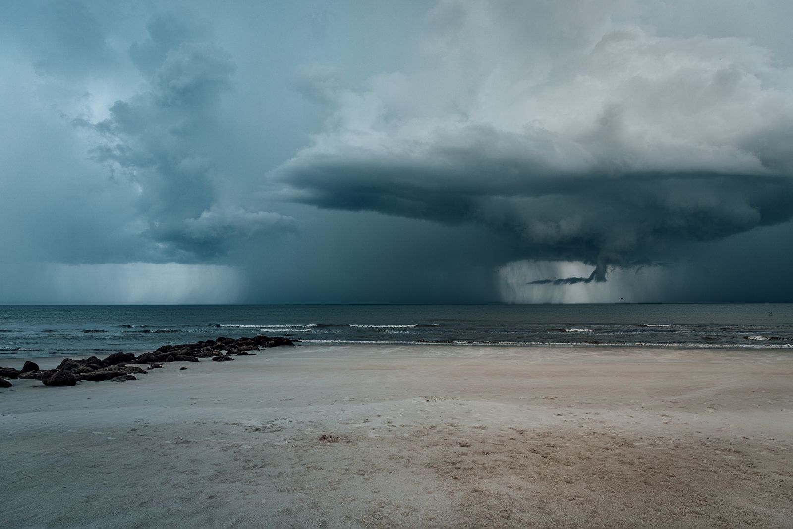
One visible sign of shear is an exposed or partly exposed center. On satellite imagery, the low-level swirl may appear on one side while the brightest, coldest cloud tops sit somewhere else. That pattern tells forecasters that the storm’s thunderstorms are not sitting over the circulation the way a healthy tropical cyclone usually needs them to.
The tilt matters because rising air and condensation are not just decoration around a hurricane. They are part of the storm’s power supply. If thunderstorms keep forming away from the center, the surface circulation may have trouble tightening. Dry air can also work into the storm more easily, especially on the side where shear has stripped away protective thunderstorm cover.
Strong shear can stop a disturbance from becoming a tropical depression in the first place. It can also weaken an existing tropical storm by repeatedly blowing new thunderstorms away before they can wrap around the center. In severe cases, the storm may become lopsided, lose its closed circulation, or degenerate back into a tropical wave.
There is a useful everyday comparison, though it is not perfect. Imagine trying to keep a candle burning while someone blows steadily across the flame from above and another breeze pushes near the base. The heat source may still be there, but the structure is being bent out of shape. A hurricane’s structure is far larger and more complex, yet the basic problem is similar: the storm cannot concentrate its energy where it needs it most.
Some storms survive shear better than others
Wind shear is powerful, but it is not an automatic off switch. A well-developed hurricane can sometimes resist shear better than a weak, disorganized system. Once a storm has a strong inner core, deep thunderstorms around the eyewall, and a broad circulation, it may be able to keep rebuilding convection near the center even while upper-level winds try to push it away.
Storm size and structure matter. A small tropical storm can change quickly because its center and thunderstorm clusters are easier to disrupt. A larger hurricane may have more momentum, but it can still weaken if shear persists. Forecasters also look at moisture, ocean heat content, dry air, steering currents, and land interaction. Shear is one major piece of the environment, not the whole environment.
Direction matters too. Sometimes the shear pushes storms into a pattern that temporarily ventilates the system, helping air leave at high altitude. That is different from destructive shear that rips the thunderstorm canopy away from the center. The same measured shear value can have different effects depending on the storm’s strength, direction of movement, surrounding moisture, and timing.
This is why hurricane intensity forecasting remains difficult. A storm over very warm water may fail to strengthen because the upper atmosphere is hostile. Another storm may sit over only marginal water but briefly intensify because shear relaxes at the right moment. The ocean supplies fuel, but the atmosphere decides how easily the storm can use it.
El Nino can raise shear over the Atlantic
El Nino begins in the tropical Pacific, where sea surface temperatures become warmer than average across the central and eastern Pacific. Its effects do not stay neatly in one ocean. By changing where heat is released into the atmosphere, El Nino can shift wind patterns far away, including the upper-level winds that blow across the Atlantic hurricane basin.
NOAA’s Atlantic Oceanographic and Meteorological Laboratory explains that El Nino generally reduces Atlantic hurricane activity by increasing vertical wind shear across the region. In practical terms, the Pacific pattern can help create a less friendly upper atmosphere over the Atlantic and Caribbean. Tropical disturbances may still roll off Africa or form in the Gulf, but more of them encounter air that makes organization harder.
That does not make a season harmless. A below-normal outlook can still include damaging storms, and it only takes one landfalling hurricane to make a season serious for the people in its path. Seasonal forecasts describe probabilities across a whole basin. Local risk depends on whether a storm forms, where it tracks, how quickly it changes, and how prepared communities are when watches and warnings appear.
Why forecasters watch shear so closely
When meteorologists discuss hurricane outlooks, wind shear is one of the clues that helps explain why a storm may strengthen, weaken, or fail to organize. Satellite images show cloud patterns, but forecasters also use aircraft data, weather balloons, ocean observations, and computer models to understand the atmosphere around the storm. They are not only asking where the storm is now. They are asking what kind of environment it will enter next.
A storm moving into lower shear over warm water may have a chance to organize quickly, especially if its center is already well defined. A storm moving into stronger shear may become ragged even if it still produces heavy rain and dangerous surf. That is one reason intensity forecasts can change as the atmosphere changes around the storm.
For readers watching a forecast, the useful lesson is not to memorize one ingredient. Warm water, moisture, low shear, and existing rotation all work together. If one ingredient is missing, development may slow. If several line up at once, a disturbance can become more concerning. Wind shear is especially important because it can decide whether a storm’s energy stays concentrated near the center or gets pulled apart before the cyclone has a chance to strengthen.
Hurricanes may be famous for their spinning shape, but their real strength depends on vertical organization. Wind shear attacks that organization directly. By tilting the storm, separating thunderstorms from the center, and disrupting the flow of heat and moisture, it can turn a promising tropical system into a lopsided swirl of clouds. That is why a quiet-looking line in a forecast discussion can matter so much: the winds above a storm often decide what the storm below can become.


Add comment