A Red Flag Warning can feel confusing because it often appears before anyone sees flames. It is not the same thing as an evacuation order, and it does not always mean a wildfire is already burning nearby. It means the weather has entered a dangerous window: if a fire starts, it may be much harder to control than it would be on an ordinary dry day.
The National Weather Service uses Red Flag Warnings to call attention to critical fire weather. The warning is especially important because wildfires do not depend on heat alone. A hot afternoon matters, but the most dangerous fire days usually combine dry vegetation, low humidity, strong wind, and sometimes dry lightning or unstable air. That combination can turn a spark from a vehicle, equipment, campfire, downed power line, or lightning strike into a fast-moving fire.
Why the warning comes before the fire
Most weather warnings are tied to something people can picture right away. A tornado warning points to a storm that may already be rotating. A flood warning points to water rising or expected to rise. A Red Flag Warning is different because it focuses on the conditions that can make a fire grow quickly after ignition.
That timing is the point. Fire crews, land managers, power utilities, parks, construction crews, farmers, and homeowners all need time to reduce risky activity before a fire starts. The warning gives people a chance to pause burning, rethink outdoor equipment use, secure trailer chains, avoid parking on dry grass, and follow local restrictions. Once a wind-driven fire is moving, prevention has already missed its best moment.
The National Weather Service glossary describes a Red Flag Warning as a fire-weather term used when forecasters have high confidence that conditions may result in extreme burning conditions. Some local forecast offices describe the warning as a signal for land managers, but many offices also emphasize public action because human-caused ignitions are common. The warning is not just a technical note for specialists. It is a public heads-up that ordinary sparks deserve unusual attention.
The three ingredients forecasters watch
Red Flag criteria vary by region because forests, grasslands, deserts, mountains, and coastal areas do not burn in the same way. A windy dry day in one place may be ordinary, while the same numbers somewhere else may be dangerous because local vegetation has dried out. That is why National Weather Service offices set local criteria instead of using one identical rule for the whole country.
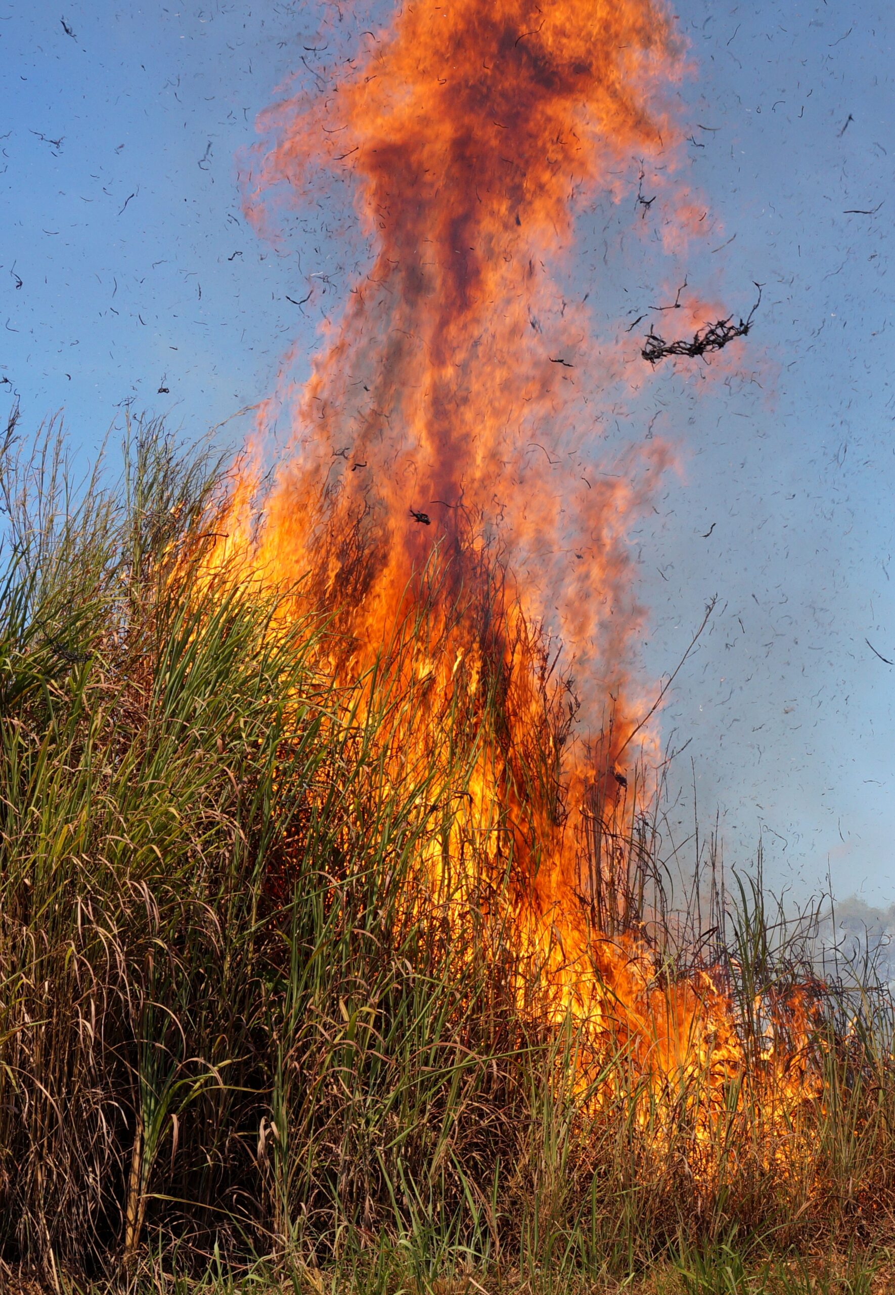
Still, the basic pattern is consistent. Forecasters look for dry fuels, low relative humidity, and wind. Dry fuels are the grasses, leaves, branches, brush, and trees that can carry fire. Fine fuels such as grass, pine needles, and small twigs respond quickly to weather. They can lose moisture during a stretch of dry air and become ready to burn long before larger logs or heavy branches do.
Relative humidity matters because dead plant material exchanges moisture with the air. The National Park Service explains that when relative humidity drops, light fuels dry faster and fire behavior can increase. Air temperature plays a supporting role because warm air can hold more moisture, which often helps pull moisture away from fuels when the air is dry.
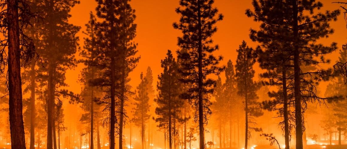
Wind is the force multiplier. It feeds oxygen to flames, tilts flames toward fresh fuel, carries embers ahead of the main fire, and can push a fire faster than people expect. A small grass fire that might be easy to contain on a calm morning can become dangerous when gusts arrive in the afternoon. In some regions, dry thunderstorms also matter because lightning can ignite fires while rainfall evaporates before it reaches the ground or falls too lightly to wet fuels.
What a Fire Weather Watch adds
A Fire Weather Watch usually comes before a Red Flag Warning when critical fire weather is possible but not certain or not yet close enough in time. The National Weather Service describes a watch as a be-prepared message and a Red Flag Warning as a take-action message. In plain terms, the watch says the ingredients may line up; the warning says they are expected soon or already happening.
The distinction matters because fire weather can change with timing. A forecast may show a dry front arriving, winds increasing, or humidity dropping during a narrow part of the day. A watch gives agencies and communities time to prepare. If confidence grows, the watch may become a Red Flag Warning. If moisture arrives, winds weaken, or fuels are not dry enough, the warning may never be issued.
People sometimes misunderstand the warning because it does not name a specific fire. That can make it seem less urgent than smoke on the horizon. But fire-weather alerts are designed around probability and consequence. The probability is that weather and fuels are favorable for ignition and spread. The consequence is that a small mistake can become a much larger emergency.
Why local details change the danger
A Red Flag Warning in Arizona, Oregon, Michigan, Texas, or New Jersey may involve different thresholds. Some offices use relative humidity values near or below 25 percent. Others use lower thresholds, stronger wind requirements, specific fuel-moisture measures, or dry-thunderstorm criteria. The National Weather Service office serving Chicago, for example, lists sustained 20-foot winds, low afternoon humidity, and low 10-hour fuel moisture as part of its local fire-weather criteria. Other offices adjust for their own landscapes.
This local approach is sensible because wildfire risk is not controlled by the atmosphere alone. A region with cured grasses can burn differently from a shaded forest with damp soil. A mountain slope can accelerate flames upslope. A neighborhood with dry brush, wooden fences, and narrow roads faces different concerns than a green park after rain. Even recent weather matters: a windy day after weeks of drought is not the same as a windy day after soaking rain.
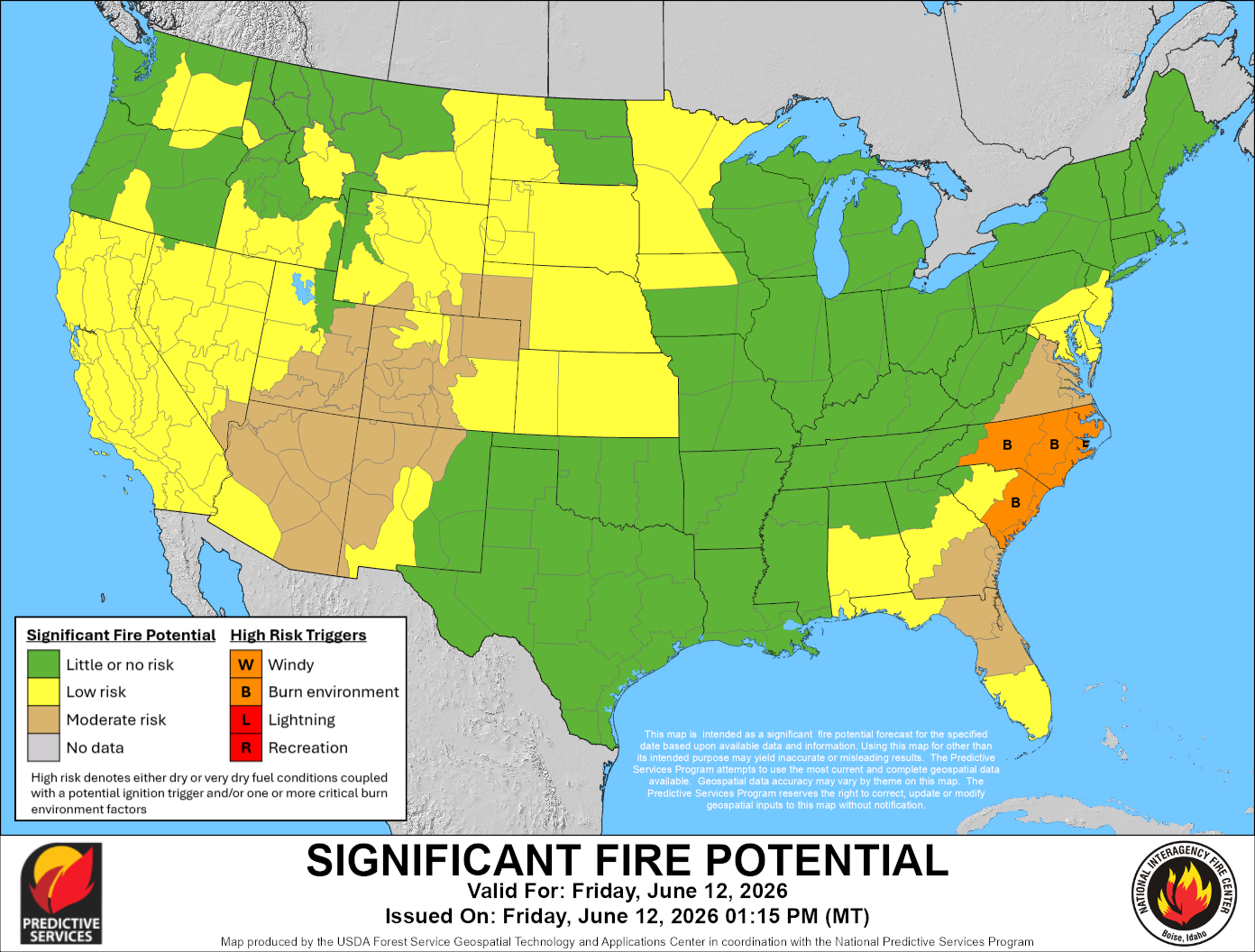
The June 2026 National Interagency Fire Center outlook shows why forecasters look beyond a single afternoon. By the end of May 2026, the outlook reported that more than 2.4 million acres had burned across the United States, well above the previous 10-year average for that point in the year. It also identified above-normal significant fire potential for parts of the West in June and other regional shifts later in the summer. Red Flag Warnings operate on a shorter timeline, but they fit into that larger picture of drought, fuel dryness, and seasonal fire potential.
What to do when one is issued
The safest response is to treat the day as spark-sensitive. That does not mean panic. It means avoiding activities that are normally manageable but become risky under dry, windy conditions. Local rules should always come first, especially burn bans, park closures, and emergency alerts. The most useful habits are simple because many dangerous ignitions begin with small heat sources.
- Do not start outdoor burns, campfires, brush piles, or fire pits when local restrictions or warnings say not to.
- Avoid parking or driving over dry grass, where hot exhaust parts can ignite vegetation.
- Secure trailer chains so they do not drag and throw sparks on roadsides.
- Be cautious with power tools, welding, grinding, mowing, and other equipment that can create heat or sparks.
- Dispose of cigarettes and matches safely, never on the ground or out a vehicle window.
- Follow local emergency messages, especially if a warning overlaps with active fires, power shutoff notices, or evacuation guidance.
Preparedness also matters before a warning appears. Ready.gov advises people in wildfire-prone areas to make an emergency plan, know evacuation routes, sign up for alerts, and keep important supplies ready. A Red Flag Warning is easier to act on when the household has already thought through where to go, how to communicate, and what to bring if conditions worsen.
The warning is about a narrow window of risk
A Red Flag Warning does not predict that a wildfire will definitely happen. Many warnings end without a major fire, and that can make people tempted to ignore the next one. But the warning is not a promise of disaster. It is a forecast that the environment is unusually ready for fire if an ignition occurs.
That distinction is the reason the warning deserves attention. Wildfire risk often depends on moments: a gust that arrives at the wrong time, a spark that lands in dry grass, a small flame that reaches brush before anyone can stop it. Red Flag Warnings help identify those moments before they become visible from miles away.
The useful question is not whether smoke is already in the air. It is whether the day has become easier to ignite and harder to control. When the answer is yes, a little restraint can matter. On a Red Flag day, prevention is not dramatic. It is the quiet work of keeping one spark from becoming the story.


Add comment