 Akshay Dinesh
The Atlantic hurricane season begins on June 1, but the atmosphere does not usually reach its most favorable setup right away. Early summer can bring named storms, especially close to land, yet the busiest part of the season normally waits until late August, September, and early October. NOAA’s tropical cyclone climatology places the statistical peak of the Atlantic season around September 10, with most activity clustered from mid-August through mid-October. That timing can feel surprising because the longest days of the year arrive back in June. The reason is that hurricanes do not respond to sunlight alone; they need a layered set of ocean and atmospheric conditions to come together.
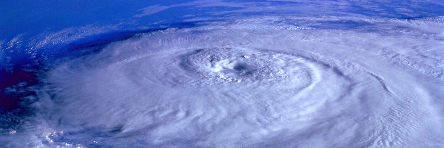
A hurricane is not simply a big thunderstorm over warm water. It is an organized heat engine that draws energy from the ocean, builds rotating thunderstorms around a low-pressure center, and keeps that structure intact long enough to strengthen. If the water is warm but the upper-level winds tear the storm apart, development struggles. If the winds are gentle but the air is dry or dusty, thunderstorms may collapse before they organize. September becomes so active because several pieces tend to align at once: stored ocean heat, lower wind shear, a steady supply of tropical disturbances, and a wide tropical Atlantic where storms have room to grow.
The ocean keeps warming after the hottest days arrive
One reason hurricane season peaks late is that the ocean changes temperature more slowly than the air. Land can heat up quickly during a hot afternoon and cool quickly at night, but seawater has a much larger heat capacity. It takes longer to warm, and it also holds that heat for a long time. By September, the tropical Atlantic, Caribbean, and nearby warm waters have spent months absorbing summer energy. Even though daylight is already shortening, the upper ocean often remains warm enough to support deep thunderstorms.
Warm sea surface temperatures matter because they help supply heat and moisture to rising air. When warm, humid air lifts and water vapor condenses inside thunderstorms, latent heat is released. That heat lowers pressure near the storm center and can help air spiral inward more strongly. Tropical cyclones generally need warm water near the surface, but the depth of that warmth also matters. If a storm churns up cooler water from below, it can weaken. When the upper ocean contains a deep reservoir of warm water, a storm has a better chance of maintaining or increasing its strength.

This delayed ocean warming explains why June is usually not the busiest month, even though the season has officially started. Some early storms form in the Gulf, western Caribbean, or near the Southeast coast, where local conditions can be favorable sooner. Long-track storms that form far out over the tropical Atlantic, however, usually become more common later. By late August and September, the ocean has had enough time to build the broad warm-water background that makes the main development region more inviting for storms.
Wind shear often relaxes near the seasonal peak
Warm water can feed a hurricane, but it cannot protect the storm from hostile winds above it. Wind shear is the change in wind speed or direction with height. Strong shear can tilt a developing storm so that its thunderstorms are pushed away from the low-level center. Instead of building a vertical column of rising air, the storm becomes lopsided, disorganized, and easier for dry air to disrupt.
Early in the season, wind patterns over parts of the Atlantic can still be too disruptive for many tropical systems. Upper-level winds may cut across the tropics, especially when large-scale climate patterns favor stronger shear. As summer progresses, shear often weakens across parts of the tropical Atlantic. NOAA satellite education materials describe late August and early September as a time when warmer Atlantic waters and weaker wind shear tend to overlap. That overlap does not guarantee storms, but it removes one of the most common barriers to development.
The timing is important because a tropical cyclone needs organization as much as fuel. Thunderstorms must keep forming near the center, surface pressure must fall, winds must wrap around the circulation, and the system must avoid being pulled apart. When upper-level winds are calmer, the storm’s vertical structure can stay stacked. That gives the system a better chance to intensify if other ingredients are present.
Tropical waves give storms more starting points
Many Atlantic hurricanes begin as tropical disturbances rather than as fully formed storms. During the peak months, one major source is the African easterly wave, a ripple in the atmosphere that moves westward from Africa into the Atlantic. These waves are common in late summer, and some carry clusters of thunderstorms over warm ocean water. Most never become named storms. A few, however, find favorable conditions and begin to organize.
A tropical wave is useful because it provides a seed. The atmosphere already has some spin, moisture, and thunderstorm activity to work with. If the wave moves over warm water, avoids too much dry air, and encounters low enough wind shear, thunderstorms can persist near a developing center of circulation. The storm may first become a tropical depression, then a tropical storm, and only later a hurricane if winds strengthen enough.
This is one reason September can produce long-track Cape Verde-type storms that travel across large stretches of the Atlantic. The eastern tropical Atlantic is usually too cool or too dry early in the season, but later summer opens more of the basin. Disturbances leaving Africa have a better chance to survive the trip west, and forecasters watch them carefully because some can develop far from land, giving them time to organize over open water.
Dry air and dust can fade as the season matures
Another seasonal factor is the air surrounding developing storms. In June and July, dry, dusty air from the Sahara can spread across parts of the tropical Atlantic. The Saharan Air Layer can suppress thunderstorm growth, stabilize the atmosphere, and inject dry air into disturbances that are trying to organize. Dry air does not have to eliminate every storm to matter; it can simply make development less likely or slow down a system that might otherwise strengthen.
By the peak part of the season, the balance often shifts. Dust outbreaks can still happen, and dry air can still disrupt storms, but the tropical Atlantic more often has the moisture, ocean warmth, and atmospheric setup needed for repeated development chances. That is why a quiet July does not prove the rest of the season will stay quiet. The background environment can change significantly before September arrives.
The reverse is also true: a stormy start does not automatically mean every later month will be severe. Seasonal outlooks describe probabilities, not promises. Individual storms still depend on weekly weather patterns, moisture, shear, steering currents, and whether disturbances form in the right place at the right time. Hurricane season has a rhythm, but it is not a schedule.
The whole basin becomes more open for development
Early-season storms often form closer to the western Atlantic, Gulf, or Caribbean because those areas can warm sooner and provide pockets of favorable conditions. Near the peak, the map of possible formation areas expands. NOAA climatology maps show activity spreading across much more of the Atlantic basin during late August and September. That wider playing field matters because it increases the number of places where a disturbance can become organized.
Once storms form farther east, they also have more time over water. A disturbance that forms close to land may run out of ocean before it can strengthen much. A system that forms in the eastern or central tropical Atlantic can spend days moving across warm water. During that time, it may remain weak, strengthen gradually, or intensify quickly if ocean heat, moisture, and low shear align. Long ocean tracks do not guarantee danger to land, but they do give storms time to mature.
Steering patterns add another layer. Subtropical high-pressure systems, troughs, and other large-scale features help determine whether a storm curves north, moves west, enters the Caribbean, or approaches the Gulf or East Coast. The seasonal peak is therefore not only about storm formation. It is also a time when forecasters pay close attention to where storms can travel after they form.
Why the peak does not mean every year behaves the same way
Climatology describes the average shape of many seasons, not the exact behavior of one season. September 10 is a useful marker because historical records show that Atlantic tropical cyclone activity is most likely to be high around then. A single year can still be quiet near the peak if dry air, strong shear, sinking air, or unfavorable large-scale patterns dominate. Another year can produce several storms before or after the traditional peak.
Large climate patterns can push a season above or below average. El Niño often increases wind shear over parts of the Atlantic, which can make development harder. La Niña often has the opposite effect, reducing shear and allowing more storms to organize when other ingredients are present. Ocean temperatures, monsoon patterns over Africa, and intraseasonal weather pulses can also raise or lower the chances over a few weeks.
That is why early-season counts can be misleading. NOAA’s hurricane FAQ notes that June and July activity has only a weak relationship with the total activity of the full Atlantic season. A slow start can be followed by a busy peak, while an early burst can be followed by quieter stretches. The better question is not simply how many storms have formed so far, but whether the late-summer environment is becoming more favorable.
The practical lesson: timing changes risk
The September peak matters because it reminds people that hurricane risk is seasonal but not evenly spread. The official Atlantic season lasts six months, from June through November, yet the most active part is usually concentrated in a shorter window. That does not make June or November harmless. It does mean late summer and early fall deserve special attention because the ocean and atmosphere are more likely to support organized tropical storms.
The same timing also helps explain why forecasters speak carefully. A warm ocean alone is not enough. A tropical wave alone is not enough. Low wind shear alone is not enough. Hurricane development becomes more likely when the ingredients overlap, and September is when that overlap most often becomes broad and persistent across the Atlantic.
Atlantic hurricane season peaks in September because the basin has spent months storing heat, upper-level winds often become less disruptive, tropical waves offer more storm seeds, and more of the ocean becomes open for development. The calendar peak is not a prediction for any single day. It is a clue about when the Atlantic is most often ready to turn disturbances into organized storms.