 Akshay Dinesh
Cloud seeding sounds almost magical at first: people fly into the sky, release tiny particles, and hope more rain or snow falls. The real science is much narrower. Cloud seeding does not build clouds from empty air, steer storms across a map, or switch rainfall on and off like a faucet. It is an attempt to encourage precipitation inside clouds that already have the right ingredients but may not be efficient at turning their water into falling drops or ice.
That distinction matters because cloud seeding often appears in public conversation during droughts, floods, and severe storms, when people are already trying to understand weather that feels too big to grasp. A careful explanation has to hold two ideas at once. Cloud seeding is a real weather-modification practice used in some regions, especially where water supply depends on mountain snowpack. It is also limited, uncertain, and far weaker than the large atmospheric systems that produce major floods, hurricanes, or long droughts.
What cloud seeding is trying to change
Most precipitation begins with tiny particles. Water vapor in the atmosphere condenses or freezes around bits of dust, salt, smoke, or other microscopic material. Inside a cloud, droplets and ice crystals grow by colliding, collecting more water, or drawing vapor from the surrounding air. When they become heavy enough, gravity pulls them down as rain, snow, sleet, or hail.
Cloud seeding adds extra particles to that process. In cold-cloud seeding, aircraft or ground generators often release silver iodide, a compound whose crystal structure can help supercooled liquid water freeze. Supercooled droplets are liquid even though their temperature is below freezing. When ice crystals form in the right kind of cloud, they can grow, gather water, and eventually fall as snow or melt into rain.
Warm-cloud seeding works differently. In some tropical or subtropical clouds, materials such as salt particles may be used to encourage bigger cloud droplets to form. Larger droplets can collide and merge more easily, which may help rainfall begin sooner or become more efficient. The basic idea is still the same: the seeding material does not supply the water. It tries to change how water already inside the cloud gathers into precipitation.
Why the cloud has to be ready first
The most common misunderstanding is that cloud seeding creates rain by itself. It cannot. A cloud must already contain enough moisture, suitable temperatures, and motion strong enough to keep droplets and crystals growing. If the air is dry, if clouds are shallow, or if the cloud has already become efficient at making precipitation naturally, seeding may do little or nothing.
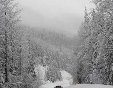
This is why many cloud-seeding programs focus on specific settings rather than random storms. Winter orographic cloud seeding, for example, targets clouds that rise over mountain ranges. As air climbs the slope, it cools, moisture condenses, and snow may form. If those clouds contain supercooled liquid water, adding ice-forming particles may increase snowfall in a targeted basin. That added snow can matter later because mountain snowpack often stores water for reservoirs, rivers, farms, and cities.
Even there, the results are not as simple as measuring one seeded cloud and declaring success. Weather varies naturally from storm to storm, and the same mountain range can receive very different snowfall from one system to the next. Researchers have to compare seeded and unseeded conditions, study radar and aircraft observations, and account for what the storm might have done on its own. The signal is usually modest compared with the size of the weather system.
What scientists can and cannot claim
NOAA has explained that cloud seeding is the main weather-modification activity commonly practiced in the United States, but the agency also states that it does not fund or run cloud-seeding projects. Many programs are operated by states, water districts, utilities, or private contractors. Their goals are usually practical and local: more winter snow in a watershed, slightly enhanced rainfall in a dry region, or reduced fog in a limited setting.
The World Meteorological Organization draws a sharp line between these limited efforts and claims about controlling severe weather. Its weather-modification statement says there are no demonstrated methods for modifying tornadoes, lightning danger, floods, or other severe weather phenomena through cloud seeding. That does not mean every seeding project is useless. It means the technique is not a tool for commanding the atmosphere when a powerful storm system is already unfolding.
History helps explain the caution. NOAA’s Project STORMFURY, which ran from the 1960s into the early 1980s, tested whether hurricanes could be weakened by seeding them with silver iodide. The idea depended on changing the storm’s eyewall structure. Later understanding showed that hurricanes already contain large amounts of natural ice and that the observed changes could not be cleanly separated from the storms’ own natural cycles. The project ended, and modern hurricane forecasting focuses on observation, modeling, warnings, and preparedness rather than trying to seed storms into submission.
Why proof is hard in weather modification
Testing cloud seeding is difficult because the atmosphere never gives researchers two perfectly identical storms. A seeded cloud cannot be rewound and replayed without seeding. Nearby unseeded clouds may look similar, but small differences in moisture, wind, terrain, temperature, and timing can change the outcome. That is why strong studies rely on long records, careful controls, radar data, aircraft measurements, and statistical comparisons rather than a single dramatic storm.
Another challenge is scale. A cloud-seeding aircraft may affect a narrow region of a cloud, while a major storm system can span hundreds of miles and draw energy from broad patterns of temperature, moisture, pressure, and wind. The difference is like nudging one small part of a moving machine while the whole machine is being driven by forces much larger than the nudge. A modest local effect can be real without being powerful enough to explain a regional disaster.
Timing also matters. Some seeding programs stop or avoid operations when dangerous weather is nearby, not because they can control the danger, but because programs are designed for specific conditions and public trust depends on caution. Responsible weather modification is treated as a narrow water-management tool, not as a license to experiment inside every storm that appears on radar.
How to read claims about cloud seeding
Cloud seeding becomes easiest to misunderstand when people jump from “humans can influence some clouds” to “humans caused this extreme weather event.” Those are very different claims. The first is a limited scientific and operational statement. The second would require strong evidence connecting a specific project, in a specific place and time, to a specific weather outcome, while ruling out the natural atmospheric setup that produced the event.
A useful test is to ask where the water and energy came from. Heavy rain needs abundant moisture, lift, and atmospheric conditions that sustain precipitation. Drought depends on patterns of rainfall, evaporation, soil moisture, temperature, and water use over time. Cloud seeding may try to improve precipitation efficiency inside a suitable cloud, but it does not provide a new ocean of moisture or reorganize regional pressure systems.
It also helps to separate cloud seeding from unrelated ideas. Silver iodide seeding, salt-particle seeding, fog dispersal, hail-suppression efforts, and broad climate-engineering proposals are not the same thing. They involve different goals, scales, evidence, and risks. Using one phrase for all of them makes the topic sound more mysterious than it needs to be.
Why the limits matter
Cloud seeding sits in an uncomfortable middle ground. It is not imaginary, but it is not weather control. It can be part of a water-supply strategy in certain regions, especially when the target is winter snowpack and the clouds already contain the right kind of moisture. It may produce small benefits that matter to a reservoir system over time. Those benefits still depend on careful monitoring, transparent reporting, and honest uncertainty.
The limits are just as important as the possible gains. When floods, droughts, and severe storms happen, explanations should begin with the atmosphere itself: moisture, terrain, fronts, pressure systems, ocean temperatures, soil conditions, and climate patterns. Cloud seeding may deserve discussion when a real program is operating nearby, but it should not become a shortcut that replaces weather science.
The clearest way to think about cloud seeding is as a nudge, not a command. It works, when it works, by trying to make a suitable cloud produce a little more precipitation than it otherwise might have produced. The sky still has to supply the cloud, the moisture, the motion, and the larger storm pattern. Without those, there is nothing meaningful to seed.