
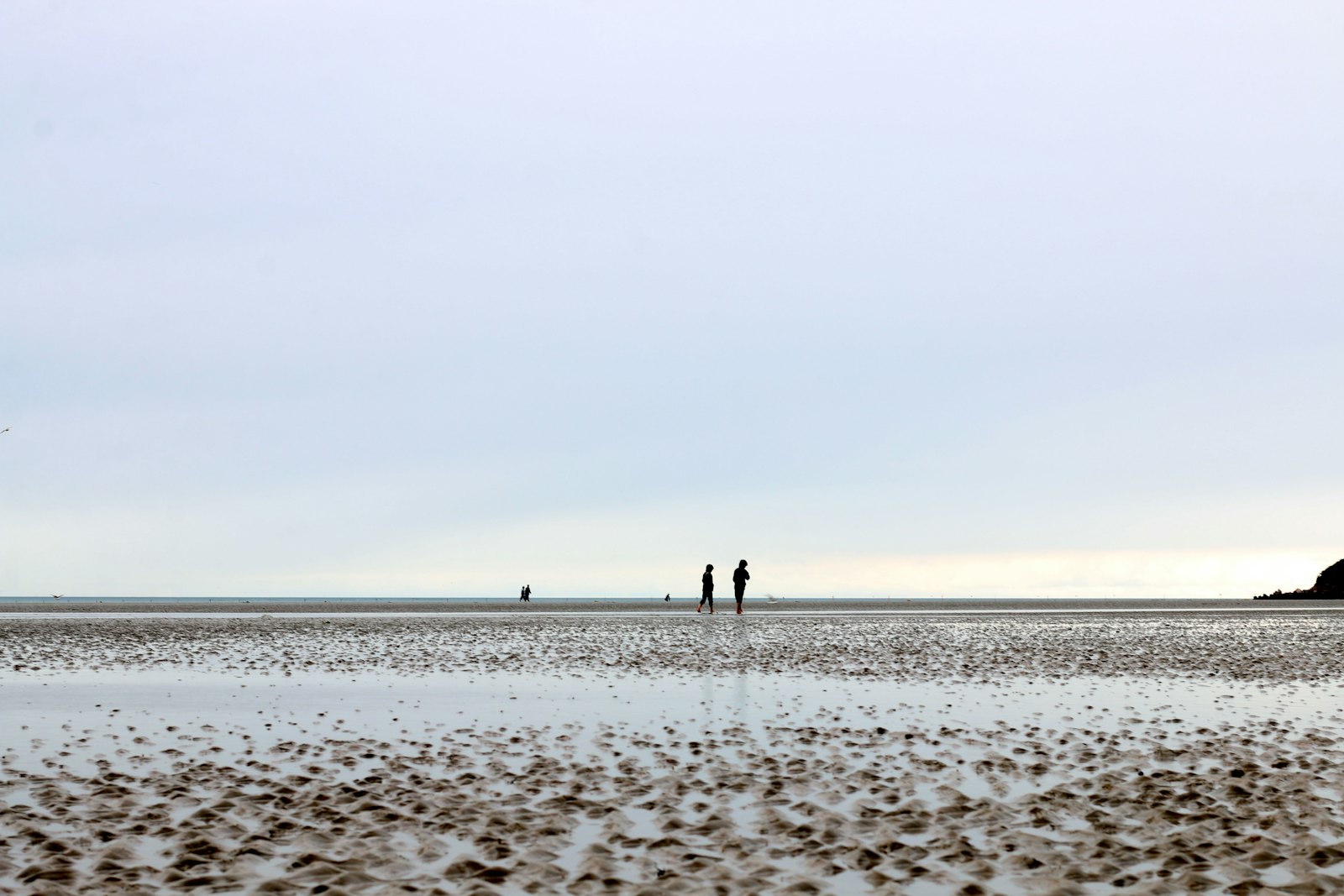
A hot beach day can feel almost still in the late morning, then suddenly different by afternoon. The air turns cooler, flags swing toward land, and a steady wind begins to move in from the water. That familiar relief is often a sea breeze, a local wind system powered by one simple difference: land and water do not warm at the same speed.
The National Weather Service defines a sea breeze as a daytime wind from a cooler ocean surface toward warmer land, caused by different heating rates between land and water. It is not just a pleasant detail of coastal weather. Sea breezes can shift temperatures, humidity, cloud growth, thunderstorm timing, sailing conditions, smoke movement, and the way a coastal city feels during the hottest part of the day.
Why Land Warms Faster Than Water
The starting point is heat capacity, which describes how much energy a material needs before its temperature changes. Water has a high heat capacity, so it takes a lot of solar energy to warm it noticeably. Land surfaces such as sand, pavement, dry soil, and rooftops usually warm much faster because the sun’s energy stays closer to the surface and raises the temperature of a thinner layer.
Water also mixes. Wind, waves, and currents spread heat through a deeper volume, which keeps the surface from warming as quickly during the day. A beach parking lot, a sandy dune, or a city street cannot stir itself in the same way. By early afternoon, the land beside the coast may be much warmer than the nearby ocean or large lake.
That temperature contrast matters because air near the ground responds to the surface below it. Air over warm land heats, expands, and becomes less dense. Air over cooler water stays denser and slightly heavier. Once those differences grow large enough, the atmosphere begins to move.
How a Sea Breeze Circulation Forms
As warm air over land rises, surface pressure over the heated land becomes slightly lower than pressure over the cooler water. Air moves from higher pressure toward lower pressure, so cooler marine air begins flowing inland near the surface. That onshore flow is the sea breeze people feel at the beach.
The circulation is not complete with surface wind alone. NOAA’s JetStream weather education materials describe sea-breeze circulation as two opposing flows: cooler air moves inland near the ground, while air aloft returns from land back toward the water. In a simple side view, it looks like a slow atmospheric loop: rising air over warm land, returning air above, sinking air over cooler water, and onshore wind at the surface.
The breeze usually does not start at sunrise. Early in the morning, land and water temperatures may be close together, especially after a mild night. The sea breeze becomes more likely several hours after sunrise, once the land has warmed enough to create a stronger contrast. On clear summer days with light background wind, the circulation can become especially noticeable.
Why the Wind Can Arrive Like a Boundary
A sea breeze often has a leading edge called a sea-breeze front. The National Weather Service describes this front as the boundary where the incoming marine air advances inland and meets warmer air already sitting over land. When that boundary passes, people may notice a wind shift, a drop in temperature, rising humidity, or a change in cloud cover.
The front can move only a short distance inland or travel many miles, depending on the strength of the temperature difference, the larger weather pattern, and the shape of the coastline. A strong offshore wind can hold the sea breeze near the beach or stop it from forming. A light background wind from the water can help it spread farther inland. Hills, bays, islands, cities, and river valleys can bend or channel the flow.
This is why two places near the same coast can feel different on the same afternoon. A neighborhood close to the shore may cool quickly, while an inland town keeps heating for another hour or two. A coastal airport may report a sudden wind shift that does not reach a school field ten miles away until later, if it reaches it at all.
How Sea Breezes Shape Clouds and Storms
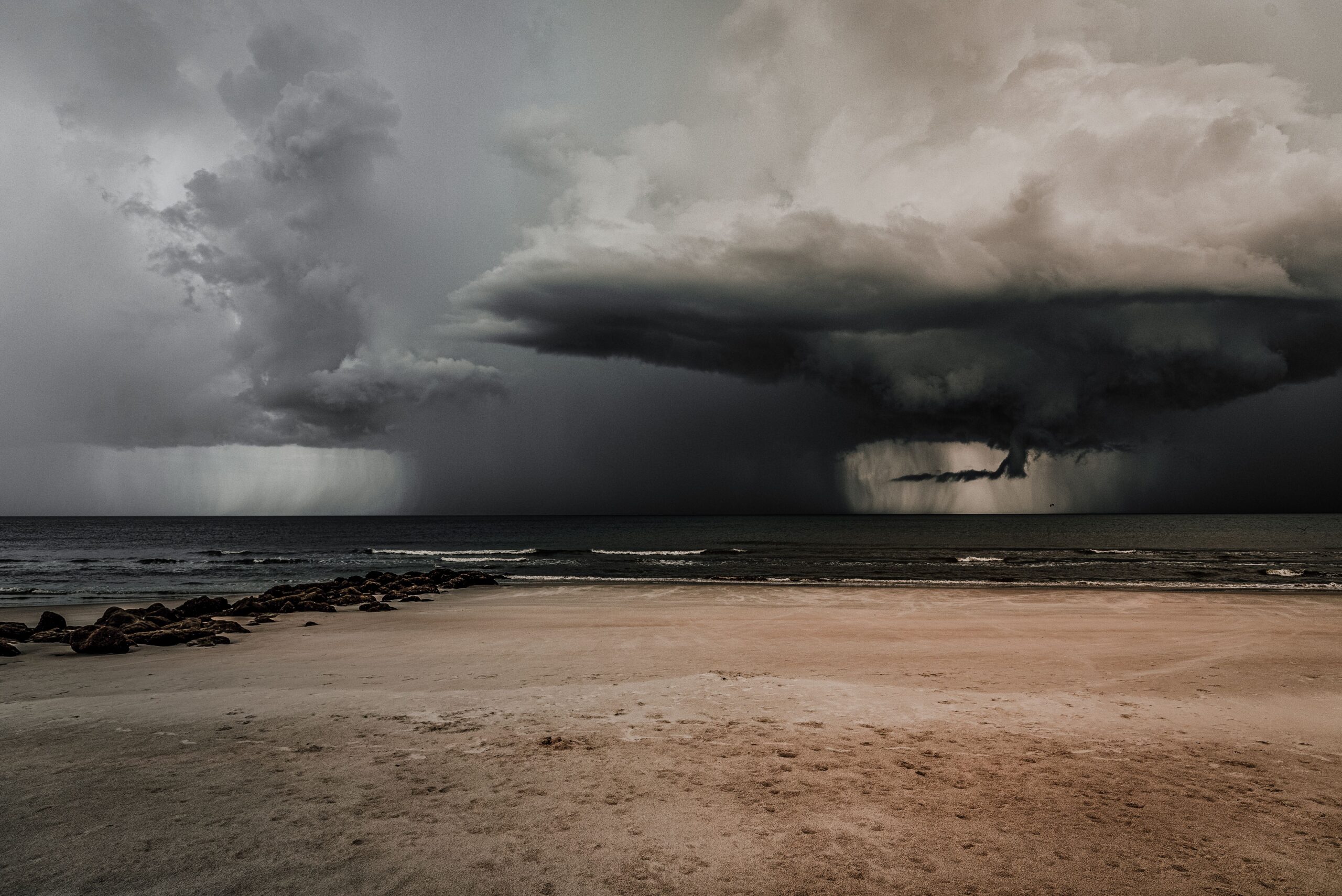
The sea breeze does more than move cooler air. At its leading edge, air from the water pushes into warmer air over land. That meeting zone forces some air upward, especially when the inland air is hot and humid. Rising air cools as it expands, and if enough moisture is present, clouds can build along or just inland from the boundary.
In places such as Florida, sea-breeze fronts are a major part of summer thunderstorm patterns. When sea breezes from opposite coasts or from different shoreline angles collide, they can lift humid air more strongly. That does not guarantee a storm, but it can provide the push that turns a hot, sticky afternoon into a line of towering clouds and heavy rain.
The same boundary can matter even on days without thunderstorms. It can concentrate haze, shift smoke, change pollen movement, and alter the direction of small aircraft takeoffs and landings. Sailors, lifeguards, beachgoers, drone pilots, and weather forecasters all pay attention to these local wind changes because the sea breeze can make the afternoon behave differently from the morning forecast summary.
Why the Pattern Can Reverse at Night
After sunset, land loses heat quickly. Pavement, sand, and soil cool faster than the nearby water, which gives up stored heat more slowly. By late evening or overnight, the temperature contrast may reverse: the land becomes cooler than the water.
When that happens, a land breeze can form. Cooler, denser air over land moves toward the relatively warmer water, while air rises offshore and returns aloft. A land breeze is often weaker than the daytime sea breeze because nighttime cooling may create a smaller contrast and the lower atmosphere can become more stable, but the basic idea is the same. Temperature differences create pressure differences, and pressure differences move air.
This daily reversal shows why coastlines have such distinctive weather. The shore is not just a line on a map. It is a meeting place between surfaces with different thermal habits. One side changes temperature quickly; the other resists quick change. The atmosphere responds by setting up a local circulation that can repeat day after day when the larger weather pattern allows it.
What to Watch for on a Coastal Afternoon
A sea breeze is easiest to notice when the morning begins hot, sunny, and fairly calm. By midday or afternoon, look for flags turning toward land, leaves moving in a new direction, small waves or ripples changing near shore, and a cooler feel close to the beach. Farther inland, the sign may be a line of fair-weather clouds marking the sea-breeze front.
The timing will not be identical every day. Cloud cover can weaken surface heating. Strong regional winds can overwhelm the local circulation. A cold ocean current, a warm bay, a curved coastline, or an urban heat island can change the details. Weather maps may show the large pattern, but local observations often reveal the sea breeze as it actually arrives.
That is the useful lesson hidden inside a beach afternoon. Wind is not only something that blows across a whole region from one weather system to another. Sometimes it begins with a patch of land warming faster than a patch of water nearby. The result is a small, elegant circulation that cools the coast, nudges clouds into place, and turns the shoreline into one of the best everyday examples of physics in the atmosphere.


Add comment