A thunderstorm does not need a tornado to cause sudden, damaging wind. Sometimes the strongest burst comes from air dropping out of the storm, hitting the ground, and spreading outward like water from an overturned bucket. That event is called a downburst, and when it is especially small and concentrated, it is called a microburst.
Microbursts matter because they are fast, local, and easy to underestimate. A neighborhood can go from ordinary rain and rumbling thunder to snapped limbs, scattered debris, and dangerous travel conditions in only a few minutes. The National Weather Service describes a microburst as a localized downdraft in a thunderstorm, usually no more than about 2.5 miles across. NOAA’s National Severe Storms Laboratory uses a similar scale, defining microbursts as small downbursts less than about 4 kilometers wide that can produce winds over 100 miles per hour in the strongest cases.
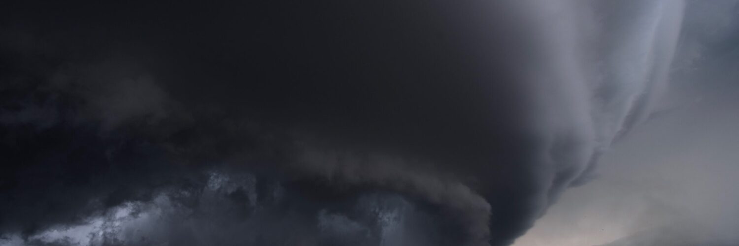
That small size is part of the danger. A tornado often draws attention because people know to look for rotation, a funnel, or a warning polygon. A microburst can arrive as a sudden blast of straight-line wind with little visual drama beyond a dark cloud base, heavy rain, or a wall of dust. The science is not mysterious, but the timing can be unforgiving.
What a Microburst Is
A microburst begins inside a thunderstorm, where air is rising, cooling, condensing, and producing rain or hail. Thunderstorms are built around motion: warm, moist air rises in an updraft, while cooler air and precipitation can pull air downward in a downdraft. Most downdrafts are part of ordinary storm circulation. A microburst is different because the descending air becomes strong enough to slam into the ground and spread outward with damaging force.
The word microburst describes the scale, not a harmless version of the event. “Micro” means the affected area is small compared with a larger downburst or a long-lived windstorm. The winds can still be severe. NOAA’s JetStream weather school notes that microbursts may last only a few minutes, yet they can produce destructive winds because the downward rush is concentrated into a compact area.
When the descending air reaches the surface, it cannot keep moving downward through the ground. It turns sideways. That outward rush creates straight-line winds, meaning the damage usually spreads away from the impact area rather than curling inward and around a rotating center. Meteorologists often use that damage pattern after a storm to distinguish a microburst from a tornado. Tornado winds rotate; microburst winds generally fan outward.
Why Air Falls So Quickly
The engine behind many microbursts is cooling. Rain and hail falling through drier air can evaporate or melt, and those processes take heat from the surrounding air. Cooler air is denser than warmer air, so it can accelerate downward through the storm. Precipitation also drags air with it as it falls. When enough cooled, heavy air gathers and begins sinking quickly, the downdraft can become powerful.
This is why microbursts are often tied to heavy rain, but not always. A wet microburst reaches the ground with significant rain. These are common in humid summer thunderstorms, where a burst of wind may arrive with an intense curtain of rain. A dry microburst can happen when much of the rain evaporates before reaching the surface, leaving wind, dust, and only light precipitation at ground level. Dry microbursts are especially familiar in parts of the western United States where storms can form above a deep layer of dry air.
The same physics explains why the air can feel suddenly cooler just before or during a storm’s wind burst. The outflow is often rain-cooled air from inside the thunderstorm. A pleasant cool gust at the start of a storm can be ordinary outflow, but a much stronger version can knock down tree limbs, flip loose objects, or make driving dangerous. The difference is intensity, speed, and how concentrated the downdraft becomes.
Microbursts can also form quickly because thunderstorms are not steady machines. A storm cell can pulse upward, build a heavy core of precipitation, then collapse part of that core downward. Radar may show high reflectivity where rain or hail is concentrated, while velocity data can sometimes reveal winds spreading apart near the surface. The National Severe Storms Laboratory notes that detecting the first onset of damaging winds is still challenging because a microburst can develop rapidly inside a changing storm.
Why the Damage Can Look Like a Tornado
After a damaging storm, people often ask whether a tornado hit. That question makes sense because the results can look similar from a distance: trees down, power lines damaged, roofs peeled, fences flattened, and debris scattered across yards or roads. In some cases, a strong microburst can cause damage comparable to a weak tornado.
The key difference is the wind pattern. Tornado damage often shows signs of rotation, with debris pulled in different directions around a narrow path. Microburst damage tends to spread outward from a central area or line up with the direction of the storm’s outflow. A row of trees may all fall in roughly the same direction. Roof or siding damage may point away from where the downdraft hit the surface. Meteorologists use these clues, along with radar and reports, when they investigate storm damage.
Microbursts are also short-lived. NOAA sources commonly describe them as lasting only several minutes, though the exact timing varies by storm. That short duration can make them feel shocking: one intense blast, then calmer rain or ordinary storm winds afterward. The storm itself may continue, but the worst wind may have already passed.
The word straight-line can accidentally make the hazard sound simple. It does not mean the wind is gentle or perfectly uniform. It means the damaging flow is not organized around a rotating tornado circulation. A straight-line wind can still shove against buildings, push vehicles, throw patio furniture, and break trees already weakened by saturated soil or previous storms.
Why Microbursts Are So Serious for Aircraft
Microbursts became especially important in aviation because they can create dangerous wind shear near the ground. Wind shear means wind speed or direction changes sharply over a short distance. During takeoff or landing, an aircraft is close to the ground and has little room to recover from sudden changes in lift and airspeed.
A classic microburst encounter can be deceptive. As an aircraft flies into the outflow, it may first meet a headwind, which can briefly increase lift. Moments later, the plane may pass into the downdraft and then into a tailwind on the other side, reducing lift when there is little altitude to spare. This sequence was a major safety concern in the late twentieth century, and it led to better training, airport detection systems, onboard wind-shear alerts, and stronger forecasting attention.
For readers on the ground, the aviation story is useful because it shows how compact and intense a microburst can be. The same event that creates a serious wind-shear problem for pilots can also create a small but severe damage area at the surface. It may not cover a whole county. It may not last long. That does not make it minor.
What Warning Signs People Can Notice
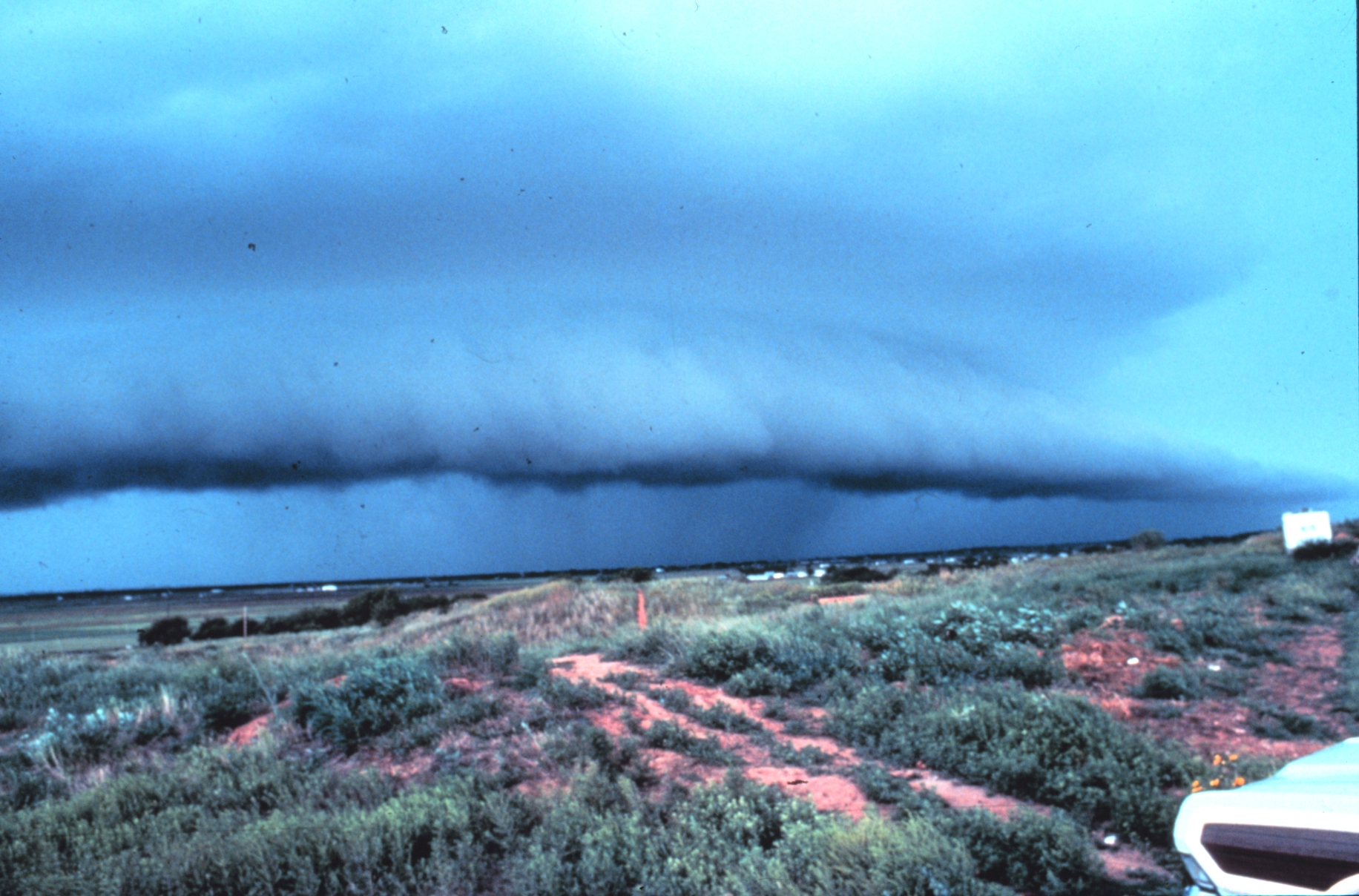
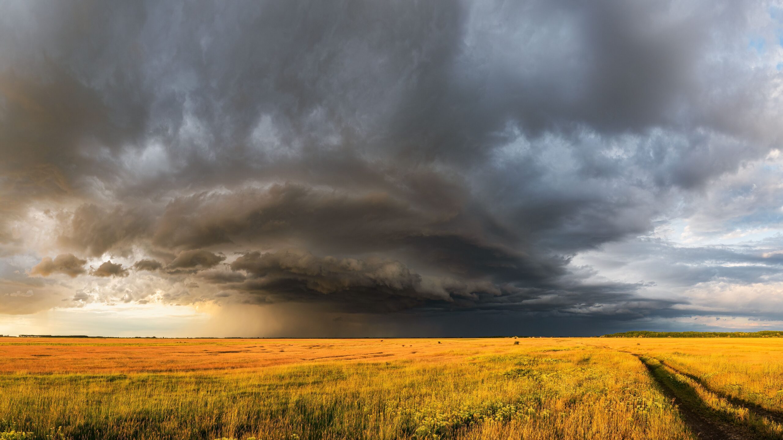
No one can diagnose every microburst by eye, and it is not safe to stand outside studying a storm that may produce damaging wind or lightning. Still, a few signs can help people understand why a thunderstorm deserves respect. A dark, lowering storm base, a sudden cool rush of air, blowing dust, rapidly approaching heavy rain, or a shelf cloud along the leading edge can all point to strong outflow. In dry regions, dust may surge outward before much rain reaches the ground.
Warnings and alerts matter more than visual guessing. Severe thunderstorm warnings are issued when storms are capable of producing damaging wind, large hail, or both. The National Weather Service’s thunderstorm wind safety guidance notes that downbursts are a common source of wind damage and can exceed 100 miles per hour. When a warning mentions destructive winds, it should be treated with the same seriousness people often reserve for more famous storm hazards.
The safest response is boring in the best possible way: get indoors, move away from windows, and avoid trees, open fields, porches, and temporary structures. Drivers should be cautious around high-profile vehicles, falling limbs, ponding water, and sudden drops in visibility. Loose outdoor items can become projectiles, so bringing them inside before storms arrive is more useful than trying to move them during the wind.
Microbursts also remind us that storm danger is not limited to the center of the heaviest rain. Outflow can spread away from the storm core, and damaging wind may arrive before a person has seen much rain at all. That is one reason thunderstorm warnings cover areas ahead of the storm’s movement, not only places already being drenched.
A Small Storm Feature With a Big Lesson
Microbursts show how much power can fit inside a small part of a thunderstorm. Their ingredients are familiar: falling rain or hail, cooling air, gravity, and a storm strong enough to organize those motions. The result can be a sudden downdraft that turns into damaging surface wind in a matter of minutes.
They also change the way severe weather should be judged. A storm does not need a funnel cloud to be dangerous. A warning for damaging straight-line winds can signal a serious threat, especially when trees, power lines, sports fields, roads, or outdoor events are exposed. Microbursts are brief, but their effects can last long after the sky clears.
Understanding the pattern makes thunderstorms feel less random. Cool air falls, spreads, and pushes outward; meteorologists watch for signs of that motion in radar, reports, and damage surveys; people nearby protect themselves by respecting warnings and moving inside early. In a summer storm, the most important wind may be the one that arrives suddenly from above.


Add comment