A wildfire does not have to be nearby for its smoke to change the sky. On some summer days, people hundreds of miles from an active fire wake up to a pale sun, a campfire smell, or an air quality alert that seems to come from nowhere. The fire may be in another state, another province, or even across a national border, but the atmosphere can move smoke as efficiently as it moves storm systems.
That travel is not random. Smoke follows a chain of physical processes: heat lifts it, winds steer it, weather layers shape its path, and tiny particles determine how long it stays in the air. Understanding that chain makes smoky days less mysterious. It also explains why the sky can look clear while air monitors still detect pollution, why smoke may arrive overnight, and why official maps can change quickly as winds shift.
Smoke starts as a rising plume
Wildfire smoke begins close to the ground, where burning wood, leaves, grasses, buildings, and other materials release gases and particles. The fire heats the surrounding air, and hot air is less dense than cooler air around it. That warm, smoky air rises, forming a plume that can grow from a local column into a broad cloud of haze.
The strength of the plume depends on the fire and the weather around it. A small, low-intensity fire may keep much of its smoke close to the surface, especially when winds are light. A large, fast-burning fire can send smoke much higher. In extreme cases, intense heat can help create pyrocumulus clouds, which are fire-driven clouds that form when rising heat carries moisture and particles upward.
Height matters because winds change with altitude. Air near the ground may move slowly in one direction, while winds several thousand feet above may move faster or blow a different way. Once smoke reaches those higher layers, it can travel far beyond the communities closest to the flames.
Winds turn a local fire into a regional air problem
Once smoke enters moving air, it behaves less like a cloud tied to one place and more like a passenger in the atmosphere. Forecast maps often show smoke moving in long ribbons because winds stretch the plume along their path. NOAA satellite specialists track these plumes from space, and the data can feed into forecast models used by weather and air-quality agencies.
Upper-level winds can carry smoke across astonishing distances. NASA has documented cases where smoke from western fires traveled along the jet stream and crossed thousands of miles to the eastern United States. The same basic process can move Canadian smoke into the northern and eastern United States, or move smoke from one region of the West into cities that are far from any visible flames.
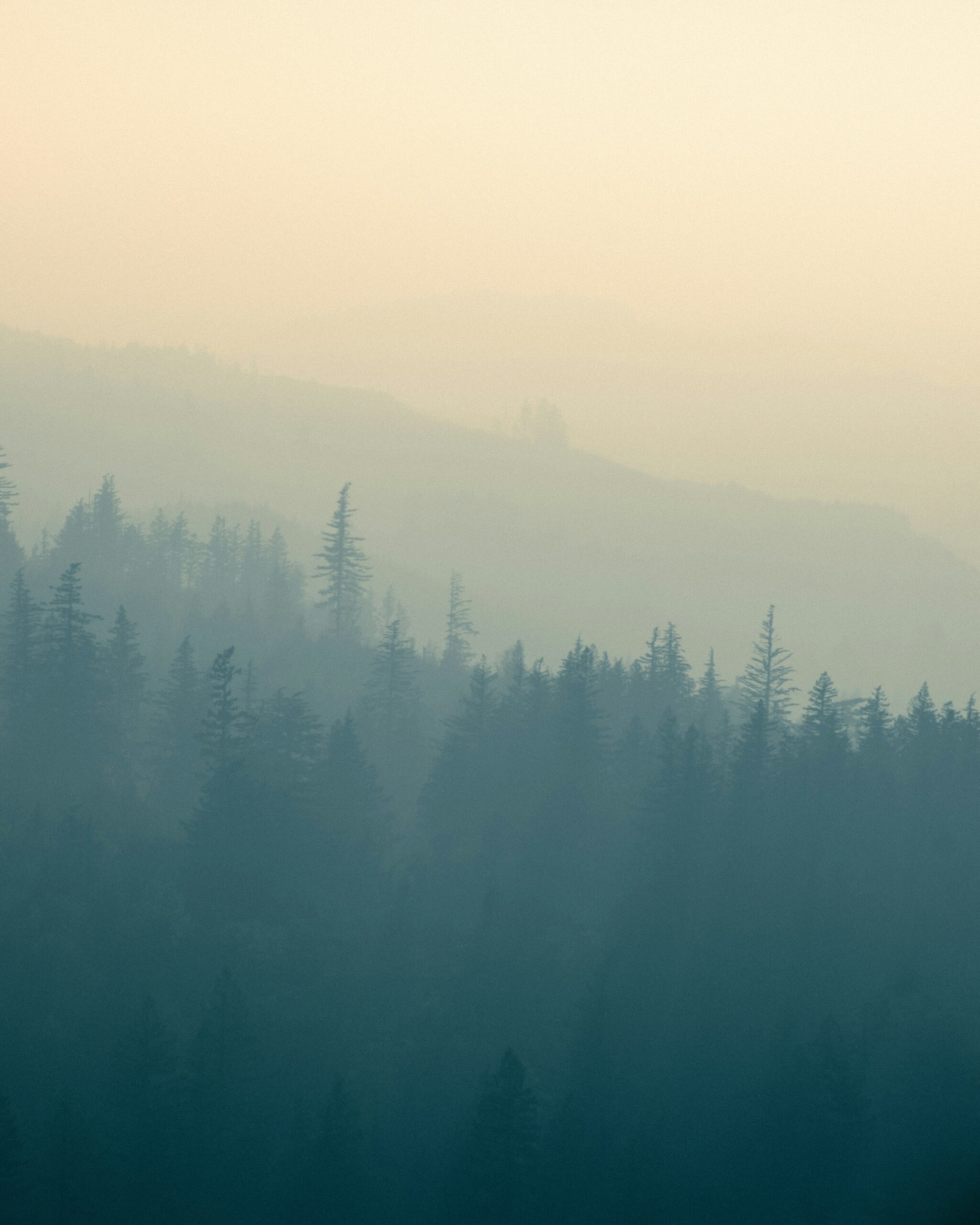
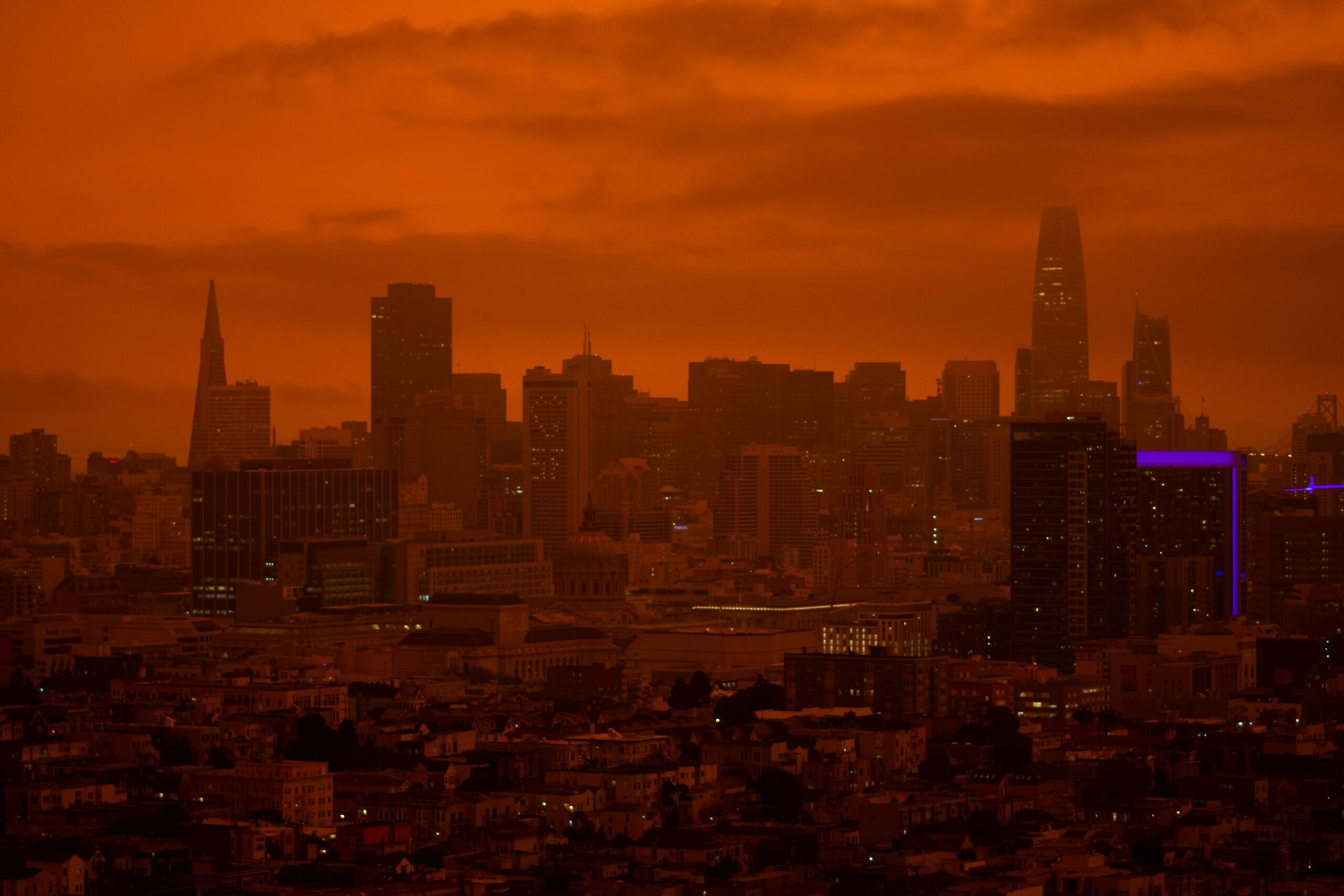
That distance can surprise people because the smoke may not look dramatic by the time it arrives. Near a fire, smoke can be thick, dark, and easy to recognize. Farther away, the plume may spread out into a gray or yellowish haze. The sun may look dimmer or redder, and distant buildings or hills may lose sharp edges. Even when the smell is faint, small particles can still be present.
The smallest particles are the biggest air-quality concern
Wildfire smoke is a mixture, not a single substance. It can contain water vapor, carbon dioxide, carbon monoxide, volatile gases, soot, ash, and many tiny particles. For public air quality, one of the most important pieces is PM2.5, short for fine particulate matter with a diameter of 2.5 micrometers or smaller.
PM2.5 is small enough to stay suspended in the air and small enough to be inhaled deeply into the lungs. That is why EPA and AirNow smoke guidance pays close attention to fine particle pollution during wildfire events. The particles are also small enough to travel long distances before gravity removes them from the atmosphere, especially when winds keep them mixed and moving.
Not all smoke at a distance is equally concentrated. A plume can spread out, dilute, and mix with cleaner air. Rain can wash some particles out. Winds can also push the worst smoke away from one city and toward another. Still, even diluted smoke can raise the Air Quality Index if enough fine particles reach the surface.
Weather decides whether smoke stays high or sinks low
A smoky-looking sky does not always mean the worst air is at breathing level. Sometimes smoke rides high above the ground, where it changes sunlight and visibility more than the air people inhale. At other times, the same plume can mix downward and create unhealthy conditions near the surface.
Daytime heating often helps mix the lower atmosphere. As the sun warms the ground, air near the surface rises in small currents, stirring smoke and other pollutants through a deeper layer. This can either dilute smoke or bring elevated smoke down, depending on where the plume is sitting. Wind speed matters too: stronger winds can disperse smoke, but they can also deliver a fresh plume quickly.
Temperature inversions can do the opposite. Under normal conditions, air tends to cool with height, which allows warmer surface air to rise. During an inversion, a layer of warmer air sits above cooler air near the ground. National Weather Service training materials describe how smoke and pollution can get trapped under that kind of lid. Valleys are especially prone to this pattern, which is one reason smoke may feel worse overnight or in the early morning before sunlight breaks up the inversion.
Why smoke forecasts can change quickly
Smoke forecasting is difficult because it depends on both fire behavior and atmospheric behavior. Forecasters need to know where fires are burning, how intensely they are burning, how much smoke they are producing, how high that smoke is rising, and what winds will do at different altitudes. If any part of that picture changes, the forecast can change with it.
Satellites help because they can detect active fires and follow visible smoke plumes over large areas. Ground monitors help because they measure what is actually reaching people at the surface. Models connect those pieces by estimating where smoke may move next. NOAA, the National Weather Service, EPA, state agencies, and local air districts all use different kinds of observations to turn a moving plume into public information.
That is why smoke maps can look different from regular weather forecasts. A storm may have a sharp radar signature, but smoke can be layered, patchy, and partly invisible to the eye. One neighborhood may smell smoke while another nearby area barely notices it. A forecast may call for smoke aloft in the afternoon and surface smoke by evening as winds and mixing change.
How to read a smoky day more clearly
The best clue is not just the color of the sky. Haze, red sunsets, and reduced visibility can suggest smoke, but they do not tell the full air-quality story. Checking an official air-quality source such as AirNow or a local environmental agency gives a better picture because it is based on measured or forecast pollution levels.
It also helps to notice time of day and terrain. Morning smoke in a valley may point to trapped air under an inversion. Afternoon haze after a wind shift may mean smoke aloft has mixed downward. A sudden smell of smoke can happen when a plume at one height reaches the ground or when winds turn from a fire region toward your area.
For learners, the larger lesson is that air is connected. A fire is a local event, but the atmosphere is a moving system. Heat lifts smoke into that system, winds carry it, particles keep it suspended, and weather decides when people far away will notice it. The next time a distant wildfire changes the sky, the path from flame to haze is not magic. It is physics, chemistry, and weather working together across a very large map.