
A heavy downpour can make a city look as if it has changed shape in minutes. A dry underpass becomes a pool, curb lanes turn into shallow streams, and water begins to spread across intersections that seemed perfectly normal a short time earlier. The speed can feel surprising, especially when there is no river nearby and the storm has not lasted very long.
Urban flooding happens quickly because a city is built to move water, not absorb it. Roofs, roads, parking lots, sidewalks, compacted soil, and storm drains all affect where rain goes after it hits the ground. When intense rain falls faster than the surface and drainage system can handle, water begins taking the easiest path downhill. In a city, that path is often a street.
Rain Becomes Runoff Almost Immediately
In a forest, meadow, or garden, some rain is intercepted by leaves, some soaks into soil, and some moves slowly across the surface. The ground acts like a temporary storage system. Water can infiltrate, fill small spaces between soil particles, and gradually move toward streams or groundwater. Even when runoff forms, it usually has to weave around plants, roots, uneven ground, and shallow depressions.
A city changes that process. Pavement and rooftops are impervious surfaces, meaning water cannot pass through them easily. Rain that lands on asphalt, concrete, and roofing has fewer chances to sink in, so it becomes surface runoff almost at once. The U.S. Geological Survey describes this as one reason urban streams can rise sharply: water enters channels faster and in greater volume than it would from a more permeable landscape.
The shape of the built environment also speeds water along. Streets are sloped toward gutters. Parking lots are graded toward drains. Roof gutters send water into downspouts, driveways, alleys, or underground pipes. These features are useful during ordinary rain because they move water away from buildings and traffic lanes, but during a cloudburst they can gather runoff from a large area and concentrate it in a small place.
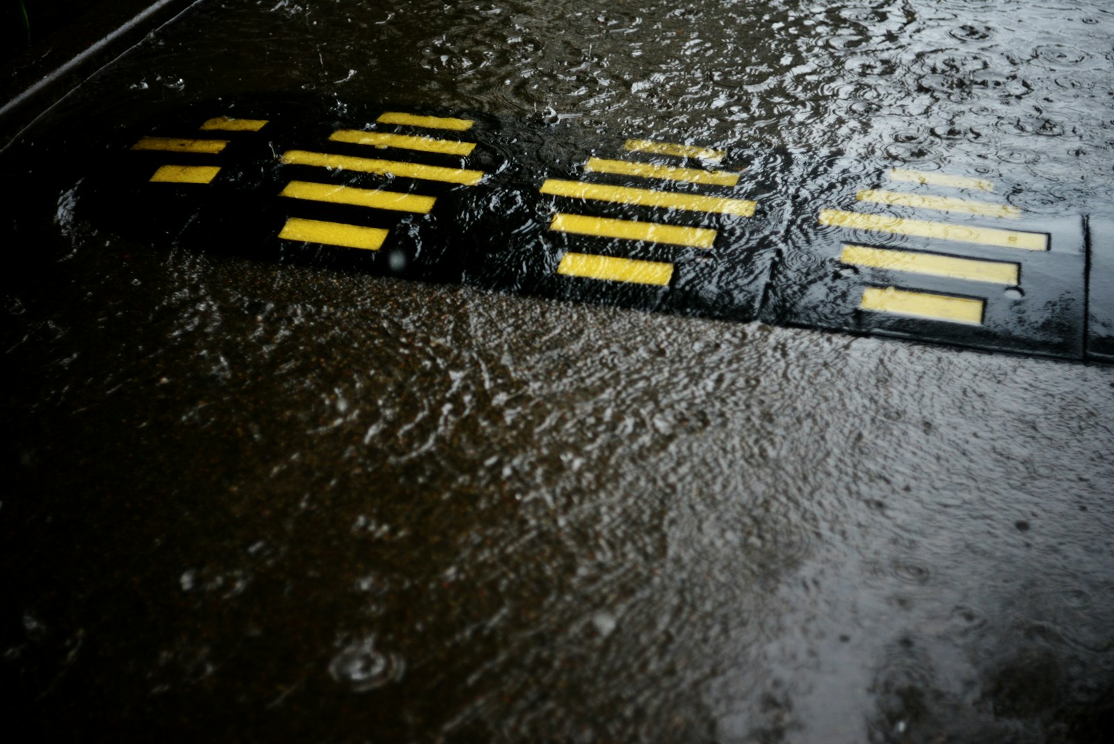
Storm Drains Have Limits
Storm drains are easy to overlook because they sit quietly at curbs and intersections most of the time. Their job is to collect runoff and send it into pipes, channels, detention basins, streams, or other stormwater systems. During a moderate storm, that system may work so smoothly that people barely notice it. During intense rain, the same system can become overwhelmed.
The National Weather Service notes that flash floods often happen within six hours of heavy rain, and sometimes much faster. Slow-moving thunderstorms, repeated storms over the same area, and sudden bursts of rain can all create more water than local drainage can carry. Urban areas, storm drains, culverts, low-lying roads, and underpasses are especially vulnerable because water gathers there quickly.
A storm drain is not a bottomless hole. It leads into a pipe with a fixed size, and that pipe connects to a larger system that also has limits. Leaves, trash, sediment, construction debris, and branches can reduce the opening. Downstream pipes may already be full. If a nearby creek or canal is high, stormwater may have nowhere to discharge. Once the drainage system reaches capacity, extra water stays on the surface.
This is why street flooding can appear even in places with visible drains. The problem is not always that the city forgot to build drainage. Sometimes the storm is delivering water faster than the drains were designed to move it. Other times, the weak point is farther away: a clogged culvert, a backed-up channel, a low bridge, or a pipe that was built for older rainfall patterns and a smaller urban footprint.
Low Spots Turn Into Temporary Basins
Water follows gravity, so small differences in elevation matter. Underpasses, sunken roads, parking garage entrances, basement stairwells, subway entrances, low intersections, and dips near creeks can collect water faster than nearby high ground. Drivers may see only a familiar road, but the landscape sees a basin.
Underpasses are a classic example. Roads often dip to pass below rail lines or highways, and the walls on either side keep water from spreading out. If rain falls hard enough, runoff flows down the slopes and pools at the lowest point. A pump or drain may be installed there, but it can still be overwhelmed by a short burst of intense rainfall. The result is a deep pocket of water in a place that normally functions as ordinary pavement.
Creeks and small channels can rise just as quickly. A narrow stream that looks harmless on a dry day may receive runoff from streets, roofs, lawns, and parking lots across a whole neighborhood. The National Severe Storms Laboratory explains that flash floods combine flood power with speed because water can rapidly fill dry channels, overtop banks, or spread across low ground. In cities, runoff from the built landscape can make that rise sharper.
The danger is not only depth. Moving water pushes sideways, hides curbs and potholes, and can cover washed-out pavement. National Weather Service flood safety guidance warns that many flood-related deaths happen when people drive into hazardous water. A road that looks passable from a distance may have a current, a missing shoulder, or a deeper center than expected.
Why Short Storms Can Still Cause Serious Flooding
People often connect flooding with long storms, but duration is only one part of the story. Intensity matters just as much. A slow day of gentle rain may give water time to soak in, drain away, and spread out. A short downpour can drop a large amount of water before the system has time to respond.
Meteorologists pay close attention to rainfall rate, not just total rainfall. Two inches of rain spread over a day is very different from two inches in an hour. The first may be inconvenient; the second can flood streets, fill small streams, and overload drains. If the ground is already wet from earlier storms, even less new rain may be needed to cause trouble.
Urban growth can add another layer. A neighborhood with more buildings, wider roads, larger parking lots, and fewer open areas produces more runoff than the same land did before development. The Environmental Protection Agency connects localized flooding to stormwater volumes that exceed storm sewer capacity, and it points to green infrastructure as one way to slow, store, and absorb runoff before it reaches pipes.
How Cities Slow the Water Down
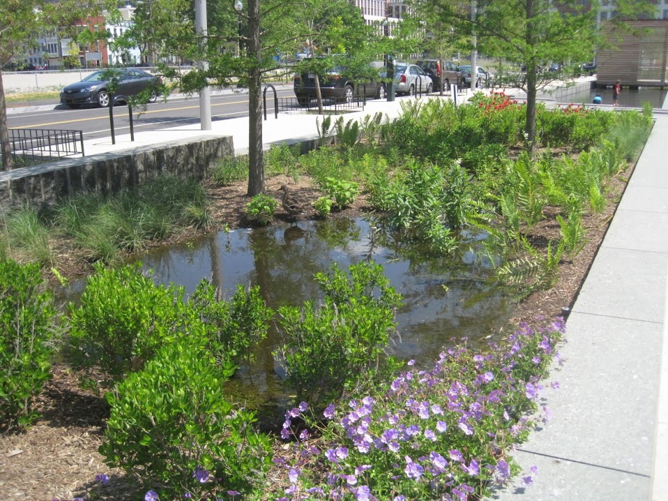
No city can prevent every flood, especially during extreme rain. Still, the most useful stormwater tools often share one idea: slow the water down before it reaches the lowest point. A storm drain moves water away, but green infrastructure gives water more places to pause, soak in, or spread out safely.
Rain gardens, bioswales, street trees, permeable pavement, detention ponds, restored wetlands, and open green space can reduce the speed and volume of runoff. They do not replace pipes everywhere, but they can reduce pressure on the pipe system during smaller and moderate storms. They also help filter pollutants that would otherwise wash from streets into streams.
Good flood planning also depends on knowing where water naturally wants to go. Engineers study watersheds, slopes, soil, land cover, stream channels, rainfall records, and problem intersections. Emergency managers track low-water crossings, underpasses, and roads that repeatedly flood. City planners may limit development in flood-prone areas or require new projects to hold stormwater on site.
The main lesson is simple but powerful: street flooding is not random. It is the visible result of rainfall meeting a landscape of hard surfaces, slopes, drains, pipes, and low spots. When rain falls gently, that system may hide in the background. When rain falls hard, the hidden water map of a city suddenly appears on the surface.


Add comment