 Akshay Dinesh
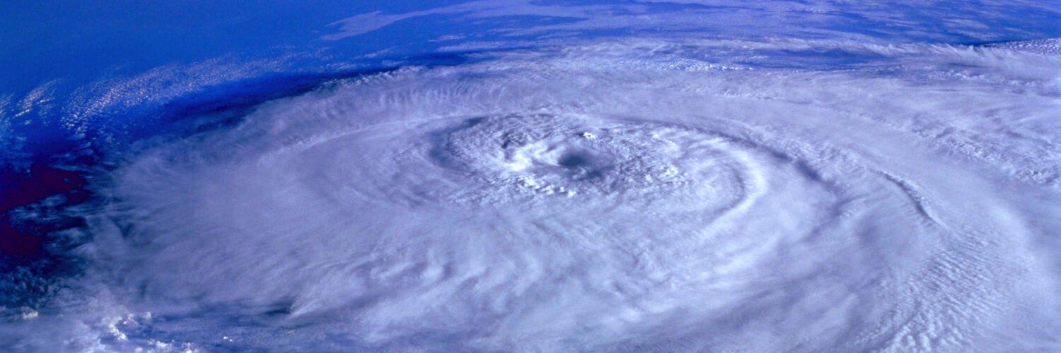
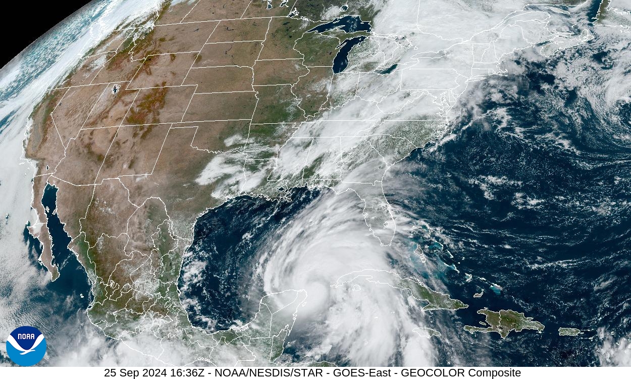
Long before a hurricane reaches a coastline, it may spend days over open ocean where few people can see it directly. Ships and aircraft can gather valuable observations, but they cannot watch every cloud cluster across an entire ocean basin all the time. Weather satellites fill that gap. They give forecasters a wide, repeated view of tropical weather systems while those systems are still far from land.
That view is not just a dramatic picture from space. Satellite data helps meteorologists see where thunderstorms are growing, how cloud tops are cooling, whether dry air is wrapping into a storm, and how the storm’s structure is changing hour by hour. The National Hurricane Center combines satellite imagery with aircraft data, radar, buoys, ships, surface observations, and forecast models. Satellites are especially important in the early stages, when a tropical disturbance may be thousands of miles from the nearest coastal radar.
The result is a better chance to notice danger while there is still time to prepare. A satellite cannot tell a family exactly what to do, and it cannot replace local warnings. But it can help forecasters recognize a developing hurricane sooner, monitor it over the ocean, and update track and intensity forecasts as the storm changes.
Why hurricanes are hard to watch from the ground
Hurricanes form over warm tropical water, often far from dense networks of weather stations. A thunderstorm cluster near the coast can be tracked by radar, airports, road sensors, and local observers. A tropical wave in the central Atlantic has fewer nearby instruments. Without satellites, forecasters would have a much patchier picture of what is happening over the ocean.
Surface reports still matter. Buoys can measure waves, pressure, wind, and water temperature. Ships can send observations from their routes. Hurricane hunter aircraft can fly into selected storms and gather direct measurements that satellites cannot provide. The challenge is coverage. A hurricane basin is huge, and storms can change quickly between direct observations.
Satellites solve the coverage problem by watching broad regions repeatedly. Geostationary satellites, such as NOAA’s GOES-East and GOES-West, orbit in a way that lets them keep looking at the same general region of Earth. That makes them useful for loops, not just single pictures. Forecasters can watch clouds pulse, rotate, stretch, and organize over time.
What visible images reveal during the day
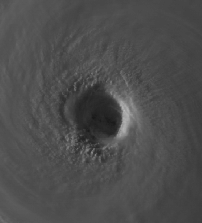
Visible satellite imagery is closest to what the human eye might expect from space. During daylight, it shows clouds reflecting sunlight. A well-organized tropical cyclone may appear as a round swirl with curved bands wrapping toward the center. A weaker disturbance may look ragged, stretched, or broken apart by wind shear.
Visible imagery helps forecasters study shape and motion. Low-level cloud lines can hint at where winds are converging near the surface. A clearing eye can show that a storm has developed a strong inner core. Overshooting cloud tops, which rise above the surrounding thunderstorm shield, can mark especially powerful bursts of convection.
The limitation is obvious: visible imagery depends on sunlight. It works beautifully during the day and fades at night. Hurricanes do not pause after sunset, so forecasters need other satellite tools that can keep watching when the storm is hidden from ordinary daylight views.
Why infrared images work day and night
Infrared satellite imagery measures emitted heat rather than reflected sunlight. Cold cloud tops usually mean tall thunderstorms, because air temperature drops with height through much of the lower atmosphere. When a satellite image shows very cold cloud tops near a storm’s center, it can be a sign that deep thunderstorms are building strongly.
This is one reason infrared imagery is so useful overnight. A storm’s cloud shield can be monitored continuously, even when visible images are dark. Forecasters can watch whether the coldest cloud tops are spreading symmetrically around the center or being pushed to one side by wind shear. They can also see whether the eye is warming and clearing out, which can happen as a hurricane becomes better organized.
Infrared images do not directly measure surface wind speed, and a cold cloud top does not automatically mean a stronger storm. A burst of thunderstorms may flare and then weaken. Still, the pattern, persistence, and placement of those cold clouds give forecasters important clues. NOAA’s GOES-R series Advanced Baseline Imager observes the atmosphere and cloud cover in multiple spectral bands, letting meteorologists compare different views of the same storm instead of relying on one picture.
How water vapor imagery shows the air around a storm
A hurricane is not only a spinning storm. It is also surrounded by air masses that can help or hurt it. Water vapor imagery helps forecasters see moisture patterns in the middle and upper parts of the atmosphere. Moist air can support thunderstorm growth, while dry air can wrap into a storm and disrupt its structure.
Water vapor loops can also show larger steering patterns. Ridges, troughs, and upper-level lows shape the winds around a hurricane. Those surrounding winds influence whether a storm curves out to sea, moves toward land, slows down, or turns unexpectedly. The satellite view does not solve the track forecast by itself, but it helps forecasters understand the atmosphere the storm is moving through.
This matters because a hurricane forecast is partly a storm forecast and partly an environment forecast. A compact hurricane may look impressive, but its future depends on ocean heat, dry air, wind shear, and steering currents. Satellite imagery helps connect the storm to that larger setting.
What satellites can and cannot tell forecasters
Satellites are powerful, but they are not all-seeing. They can show cloud patterns, temperatures, moisture, lightning in some cases, and the motion of features over time. They can help estimate where the center is, whether the storm is becoming more organized, and how the surrounding atmosphere is changing.
They do not directly measure every important condition at the ocean surface. Surface winds, central pressure, and the exact structure inside the eyewall often need aircraft reconnaissance, dropsondes, scatterometer data, or other observations. That is why hurricane forecasts improve when multiple tools are used together. A satellite loop may suggest that a storm is strengthening, but aircraft data can confirm what is happening inside the circulation.
Forecasters also use computer models that depend on observations from many sources. Satellite data helps initialize and adjust those models, especially over oceans where direct measurements are sparse. Better starting information gives models a clearer picture of the atmosphere, though uncertainty never disappears completely.
Why the repeated view matters most
A single satellite image can be useful, but the real value often comes from the loop. Hurricanes are living weather systems. Their cloud bands tighten or loosen. Thunderstorms flare near the center or collapse. Dry air intrudes. Wind shear exposes the circulation. An eye appears, disappears, or becomes clearer.
NOAA’s GOES imagery can update very frequently, allowing meteorologists to watch those changes almost as they happen. The Advanced Baseline Imager can scan broad regions and smaller storm areas at faster intervals when needed. That frequent view is one reason modern satellite monitoring feels so different from older weather maps built from scattered reports.
For the public, satellite imagery can also make risk easier to understand. A storm that looks far away may already be part of a larger weather pattern. A hurricane with a clear eye and tight bands may help people see why officials are taking it seriously. Still, the safest information comes from official forecasts, watches, warnings, and local emergency guidance, because those include hazards that satellite images alone cannot show, such as storm surge, rainfall flooding, and evacuation timing.
Weather satellites do not stop hurricanes, but they make them less invisible. They turn remote ocean storms into trackable systems that can be studied, forecast, and communicated before landfall. That early view is one of the quiet reasons people often hear about a dangerous storm days before the worst weather arrives.