
Every rainy street, farm field, forest slope, parking lot, and backyard belongs to a watershed. The idea sounds technical at first, but it answers a simple question: where does water go after it falls? Some rain soaks into soil, some collects in low places, and some begins moving downhill through ditches, creeks, storm drains, wetlands, and rivers. Follow that water far enough and it eventually reaches a shared outlet, such as a lake, bay, reservoir, river mouth, or ocean.
That shared path matters because water does not travel alone. It can carry leaves, soil, fertilizer, oil, road salt, bacteria, plastic, and heat from sun-warmed pavement. A watershed is therefore more than a map of streams. It is a living connection between land, water, weather, and human choices. The same boundary that helps geographers understand rivers also helps communities think about floods, drinking water, pollution, farming, city planning, and habitat.
A Watershed Is a Drainage Area, Not Just a River
The U.S. Geological Survey describes a watershed as the land area that drains streams and rainfall to a common outlet. The same idea is often called a drainage basin or catchment. A small ditch beside a road can have a tiny watershed, while the Mississippi River watershed covers a huge part of the central United States because thousands of small streams and rivers eventually join the same larger system.
The easiest way to picture a watershed is to imagine pouring water onto a wrinkled sheet of plastic. Water does not spread evenly in every direction. It follows the slopes, folds, and low channels. A real landscape works in a similar way, except the folds are hills, valleys, ridges, streets, roofs, soils, wetlands, pipes, and stream channels. Gravity supplies the direction, but the surface decides the route.
This is why a watershed is not limited to the visible river. It includes the land around that river, the smaller tributaries that feed it, the lakes and wetlands connected to it, and much of the groundwater beneath it. A person standing miles from the nearest river may still be inside that river’s watershed. If rain from that place eventually drains toward the same outlet, it belongs to the system.
National Geographic notes that watersheds can be small enough to include one creek or large enough to span thousands of miles. That nesting pattern is important. A neighborhood stream may drain into a town river, the town river may drain into a larger regional river, and that river may join a continental-scale basin. Smaller watersheds sit inside larger ones like bowls within bowls.
Drainage Divides Draw the Boundaries
If a watershed is the area where water drains toward one outlet, then its boundary is the place where water begins draining somewhere else. That boundary is called a drainage divide. In steep country, a divide may follow a clear ridge or mountain crest. Rain falling on one side flows toward one river system; rain falling on the other side flows toward a different one.
Some divides are famous. The Continental Divide in North America separates many waters that eventually flow toward the Pacific Ocean from many that flow toward the Atlantic or Arctic systems. But most divides are far less dramatic. They can run through low hills, neighborhoods, school grounds, farmland, or flat ground where the boundary is hard to notice without a map.
Divides also remind us that political borders and water borders rarely match perfectly. A city, county, state, or country may share a watershed with many other places. That can make water management complicated. A community downstream may deal with runoff, sediment, or flooding influenced by land use upstream, even when the upstream decisions were made in another jurisdiction.
For students, the divide is often the missing piece that makes watershed maps click. Rivers are easy to see because they are blue lines on a map. Watershed boundaries are invisible on the ground unless they follow obvious high land. Once those boundaries are drawn, however, the river system looks less like a loose collection of lines and more like a connected drainage network.
Rainfall Becomes Runoff, Infiltration, and Streamflow
Rain does not automatically become a flood, a puddle, or a river. What happens next depends on the surface it reaches. The National Weather Service describes infiltration as precipitation that soaks into soil and runoff as precipitation that moves across the land surface toward streams. Streamflow is the water moving through channels once runoff, groundwater, and smaller tributaries join the stream network.
A forested hillside and a paved parking lot can receive the same storm but send water through the watershed very differently. In a forest, leaves, roots, soil pores, and uneven ground slow water down. Some water evaporates, some is taken up by plants, some sinks into the ground, and some reaches streams gradually. On pavement or compacted soil, water has fewer places to go. It moves faster across the surface, often picking up pollutants as it flows.
This speed matters during storms. When a watershed sheds water quickly, streams can rise quickly. When water is stored in soil, wetlands, floodplains, and vegetation, the same rainfall may arrive more slowly at the channel. That does not mean natural landscapes prevent every flood, especially during extreme rain or saturated conditions, but they can change the timing and intensity of water movement.
Watershed size also changes the response. A small urban creek may rise within minutes during a downpour because water has only a short distance to travel. A large river basin may respond over hours, days, or even weeks as water from many tributaries works its way downstream. Hydrologists pay attention to this timing because it affects flood forecasting, reservoir operations, and emergency planning.
What Happens Upstream Travels Downstream
The phrase upstream and downstream is more than a direction on a river. It is a reminder that choices made in one part of a watershed can affect people and ecosystems elsewhere. Soil eroded from a construction site can cloud a creek. Fertilizer from lawns or farms can add nutrients to lakes and estuaries. Oil and tire particles from roads can wash into storm drains. Warm runoff from pavement can raise stream temperatures, which can stress cold-water organisms.
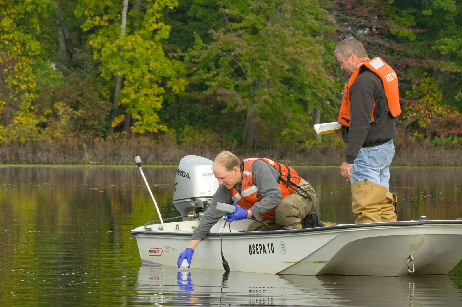
NOAA education materials describe stormwater runoff from nonpoint source pollution as a major threat to aquatic ecosystems. Nonpoint source pollution is difficult because it does not come from one obvious pipe or factory. It comes from many small places spread across the watershed. A little fertilizer here, a little pet waste there, a little oil from roads after a storm, and the combined effect can become serious downstream.
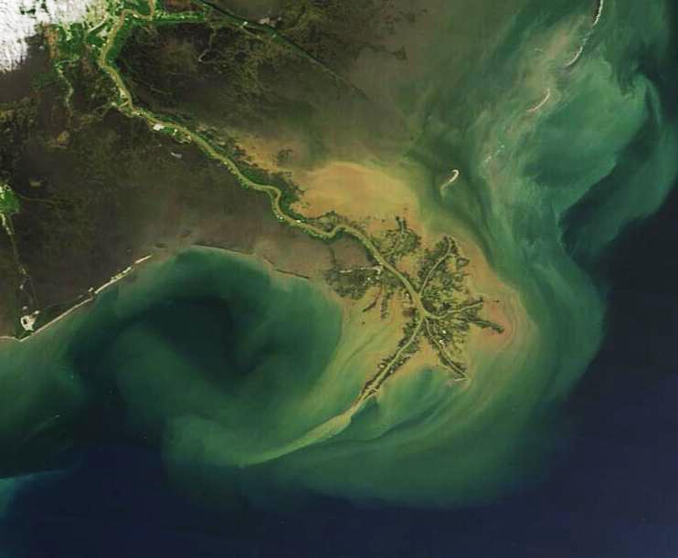
Watersheds also carry useful materials. Rivers move sediment that can build deltas, renew floodplain soils, and create habitat. The Mississippi River, for example, carries sediment toward its delta, where river, wetland, and coastal processes meet. Problems arise when the amount, timing, or type of material changes too much. Too much sediment can smother habitats and fill channels; too little sediment can starve deltas and wetlands that need replenishment.
This connectedness is why water quality is often managed at the watershed scale. Cleaning a single stream segment may not work if the main sources of pollution are scattered across the surrounding land. A watershed view asks broader questions: Where is water entering the system? What surfaces does it cross? Which tributaries contribute the most sediment or nutrients? Which wetlands, forests, or floodplains help slow and filter water?
Human Landscapes Change How Watersheds Work
People do not just live inside watersheds; they reshape them. Roads, roofs, lawns, farms, storm drains, dams, levees, culverts, canals, and reservoirs all change how water moves. Some changes are necessary for transportation, housing, agriculture, and flood protection. Others create problems when they speed water into channels, disconnect rivers from floodplains, or remove wetlands that once stored and filtered runoff.
Urban watersheds show these changes clearly. A stream in a heavily paved area may receive a sudden rush of stormwater after rain, then drop quickly once the storm ends. That flashier pattern can erode banks, damage habitat, and make flooding more likely in low areas. Many cities now use green infrastructure, such as rain gardens, permeable pavement, restored stream buffers, and constructed wetlands, to help water soak in or slow down before it reaches streams.
Rural watersheds have their own challenges. Farming can expose soil, add nutrients, or change drainage patterns, especially when fields are bare or drainage systems move water quickly away from land. At the same time, farms can also be part of watershed solutions through cover crops, buffer strips, careful nutrient management, restored wetlands, and soil practices that improve infiltration.
None of this means a watershed should be treated as untouched wilderness. Watersheds include towns, highways, schools, factories, forests, farms, parks, and homes. The useful question is how the whole system behaves. Good watershed planning looks for ways to meet human needs while keeping water movement, water quality, habitat, and flood risk within healthier limits.
Why Watershed Thinking Changes the Map
Watersheds make geography feel less abstract because they connect places that may seem separate. A hilltop, a street drain, a creek behind a school, a reservoir, and a coastal bay can all belong to the same story. The map is not only about where things are. It is about how movement links them.
This way of thinking is useful far beyond geography class. It helps explain why a river can flood even when the heaviest rain fell miles away, why beach water can be affected by inland runoff, why a city cares about forests upstream from its drinking water supply, and why pollution prevention often starts on ordinary land rather than at the river’s edge. It also helps people understand why local actions can have wider effects.
The next time rain runs along a curb or gathers in a low part of a field, it is worth asking where that water is headed. It may enter a storm drain, sink into soil, cross a park, join a creek, or feed a river many miles away. A watershed turns that small movement into part of a larger pattern. Once the pattern is visible, rivers become easier to understand, and the places around them feel more connected than they first appear.


Add comment