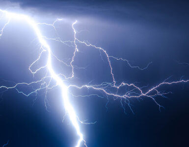
A hazy morning can feel puzzling when there is no fire nearby, no visible factory plume, and no obvious reason for the air to look heavy. The sky may be pale, distant buildings may fade, and smoke from fireplaces, traffic, or wildfires may seem to hover instead of lifting away. One of the most common reasons is a temperature inversion, a quiet weather pattern that changes how air mixes near the ground.
Under ordinary daytime conditions, the ground warms the air just above it. That warmer air rises, cooler air sinks, and the lower atmosphere stirs itself. Pollution does not disappear, but it can spread through a deeper layer of air. During a temperature inversion, that usual pattern is flipped. Cooler air stays near the surface while warmer air sits above it, creating a stable layer that can hold smoke, smog, and exhaust close to where people breathe.
The Normal Air Pattern Gets Turned Upside Down
Most weather explanations begin with a simple idea: warm air tends to rise. Air near the ground often becomes warmer than the air above it because sunlight heats land, roads, roofs, and fields. As the warm surface air rises, it carries moisture, dust, smoke, and other small particles upward. This vertical movement, called mixing, is one reason a breezy afternoon can feel cleaner than a still morning.
A temperature inversion reverses the usual temperature pattern in a layer of the lower atmosphere. Instead of getting colder with height, the air gets warmer for a stretch above the ground. The National Weather Service describes an inversion as a layer where temperature increases with height, often forming beneath a warmer cap of air aloft. That cap matters because rising air parcels become cooler than the air around them and lose the buoyancy that would normally help them keep climbing.
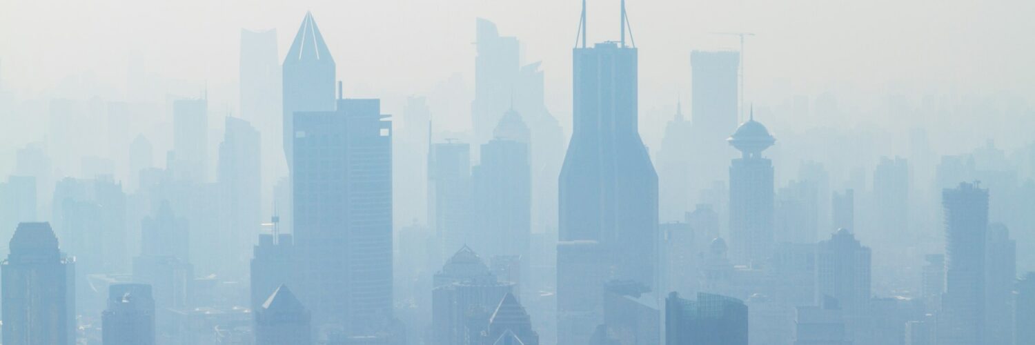
The result is not a wall, but it behaves like a lid. Cooler, denser surface air remains pooled below warmer air. Smoke from a chimney, exhaust from traffic, dust from roads, and fine particles from distant fires may spread sideways under that lid instead of mixing upward. The effect can be subtle at first: a thin layer of haze, a lingering smell, or a city skyline that looks softer than usual.
Why Inversions Often Form at Night and in Valleys
Many surface inversions begin after sunset. Land loses heat quickly at night, especially under clear skies. The air touching that cooling ground also cools, while the air a little higher up stays warmer. If winds are light, there is not enough turbulence to stir the layers together. By late evening or early morning, a shallow pool of cool air can sit under warmer air above it.
The National Weather Service office in Little Rock notes that inversions are most likely when skies are clear and winds are light or calm, with cooling especially strong in low places such as sheltered valleys. Valleys are natural collectors of dense air. Cool air drains downhill like a slow invisible fluid and settles in basins, where surrounding hills make it harder for wind to sweep the air away.
This is why some towns experience worse haze in the morning than in the afternoon. The pollution source may not have changed much, but the atmosphere has. Overnight, the inversion keeps pollutants in a shallow layer. After sunrise, the ground warms again, the cool pool starts to break apart, and mixing improves. If the sun is weak, winds remain calm, or a broad high-pressure system keeps the air stagnant, the inversion can last longer.
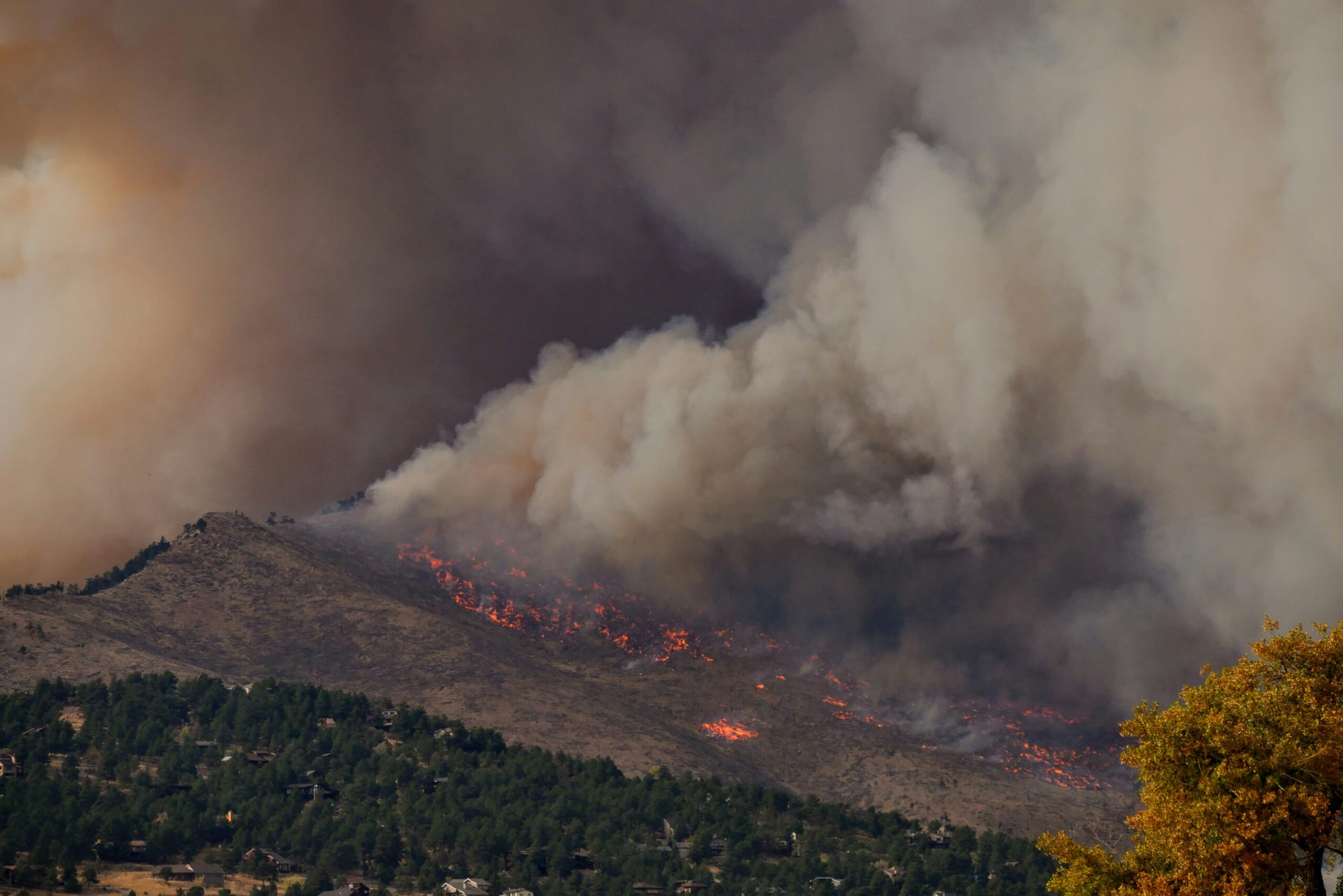
Inversions are not only a winter problem, though they can be especially noticeable in cold seasons when wood smoke, vehicle exhaust, and fireplace emissions are common. They can also happen during wildfire smoke events, calm summer mornings, and in coastal or mountain regions where terrain and temperature contrasts shape local air movement. The same basic pattern repeats: stable air limits vertical mixing.
How the Lid Effect Changes Air Quality
Air pollution becomes more concentrated when it is released into a smaller volume of air. Imagine pouring a spoonful of dye into a glass of water instead of a bathtub. The amount of dye is the same, but the concentration is very different. A temperature inversion can make the lower atmosphere act more like the glass. Pollutants released near the ground have less room to spread upward, so their concentration near the surface can rise.
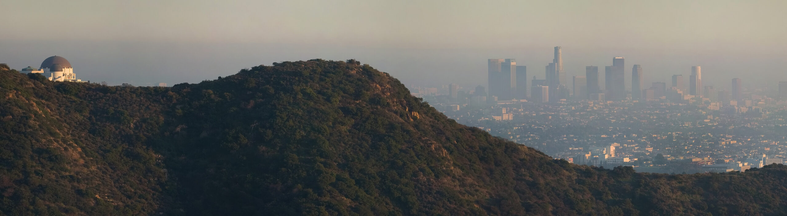
UCAR’s Center for Science Education explains the contrast clearly: rising warm air often helps disperse pollution from the surface, while a temperature inversion keeps pollution trapped closer to the ground. That is why inversions are often discussed with smog, wintertime wood smoke, industrial emissions, and wildfire haze. Cities in basins or valleys can be especially vulnerable because terrain already limits airflow. Los Angeles, Denver, Salt Lake City, and Mexico City are commonly used examples in air-quality education because topography and weather can work together to hold polluted air in place.
Fine particle pollution is one of the main concerns when smoke is involved. PM2.5 particles are small enough to remain suspended and small enough to be inhaled deeply. AirNow’s Fire and Smoke Map focuses on fine particle pollution from wildfires and other sources because PM2.5 is a major part of wildland fire smoke. During an inversion, those particles may stay near breathing level longer than they would on a well-mixed, windy day.

What Haze, Smoke, and Smog Can Tell You
An inversion is invisible, but its effects can be visible. Smoke that hugs the ground, steam that spreads sideways, and a sharp upper edge to a haze layer can all suggest stable air. In a simple demonstration described by the National Weather Service, smoke released before an evening inversion dispersed quickly, while smoke released after the inversion formed hovered near the ground. The same clue appears at larger scales when a city haze layer looks capped beneath clearer air above.
Still, sight alone is not enough to judge air quality. Smoke can ride high overhead and tint the sky without creating the worst breathing conditions at the surface. The opposite can also happen: ground-level pollution can be elevated while the sky looks only mildly hazy. That is why official air-quality readings matter. The Air Quality Index turns measured pollution into categories that help people decide whether to adjust outdoor activity.
A good way to read a hazy day is to combine clues. Notice the time of day, wind, terrain, smell, visibility, and local AQI. Morning haze in a valley after a calm, clear night points strongly toward trapped surface air. Afternoon improvement after sunshine and a breeze suggests mixing has returned. If the AQI stays elevated even after the haze looks less obvious, particles or ozone may still be affecting the air.
Smog is also shaped by chemistry, not just trapping. Ground-level ozone forms through sunlight-driven reactions involving nitrogen oxides and volatile organic compounds, often from vehicles, industry, and other combustion sources. Inversions and stagnant high-pressure patterns can help those ingredients accumulate, while sunlight and heat can drive ozone formation. The visible haze, the AQI number, and the underlying chemistry are related, but they are not identical.
Why Sunlight and Wind Often Break the Pattern
Many surface inversions weaken after sunrise because the ground begins warming the air above it again. Once surface air becomes warm enough to rise, it can punch into the stable layer and start mixing. A light breeze can help by stirring the lower atmosphere, while stronger winds can replace trapped air with cleaner air from elsewhere. This is why morning pollution sometimes improves by midday.
The breakup is not automatic. Winter sun may be too weak to warm the ground quickly, especially when snow cover reflects sunlight and keeps the surface cold. High-pressure systems can bring several days of sinking, stable air and weak winds. In basins, cold air may remain pooled even while ridges above are warmer. When that happens, pollution can build day after day until a stronger weather system finally clears the air.
Forecasters pay attention to mixing height, wind speed, pressure patterns, and expected sunlight because those details help predict whether pollutants will disperse or linger. NOAA and the National Weather Service provide air-quality forecast guidance, while AirNow points readers to local air-quality data and smoke maps. The useful lesson for everyday readers is that air quality is not only about sources. It is also about the atmosphere’s ability to dilute, move, or trap what those sources release.
How to Use This Knowledge on a Bad Air Day
Understanding inversions does not require anyone to become a meteorologist. It gives people a better way to interpret what they already notice. If smoke smells stronger before breakfast, if a valley looks hazy under clear skies, or if a cold still morning holds exhaust near roads, the atmosphere may be trapping pollution close to the surface. That is a signal to check local air-quality information before planning strenuous outdoor activity.
During elevated particle pollution, small adjustments can reduce exposure. Moving a run to later in the day, choosing an indoor workout, keeping windows closed during the worst hours, or using a cleaner indoor air space can matter for people who are sensitive to smoke and pollution. Children, older adults, people with asthma or heart disease, and people who work or exercise outdoors often need to be more cautious when AQI readings rise.
The deeper point is that pollution is never only a list of emissions. It is a meeting between sources and weather. A city can release the same exhaust on two different mornings and have very different air quality because one atmosphere mixes and the other traps. A wildfire hundreds of miles away can send smoke overhead, but whether people breathe much of it near the ground depends on wind, terrain, and vertical mixing.
Temperature inversions make the lower atmosphere feel smaller. They compress smoke, smog, and fine particles into the air people use most directly. Once the lid lifts, the haze may thin, smells may fade, and the skyline may sharpen. Until then, the stillness itself is part of the story: the air is not empty, and when it stops moving upward, everything released into it has fewer places to go.


Add comment