
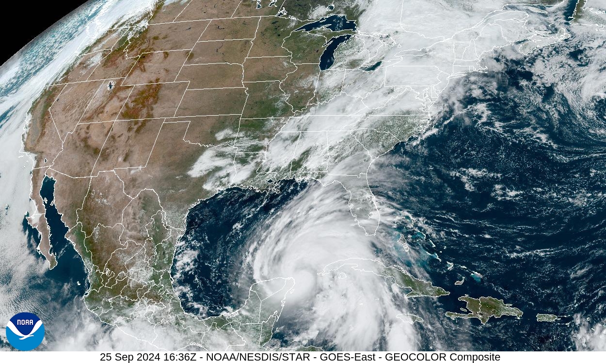
When a hurricane approaches, the map that gets shared most often is usually the forecast cone. It is easy to see why: the cone is simple, dramatic, and updated regularly. But the cone is not the same thing as an evacuation zone, and confusing the two can lead people to make the wrong decision at the worst possible time. The cone is mainly about where the center of the storm may travel. Evacuation zones are about where water, wind, roads, housing, and local conditions may make staying dangerous.
That distinction matters even in a season expected to be quieter than usual. NOAA’s May 2026 Atlantic hurricane outlook called for 8 to 14 named storms, 3 to 6 hurricanes, and 1 to 3 major hurricanes, below the long-term average. A seasonal outlook, though, cannot say which neighborhoods will flood or which roads will close. Emergency managers plan around the storm that is actually coming, not the average season. A single landfalling storm can make evacuation-zone knowledge more useful than any broad forecast number.
The Cone Tracks the Center, Not the Whole Storm
The National Hurricane Center’s forecast cone represents the probable track of a tropical cyclone’s center, based on recent years of official forecast errors. It does not show the storm’s full size. It does not draw the edge of danger. It also does not mean that places outside the cone are safe. A large hurricane can push water, rain, tornadoes, and tropical-storm-force winds far from the line that marks the center’s expected path.
The cone is still valuable. It helps people see uncertainty in the track, especially several days before landfall. A storm expected to turn north may turn sooner or later than forecast. A storm expected to move quickly may slow down. The cone gives a visual reminder that the forecast is a range of possibilities, not a promise.
Evacuation decisions need a different kind of map. A family does not evacuate because the centerline crosses a town, and a family is not automatically safe because the centerline passes somewhere else. Local officials look at expected hazards, road timing, bridge access, shelter capacity, hospital needs, and the areas most likely to become cut off or flooded. That is why evacuation orders are usually issued by zones, not by the shape of the forecast cone.
Evacuation Zones Are Built Around Local Risk
A hurricane evacuation zone is a planning area used by local or state officials to organize who may need to leave before conditions become unsafe. The exact labels vary by place. Florida commonly uses zones from A to F, with Zone A generally the most vulnerable and most likely to be ordered out first. North Carolina and South Carolina also use zone systems for coastal counties. New York City uses numbered hurricane evacuation zones. The labels differ, but the purpose is similar: make a complicated risk map easier for the public to understand quickly.
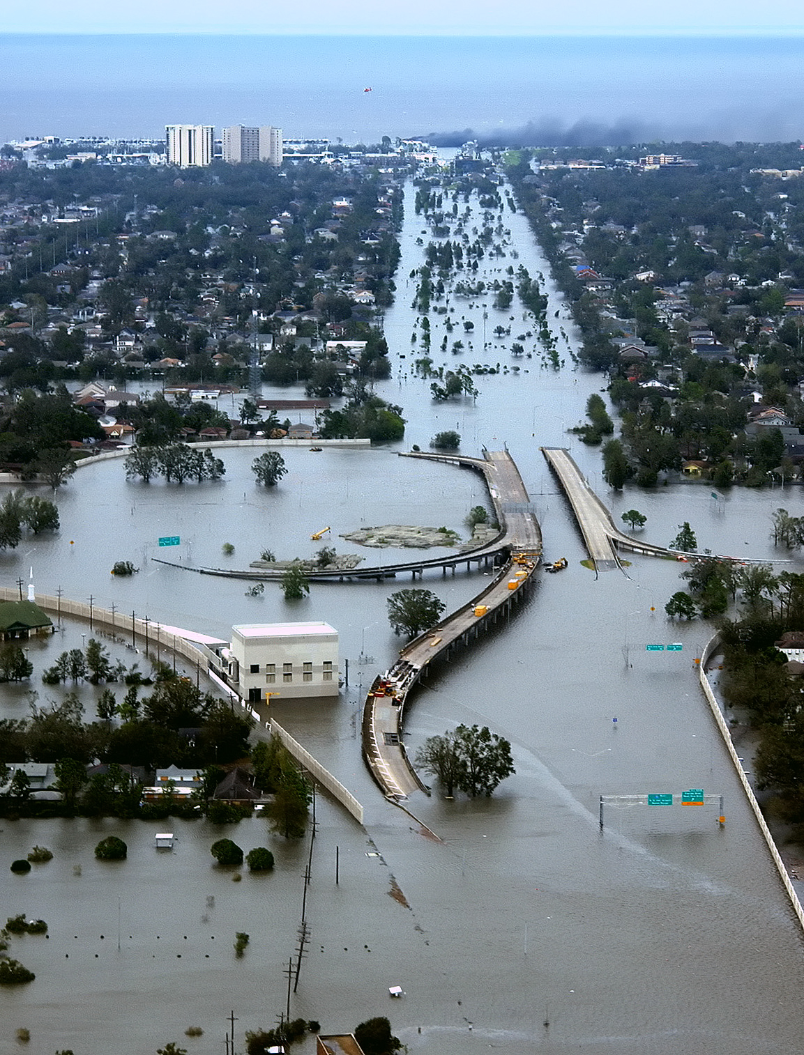
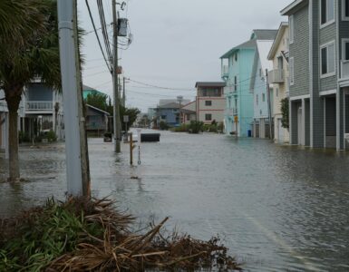
Evacuation zones are often shaped heavily by storm surge risk. Storm surge is the abnormal rise of seawater pushed toward land by a storm. It can move through bays, canals, rivers, marshes, and low roads, which means danger is not limited to the first row of houses at the beach. The National Hurricane Center’s storm surge risk maps are designed to show where saltwater flooding could extend well inland along parts of the Gulf and Atlantic coasts, Hawaii, Southern California, and several U.S. territories.
Local details matter. Two homes the same distance from the shoreline may face very different risks if one sits higher, one is near a tidal river, or one depends on a bridge that can close early. A low road can become impassable before a house itself floods. A mobile home can be unsafe in strong winds even if it is not in the lowest surge area. Evacuation zones give officials a way to turn those layered risks into an order people can actually follow.
Storm Surge Is Why Distance Can Mislead
One of the easiest mistakes is judging hurricane danger by distance from the ocean. Distance matters, but water does not move across land in a perfectly even line. Coastal shape, seafloor slope, storm angle, tide timing, and river connections all affect where surge can go. A shallow continental shelf can let water pile up more dramatically. A bay can funnel water into a smaller space. A storm arriving near high tide can create a different flooding problem than the same storm arriving at low tide.
This is also why hurricane category alone cannot tell someone whether to evacuate. The Saffir-Simpson scale is based only on maximum sustained wind speed. The National Hurricane Center is clear that the scale does not include storm surge, rainfall flooding, or tornadoes. A Category 1 hurricane can still create dangerous water in the wrong coastal setting. A weaker storm that moves slowly can bring severe flooding. A stronger storm passing at the right angle may create a different surge pattern than people expect.
Evacuation zones help separate the water question from the wind number. They do not predict exactly how high the water will rise in every storm. Instead, they identify areas where officials may need to order people out when a particular forecast suggests life-threatening water, unsafe housing, or blocked routes. That is why residents are often told to know their zone before hurricane season, not while the storm is already close.
Flood Zones and Evacuation Zones Are Not the Same
Another common confusion is between FEMA flood zones and hurricane evacuation zones. FEMA flood maps are used for long-term floodplain management, building rules, and insurance decisions. They describe flood risk in a regulatory and statistical way. Evacuation zones are operational tools used during emergencies. They help officials decide who should leave first, who may be told to shelter, and how to reduce traffic pressure when time is limited.
A home can be outside a high-risk FEMA flood zone and still be inside a hurricane evacuation zone. The reverse can also happen. A property may have a flood-insurance concern from rainfall, rivers, or drainage but not be part of the first hurricane evacuation order. The map names can make this especially confusing because both systems may use letters such as A. A Zone A on one map may not mean the same thing as Zone A on another.
The safest approach is to look up both before a storm threatens. Flood maps help with long-term decisions about insurance, construction, and property risk. Evacuation-zone maps help with short-term hurricane planning. They answer different questions. One asks, in effect, what kind of flood risk exists here over time? The other asks, if a coastal storm is approaching, might local officials tell this area to leave?
Why Orders Often Come Before the Weather Looks Bad
Evacuation orders can feel early because they are designed around travel time, not just the moment hazards arrive. Roads fill. Gas stations run low. Bridges may close. Buses, shelters, hospitals, nursing homes, and emergency services need time to move people safely. Once tropical-storm-force winds begin, outdoor preparation and travel become more dangerous, and emergency responders may not be able to reach every place quickly.
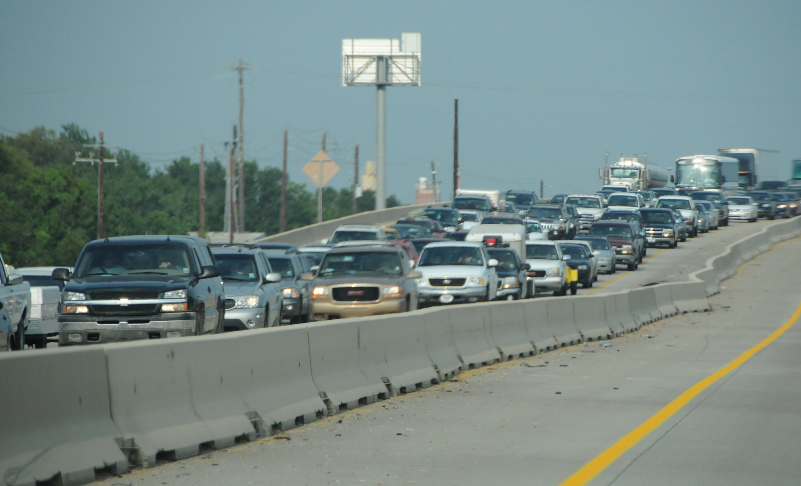
This is why officials may order the most vulnerable zones first. A phased evacuation can reduce gridlock and leave road capacity for people who truly need to move. It also prevents unnecessary evacuation when a storm does not threaten every zone equally. Maryland’s emergency management system, for example, describes evacuation zones as a way to simplify hundreds of local evacuation areas, reduce highway congestion, and avoid overcrowding shelters.
Timing can also change as the forecast changes. A county might announce voluntary evacuation guidance, then mandatory orders for certain zones, then shelter-in-place advice for areas that are safer staying put. These decisions can sound inconsistent if people expect one all-purpose hurricane rule. They make more sense when evacuation is treated as a local risk-management decision. The goal is not for everyone to drive as far away as possible. The goal is for people in the highest-risk places to reach safer shelter before travel itself becomes dangerous.
How to Read Your Zone Before a Storm
The practical habit is simple: know the official evacuation zone for the address where you live, work, study, or stay during hurricane season. Visitors need this too, especially in coastal rental areas where they may not know local road names or flood history. Many states and counties provide address lookup tools, and local emergency management offices usually explain what each zone label means.
Once a storm threatens, compare three things instead of watching only one map. First, check whether your location is in an evacuation zone and whether that zone has been ordered to leave. Second, read National Weather Service and National Hurricane Center watches, warnings, and key messages for surge, wind, rainfall, and flooding. Third, follow local officials, because they know which bridges, roads, shelters, and neighborhoods are most vulnerable in that specific place.
The forecast cone, the category number, the storm surge map, the flood map, and the evacuation-zone map are all useful, but none of them replaces the others. Together they tell a fuller story: where the center may go, what hazards may spread outward, which places are most exposed, and when people need to act. Good hurricane preparation starts before the sky changes. Knowing the difference between the cone and the zone is one of the clearest ways to make the maps less confusing when every update matters.


Add comment