A weather radar map can look almost magical. Green, yellow, and red patches sweep across a screen, storms seem to move in real time, and a few minutes of animation can make the sky feel readable. That confidence is useful, but it can also hide an important truth: radar does not see the atmosphere perfectly. It scans from fixed locations, at fixed angles, through air that bends the signal, across terrain that can block it, and over distances that make the beam wider and higher.
That is why a storm can be more complicated than it looks on a phone map. A radar may show heavy rain clearly while missing part of the lowest circulation. It may show a thunderstorm’s upper structure while seeing less of what is happening near the ground. In some places, especially far from the nearest radar or behind mountains, the lowest few thousand feet of the atmosphere can be difficult to observe. The issue is not that weather radar is unreliable. It is that radar is a real instrument with real geometry, and understanding those limits makes the map more useful.
Radar Sends Out a Beam, Not a Flat Picture
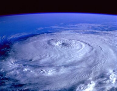
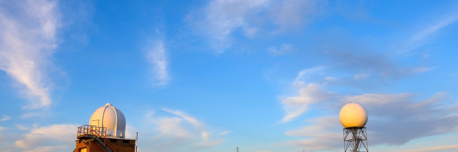
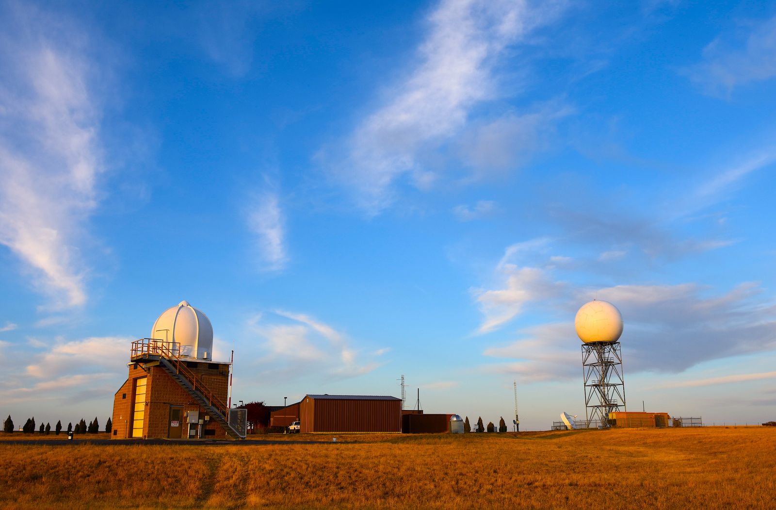
Weather radar works by sending pulses of energy into the atmosphere and listening for energy that scatters back from raindrops, snowflakes, hailstones, insects, or other targets. The National Oceanic and Atmospheric Administration’s NEXRAD system is a network of high-resolution S-band Doppler radars operated by the National Weather Service, the Federal Aviation Administration, and the U.S. Air Force. Those radars detect precipitation and wind, then turn many individual scans into products that forecasters and public maps can use.
The familiar map on a screen is the final display, not the way the radar actually sees. The radar antenna does not cover the whole sky at once. It sweeps around in circles and tilts upward at several angles, building a three-dimensional sample of the atmosphere. The lowest common tilt is close to the horizon, but it is still aimed slightly upward. Higher tilts help show storm depth and structure, while lower tilts are especially important for seeing rain, hail, wind shifts, and rotation closer to the surface.
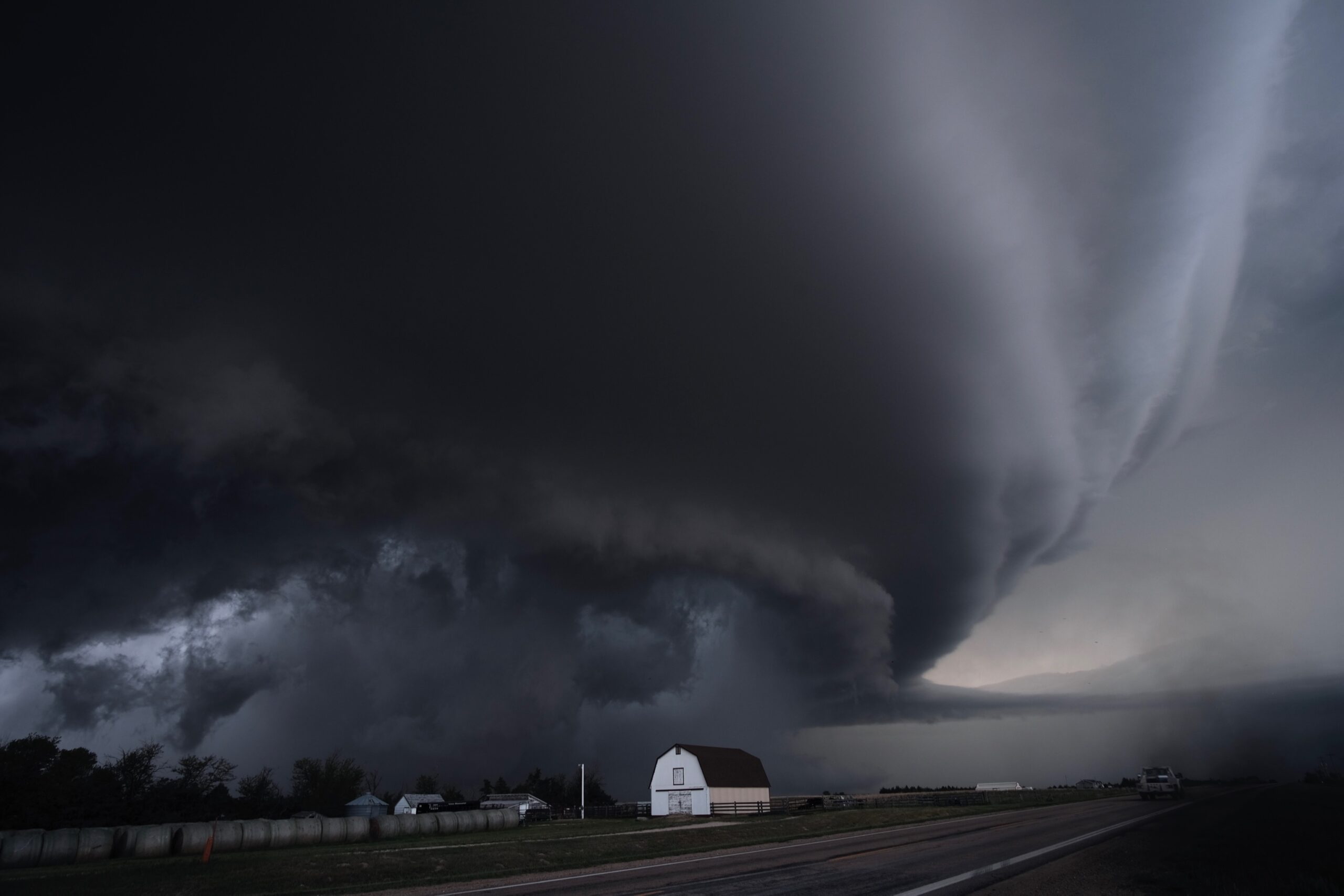
This matters because a storm is not a flat object pasted onto a map. It is a tall, moving column of air with different features at different heights. A radar image may show a strong echo at one level while the most dangerous part of the wind field is lower down. Doppler velocity can reveal motion toward and away from the radar, but that motion is sampled only where the radar beam passes through the storm. The map is a brilliant measurement, not a perfect window.
The Beam Gets Higher and Wider With Distance
The first source of a radar blind spot is simple geometry. As the beam leaves the radar, it spreads outward. The National Weather Service explains that the beam width on a WSR-88D radar is about one degree, but that angle turns into a much wider slice of air as distance increases. A beam that is narrow near the radar can be thousands of feet wide many miles away.
At the same time, the beam rises above the ground. Part of that rise comes from the upward tilt of the antenna. Part comes from Earth’s curvature. Even if a beam begins close to horizontal, the ground curves away underneath it as distance grows. Atmospheric refraction bends the beam somewhat, so the exact height can change from one day to another, but the basic pattern remains: far from the radar, the lowest beam is sampling higher air.
That can make a distant storm look less detailed than a nearby storm. A tight area of rotation near the ground may be easier to detect when it is close to a radar and harder to see when the beam passes thousands of feet above it. Small hail cores, shallow snow bands, or low-level wind features may be smoothed out because the beam is wider. The radar still provides valuable information, but the detail fades with range in the same way a flashlight beam covers a larger, dimmer circle on a far wall.
Coverage Gaps Are About More Than Empty Space
A radar gap does not always mean there is no radar signal at all. Often it means the lowest useful radar beam is too high above the ground to observe the weather feature that matters most. The National Weather Service’s 2020 Report to Congress on NEXRAD radar coverage examined limited or missing coverage below 6,000 feet above ground level because that layer can be important for tornadoes, flash flooding, winter weather, and other hazards.
Mountains make the problem more obvious. Terrain can block or partly block the beam, leaving shadowed areas behind ridges. In broad western valleys, a radar can be physically distant from communities because the network was designed around national coverage, airport needs, available sites, and technical limits rather than every local valley. Coastal areas can have their own challenges, especially when storms form over water where low-level radar coverage is weaker or farther away.
The National Academies described several causes of radar data voids, including beam overshoot, beam blockage, vertical gaps, low signal strength, and the “cone of silence” directly above a radar. Beam overshoot happens when the lowest beam passes above the weather feature instead of through it. The cone of silence is different: because the antenna cannot scan straight up in the same way it scans outward, there is a small area above the radar where coverage is limited. These limits are physical, not careless.
Atmospheric Conditions Can Bend the Signal
Radar beams do not travel through a perfectly uniform atmosphere. Temperature, pressure, and moisture change with height, and those changes affect how the radar energy bends. Under ordinary conditions, the beam curves slightly as it moves away from the radar. When the atmosphere departs from ordinary conditions, the beam can bend more or less than expected.
The National Weather Service describes subrefraction as a situation where the beam bends less than normal and climbs too high. That can cause the radar to overshoot distant thunderstorms or underestimate the intensity of echoes lower in the cloud. Superrefraction bends the beam more strongly toward the ground, which can make the radar sample lower parts of a storm than expected. In stronger cases, ducting can trap the beam and create false echoes known as anomalous propagation.
This is one reason radar interpretation takes training. A bright echo may be a real storm, but it may also be affected by melting snow, ground clutter, insects, sea spray, or unusual beam bending. A weak echo may mean light precipitation, or it may mean the radar beam is too high, too broad, or partly blocked. Forecasters compare radar with satellite imagery, surface observations, storm reports, lightning data, weather models, and neighboring radars because no single tool tells the whole story.
Why Blind Spots Matter During Severe Weather
Radar blind spots matter most when dangerous weather is small, shallow, or fast-changing. A broad shield of rain is usually easy to see. A narrow low-level rotation, a quick spin-up tornado along a line of storms, a shallow snow band, or a flash-flood-producing downpour in complex terrain can be harder. The farther that feature is from the nearest radar, the more careful forecasters must be when interpreting what the data shows.
This does not mean warnings depend only on radar. The 2020 National Weather Service report emphasized that trained forecasters use many datasets, including satellites, surface observations, storm spotters, and high-resolution forecast models. Radar data is critical, but warnings are human decisions built from multiple forms of evidence. A spotter report, a sudden wind shift at a surface station, or satellite signs of rapid storm growth can matter when radar coverage is limited.
For readers using public radar apps, the practical lesson is modest but important. Do not treat a blank or weak-looking radar image as proof that conditions are safe, especially during a watch or warning. Check official warnings, local forecast discussions, and trusted meteorologists when storms are nearby. If a warning is issued for your area, act on the warning rather than waiting for the radar image to look dramatic over your exact location.
How to Read Radar With Better Judgment
A good radar map is still one of the best tools for understanding short-term weather. It can show where rain is moving, how a thunderstorm is organizing, where a line of storms is accelerating, and whether precipitation is changing type. The goal is not to distrust radar. The goal is to read it with the instrument in mind.
Distance is the first clue. If the storm is far from the nearest radar, low-level details are less certain. Terrain is the second clue. Mountains, ridges, and even local obstructions can reduce what the beam sees. Time is the third clue. A radar loop may be a few minutes old, and a rapidly changing storm can strengthen, weaken, or turn between scans. Product choice also matters. Reflectivity shows returned energy from precipitation, while velocity shows motion toward or away from the radar. Each answers a different question.
Radar becomes most powerful when it is paired with context. A summer thunderstorm line moving into a radar gap deserves caution even if the image looks uneven. A winter snow band may be stronger at the ground than a distant radar suggests. A storm near a radar may show fine detail that a similar storm far away would not reveal. Once those limits are visible, radar becomes less like a magic map and more like what it really is: a remarkable measurement system that helps people make better decisions when the atmosphere is moving faster than the eye can follow.