

 Akshay Dinesh
Two winter storms can arrive at the same temperature and leave remarkably different surfaces. One rattles against windows and scatters tiny ice pellets across the pavement. The other falls as ordinary-looking rain, then coats branches, steps, and wires in a smooth layer of ice. The difference between sleet and freezing rain is not simply how cold it feels outside. It is what happens to precipitation on its journey through layers of air above the ground.
In the United States, sleet means pellets of ice that freeze before they land. Freezing rain reaches the surface as liquid and freezes on contact with sufficiently cold objects. Both can make travel hazardous, but freezing rain can also build a heavy glaze on trees and power lines. A thermometer at street level tells only part of the story.
A journey through warm and cold air
In a common winter-storm setup, precipitation begins as snow high in a cloud, where the air is below freezing. As the snow falls, it may enter a layer of air warmer than 32°F (0°C). The flakes melt partly or completely, depending on the warmth and depth of that layer and the time they spend in it. Below the warm layer, the precipitation encounters colder air again.
That lower cold layer is the crucial fork in the road. When it is sufficiently deep and cold, the drops can refreeze in the air and reach the ground as sleet. When the cold layer is shallow, drops may remain liquid until they strike a cold surface, producing freezing rain. The National Weather Service describes these contrasting paths in its winter precipitation comparison.
These are useful patterns, not rigid recipes. The temperature profile changes with height and time, and the amount of melting and refreezing depends on more than a single threshold. A storm can bring snow in one place, sleet a short distance away, and freezing rain farther along its path. At one location, the precipitation may change type as the layers move.
Why sleet arrives as pellets
Sleet is already solid when it lands. Its small, hard ice pellets can bounce off a windshield or make a tapping sound against a window. On the ground, they may gather into a granular layer that looks different from the smooth sheet produced by freezing rain. In North American weather forecasts, the terms sleet and ice pellets refer to this precipitation; usage of “sleet” differs in some other countries.
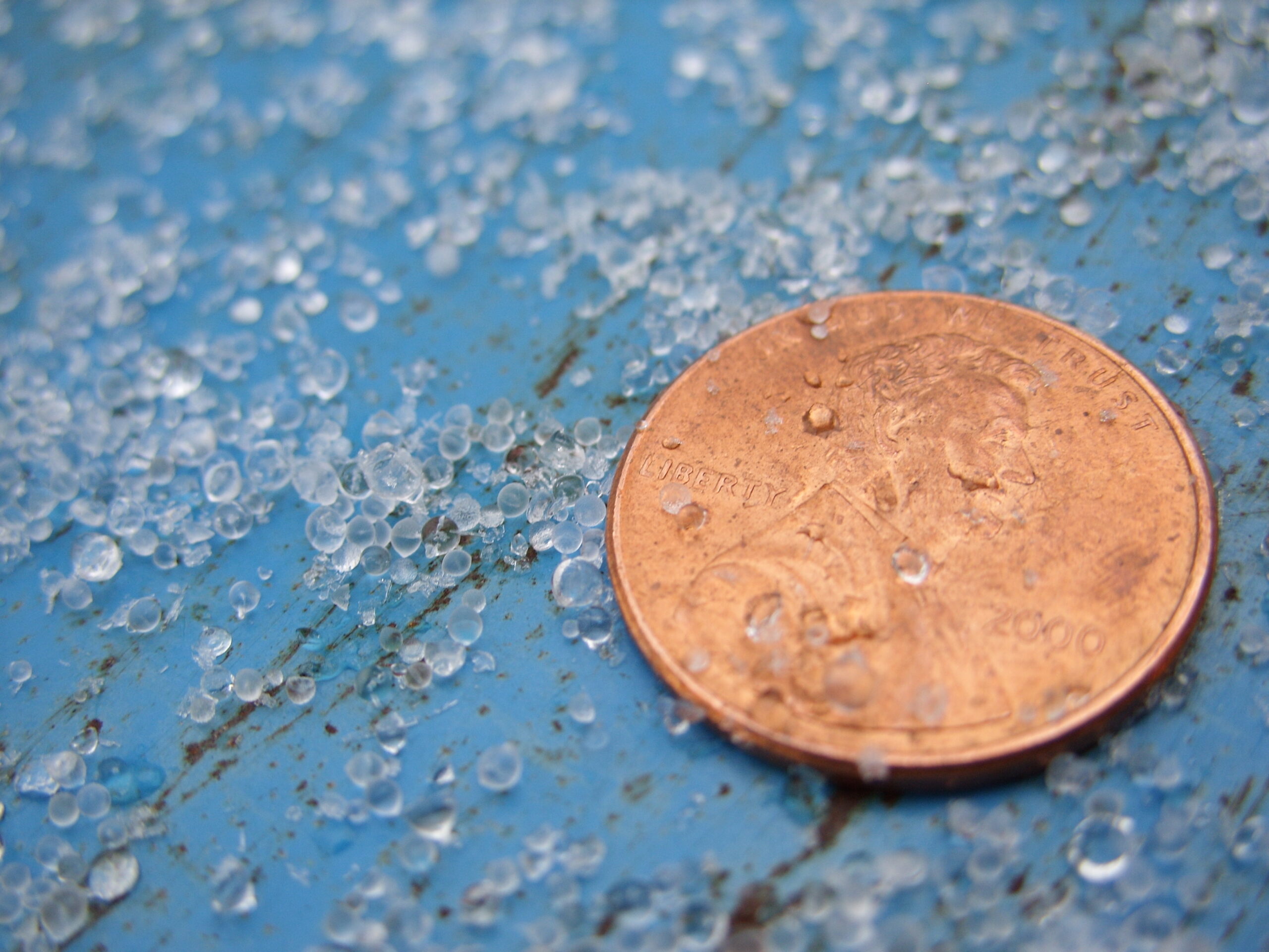
Because sleet freezes before impact, it does not normally coat every exposed branch and wire in the same continuous glaze as freezing rain. That does not make it harmless. Pellets can accumulate, reduce traction, and mix with snow or freezing rain. The sound and appearance offer a useful clue about what is falling, but they are not a substitute for a local forecast or road conditions.
Sleet is also different from hail. Hailstones grow inside thunderstorms as strong updrafts carry water and ice through the cloud. Sleet in this winter-weather sense usually forms when precipitation melts and then refreezes on its way down through a cold layer. Their shared ingredient is ice; their formation stories are different.
Why freezing rain stays liquid until it lands
Liquid water can remain liquid below its normal freezing point. Such water is called supercooled. In the familiar freezing-rain pattern, melted precipitation passes through a shallow layer of subfreezing air near the ground without fully refreezing. When the supercooled drops strike sufficiently cold surfaces, some or all of the water freezes, and repeated drops can build a coating called glaze.
The outcome also depends on the surface. A road, a tree branch, a car, and an elevated wire do not necessarily have the same temperature. The National Weather Service notes that a comparatively warm road can resist icing while colder elevated objects collect ice. A reported air temperature near freezing therefore cannot by itself tell you whether every surface is safe.
Freezing rain is not simply rain that has frozen in midair; that would describe an ice pellet by the time it reaches the ground. Nor does every drop instantly turn entirely to ice on contact. Water can spread or run before freezing, helping glaze cling to the shape of an object. The resulting transparent coating can be difficult to see, especially on dark pavement.
Why the difference matters during a storm
Both types can make walking and driving dangerous, and a thin glaze can be treacherous even before a storm becomes severe. Freezing rain presents an additional problem when ice accumulates on elevated objects: the added weight can bend or break branches and strain utility lines. The National Weather Service uses the term ice storm for significant damaging ice accumulation associated with freezing rain; alert thresholds can vary by location.
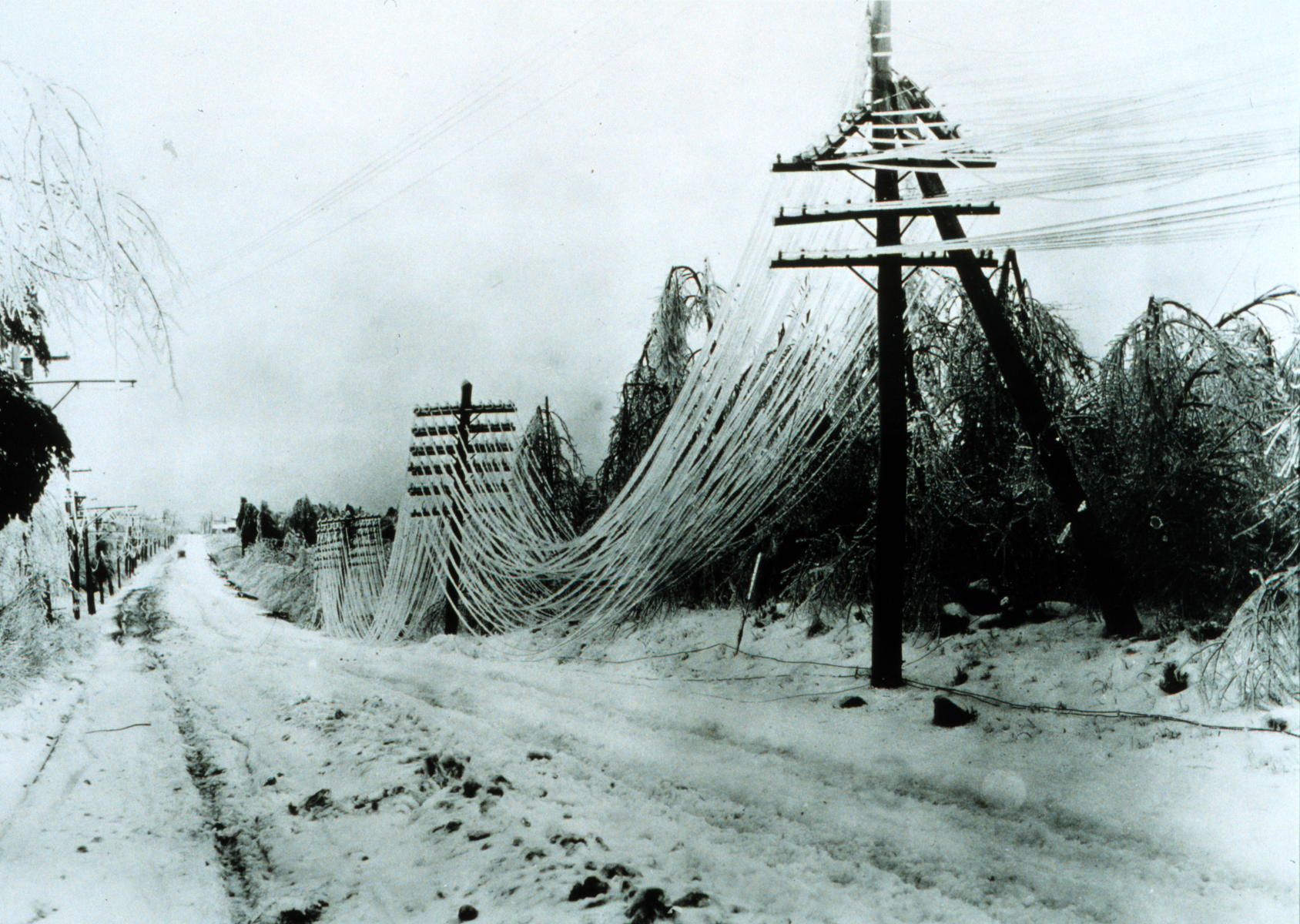
For forecasts, the distinction is also difficult. A small shift in the depth or temperature of a layer aloft can change whether drops refreeze before reaching the ground. Forecasters examine observations and models of the atmosphere at several heights, not just the temperature shown on a phone. Even then, the boundary between precipitation types can move, and a forecast may include a mixture or a range of possible ice amounts.
When wintry precipitation is expected, check the local National Weather Service forecast and follow current advisories from local authorities. Avoid unnecessary travel in icy conditions, and stay away from downed power lines. A surface that looks merely wet can be icy; neither the sound of pellets nor the absence of visible snow guarantees safe footing.
The next time a forecast distinguishes sleet from freezing rain, picture the air in layers. With enough cold air below a warm layer, falling water can become pellets before it lands. With a shallower cold layer, supercooled drops can reach the surface and leave a glaze. The small difference in the journey makes a large difference to what the storm leaves behind.




Add comment