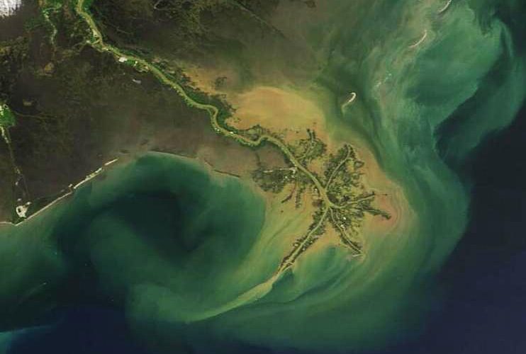
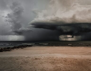
Each summer, a large patch of low-oxygen water forms along the northern Gulf, where the Mississippi and Atchafalaya rivers meet the sea. It is often called the Gulf dead zone, but the name can be misleading. The water is not poisoned in a single dramatic event, and the entire Gulf does not become lifeless. Instead, a chain of ordinary-looking processes builds into an underwater squeeze: nutrients wash downstream, algae grow, dead organic matter sinks, bacteria decompose it, and oxygen near the seafloor drops too low for many animals to stay.
That makes the dead zone a useful way to understand how connected land and ocean really are. Fertilizer applied far upriver, stormwater from streets, wastewater, spring rainfall, river flow, summer heat, and calm weather can all help shape what happens hundreds of miles away on the continental shelf. In June 2026, NOAA forecast an above-average Gulf hypoxic zone of about 7,027 square miles, with a wide uncertainty range because weather can still mix or rearrange the water before scientists measure it in late summer. The forecast gives the topic a timely edge, but the lesson is larger than one year: water quality problems often begin long before the water looks unhealthy.
What a Dead Zone Really Means
A dead zone is an area of hypoxia, which means the water has too little dissolved oxygen to support many forms of aquatic life. Fish, shrimp, and crabs need oxygen just as land animals do, but they take it from water rather than air. When oxygen near the bottom drops very low, animals that can swim usually leave. Animals that move slowly or live on the seafloor may be stressed, weakened, or killed if they cannot escape.
Scientists commonly use dissolved oxygen measurements to define hypoxic water. USGS explains that in the northern Gulf, oxygen-depleted subsurface water forms seasonally, usually beginning in late spring, growing through summer, and ending as fall weather helps mix the water again. This seasonal pattern matters because it shows that the dead zone is not a permanent empty place. It is a repeating condition created by chemistry, biology, river flow, and weather.
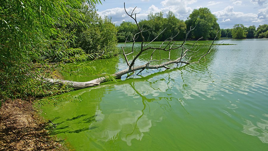
The word dead also hides an important contrast. The same nutrient-rich water that helps fuel the problem can make surface waters highly productive. Algae and plankton grow quickly when nitrogen and phosphorus are abundant. The trouble appears later, when that growth sinks and decomposes below the surface, pulling oxygen out of deeper water faster than it can be replaced.
How Nutrients Travel From Land to Sea
The Gulf dead zone begins on land. The Mississippi-Atchafalaya River Basin drains a huge part of the central United States, collecting water from farms, towns, suburbs, and cities before carrying it toward Louisiana and the Gulf. Along the way, runoff can pick up nitrogen and phosphorus from fertilizer, manure, soil, storm drains, wastewater systems, and other sources. These nutrients are not automatically harmful; plants need them to grow. The problem is excess.
In a cornfield, garden, or wetland, nitrogen and phosphorus can feed plant growth in useful ways. In coastal water, too much of them can act like fertilizer for algae. Heavy spring rains can move more nutrients into rivers, and high river flow can deliver them more quickly to the coast. That is why the Gulf forecast uses May river discharge and nutrient loads as key inputs. NOAA’s 2026 ensemble forecast used USGS estimates of 134,500 metric tons of nitrate and 16,300 metric tons of phosphorus carried toward the Gulf in May.
The pathway is not simple. Some nutrients are absorbed by plants, held in soil, processed by microbes, or slowed by wetlands and floodplains. Some continue downstream. A watershed acts like a vast collection system, and the Gulf dead zone shows what can happen when many small inputs accumulate across a large area. A single lawn or field does not create the dead zone by itself, but millions of decisions across a watershed can shape the water at the end of the river.
Why Algae Can Lead to Oxygen Loss
Once nutrient-rich river water reaches the Gulf, algae and other tiny organisms can grow rapidly in the sunlit surface layer. At first glance, this may sound like more life, not less. The critical step happens when algae die or are eaten and waste material sinks. Bacteria break down that organic matter, and decomposition uses oxygen. If oxygen is being consumed near the bottom faster than new oxygen arrives, the lower water becomes hypoxic.
Summer makes the process easier to sustain because warm, fresh river water can sit above cooler, saltier Gulf water. These layers do not mix as readily as a single uniform water column. The oxygen-rich surface layer may be exposed to air and photosynthesis, while bottom water becomes more isolated. Without enough wind, waves, or storms to stir the layers together, the deeper water can keep losing oxygen.
This is why forecasts are never perfect. A hurricane or strong storm can mix the water column and shrink the measured dead zone, even if nutrients were high earlier in the season. Calm weather can let low oxygen persist and spread. NOAA’s forecast gives a likely size under expected conditions, but the late-summer survey provides the measured result.
What Low Oxygen Does to Marine Life
Low oxygen changes habitat before it creates obvious die-offs. Fish and shrimp may move away from the seafloor or crowd into areas where oxygen remains higher. That movement can affect where fishing boats find catchable species and how much time they spend searching. Smaller animals that live in or on bottom sediments have fewer choices. Some can tolerate low oxygen for a while, but many cannot survive prolonged hypoxia.
The effects ripple through the food web. Bottom-dwelling organisms help feed larger fish. If those organisms decline in a hypoxic area, predators may lose feeding grounds even if they can swim away. Young fish and shrimp can also be affected if low oxygen overlaps with important nursery habitat. The dead zone is not just a blank spot on a map; it is a shift in where animals can breathe, feed, and grow.
The Gulf is also economically important. Commercial and recreational fisheries, seafood processing, tourism, and coastal communities all depend on healthy marine systems. A dead zone does not shut those systems down by itself, but it adds pressure. When oxygen loss pushes species into smaller usable areas, the cost is paid in habitat stress, shifting catch patterns, and the long-term challenge of managing a productive coast under changing conditions.
Why the 2026 Forecast Matters
The 2026 NOAA forecast is useful because it turns an invisible underwater condition into something people can track and discuss before the annual measurement cruise. NOAA’s ensemble predicted about 7,027 square miles of hypoxic water, larger than the 39-year average measured size of 5,223 square miles and below the 2017 record of 8,776 square miles. The agency also reported a 95 percent confidence interval from 3,895 to 10,021 square miles, a reminder that real ecosystems do not behave like simple calculators.
That uncertainty is not a weakness of the science. It is part of the science. Different forecast models represent different parts of the system, including river flow, nutrient loads, ocean conditions, and biological response. When the models broadly agree, forecasters can be more confident. When they spread out, the range itself tells researchers and decision-makers that the season could unfold in more than one way.
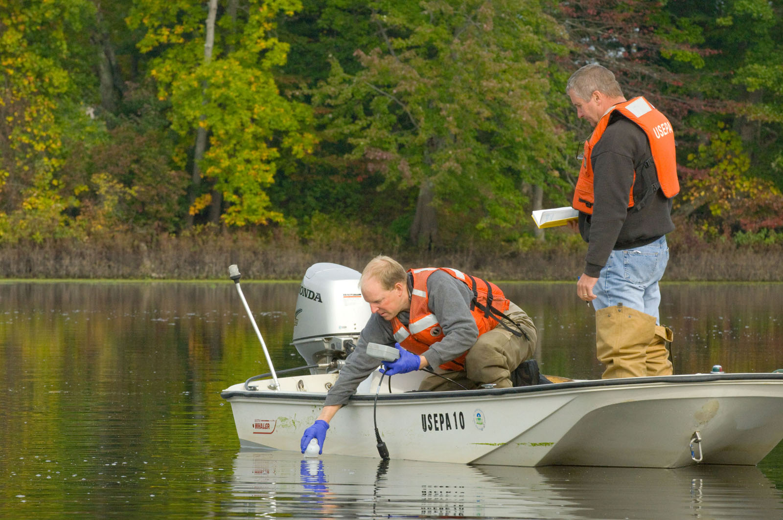
EPA notes that NOAA releases a forecast in late spring and supports a later summer cruise to measure the zone directly. That sequence matters for learning. Forecasts help communities and agencies understand risk ahead of time, while measurements test how well the models captured the season. Over many years, those comparisons help scientists improve their understanding of how land use, rainfall, river flow, temperature, and storms interact.
How Communities Can Reduce the Problem
The Gulf dead zone is large, but the solution is not one giant switch. Reducing it means cutting the amount of excess nitrogen and phosphorus that reaches waterways. On farms, that can involve applying fertilizer more precisely, planting cover crops, improving drainage management, and keeping soil in place. In towns and cities, it can involve better stormwater systems, wastewater treatment, green infrastructure, and practices that keep nutrients out of streams.
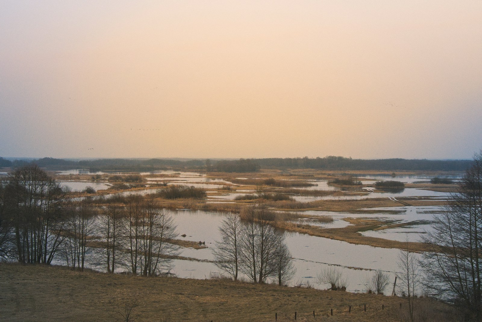
Wetlands and floodplains can help because they slow water down and give plants and microbes time to process nutrients. They are not magic filters, and they cannot erase unlimited pollution, but they can reduce the speed and amount of nutrient delivery when they are protected or restored thoughtfully. This is one reason watershed management often looks upstream, not only at the coast where the dead zone appears.
The most useful way to think about the dead zone is as a delayed consequence. Nutrients may leave a field, street, or pipe long before anyone sees the effect. Algae may bloom before oxygen drops. Fish may move before people notice a change in catch. By the time the dead zone is mapped, the chain of causes has already stretched across a continent-sized watershed.
That can sound discouraging, but it also points to a practical lesson. Water problems are rarely only local or only distant. They connect places. A river carries not just water, but evidence of how land is used, how storms move through a region, and how communities manage waste and soil. The Gulf dead zone forms underwater, but its story begins upstream, one rainfall, one field, one drain, and one river mile at a time.


Add comment