
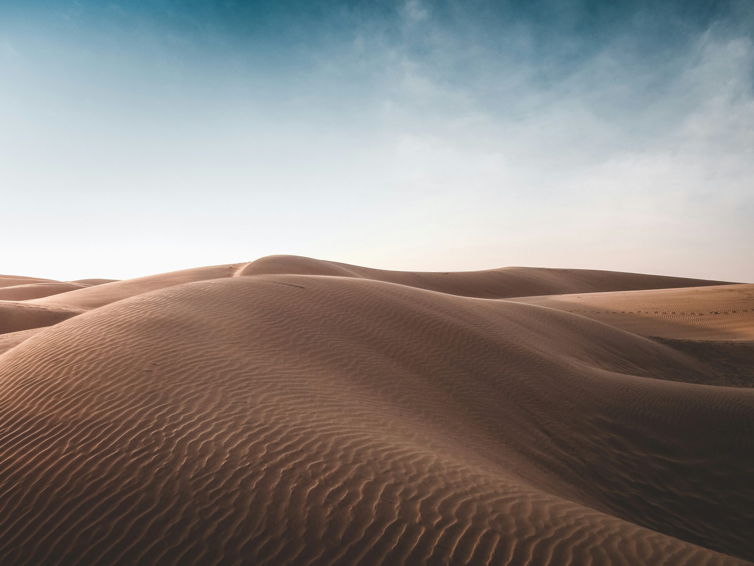
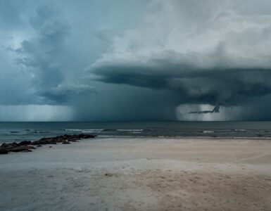
Each summer, enormous pulses of hot, dry, dusty air lift off North Africa and move west across the Atlantic Ocean. From the ground, they may look like a hazy sky, a muted sunset, or a fine layer of dust on a car. From a weather satellite, they can look like a pale veil stretching thousands of miles from the Sahara toward the Caribbean, Florida, and the Gulf Coast. That traveling air mass is called the Saharan Air Layer, and it is one of the quiet forces forecasters watch during the Atlantic hurricane season.
The connection can sound surprising at first. Hurricanes grow over warm tropical water, while the Sahara is a desert far away on another continent. Yet the atmosphere does not respect the neat borders on a map. Air masses move, mix, rise, sink, and collide. When dry Saharan air reaches the same ocean corridor where many tropical storms begin, it can change the odds of storm growth in ways that matter.
What the Saharan Air Layer is
The Saharan Air Layer is a warm, dry, dust-rich layer of air that forms over the Sahara Desert, especially during the summer months. Strong heating over the desert helps create air that is much warmer and drier than the tropical marine air nearby. Disturbances moving across North Africa can lift desert dust high into the atmosphere, where winds carry it westward over the Atlantic.
NOAA tracks these outbreaks because the layer is not just dusty air near the ground. It often rides above cooler, more humid air over the ocean, with its base roughly a mile above the surface and a depth that can reach a few miles. That vertical setup matters. Tropical storms need deep columns of moist air to build tall thunderstorms. A dry, warm layer in the middle atmosphere can interrupt that process before it becomes organized.
The dust is made of tiny mineral particles from desert soil. Some particles are large enough to fall out along the way, while smaller ones can remain suspended for days. As the air mass moves west, satellites, aircraft observations, weather balloons, and forecast models help scientists estimate where the dust is thickest and how it may interact with developing weather systems.
Why dry air makes storms struggle
A tropical cyclone is powered by warm ocean water and moist, rising air. Warm water encourages evaporation. Moist air rises, cools, condenses into clouds, and releases heat. That released heat helps lower pressure near the center of the storm, drawing in more air and building more thunderstorms. The process works best when the atmosphere stays humid through a deep layer and winds are not tearing the storm apart.
Saharan dust outbreaks can interfere with that recipe in several ways. The first is dryness. NOAA’s Atlantic Oceanographic and Meteorological Laboratory describes Saharan Air Layer air as having far less moisture than the typical tropical atmosphere. When that dry air mixes into a developing storm, it can weaken thunderstorms by encouraging downdrafts. Instead of a steady engine of rising, moist air, the system gets patches of sinking air that disrupt the storm’s structure.
The second factor is stability. Because the Saharan Air Layer is warm, it can sit above cooler marine air and make the atmosphere less willing to overturn. A growing storm needs air to rise freely. If the atmosphere becomes more stable, thunderstorm towers have a harder time growing tall and staying organized. The result is not always dramatic, but it can be enough to keep a tropical disturbance from becoming stronger.
The third factor is wind shear. Many Saharan dust outbreaks travel with a fast-moving belt of air known as the African easterly jet. If winds change too much with height, a developing storm can be tilted or torn apart before it builds a strong center. Hurricanes prefer a more vertically aligned structure. Too much shear pushes the storm’s thunderstorms away from its low-level circulation, making intensification harder.
Dust does not simply stop hurricanes
It would be easy to imagine Saharan dust as a simple shield against hurricanes, but weather rarely works that cleanly. A dust outbreak may suppress one tropical disturbance while leaving another mostly unaffected. The timing, location, strength of the dry air, sea surface temperatures, and surrounding wind pattern all matter. Once a storm becomes well organized, it may also be better at protecting its moist core from nearby dry air.
That is why forecasters do not treat Saharan dust as a yes-or-no answer. They look at the broader environment. Is the disturbance embedded in deep moisture or surrounded by dry air? Are upper-level winds favorable? Is the ocean warm enough to support strong thunderstorms? Is the dust plume ahead of the system, wrapped into it, or far away? The answers can change from day to day.
There is another wrinkle: the Atlantic hurricane season has a rhythm. Saharan dust tends to be most noticeable during the early and middle parts of the season, while the most active hurricane period usually peaks later, when ocean heat is high and atmospheric conditions can become more favorable. Dust can still appear during active periods, but it is only one part of a larger seasonal pattern.
What people notice at the surface
For people far from the Sahara, the most visible effect is often haze. Fine dust can scatter sunlight, soften the color of the sky, and produce vivid orange or red sunsets. In some places, especially across the Caribbean, Florida, and parts of the Gulf Coast, a strong dust plume can lower visibility and leave a faint coating on outdoor surfaces.
Air quality can also change. Dust is made of particles, and particles small enough to stay airborne can irritate the eyes, nose, throat, and lungs. Most healthy people may notice only hazy skies, but people with asthma or other respiratory conditions may pay closer attention to local air quality reports when dust is forecast. The same plume that is interesting to meteorologists can still be uncomfortable for people breathing it near the ground.
Dust also has a larger environmental story. Mineral particles from Africa can travel across the Atlantic and settle into the ocean or onto land. Scientists have studied how Saharan dust can carry nutrients such as iron and phosphorus, which may influence ocean plankton or even fertilize parts of the Amazon Basin. The same journey can therefore connect desert soils, tropical skies, ocean life, and distant forests.
How forecasters watch dust from space
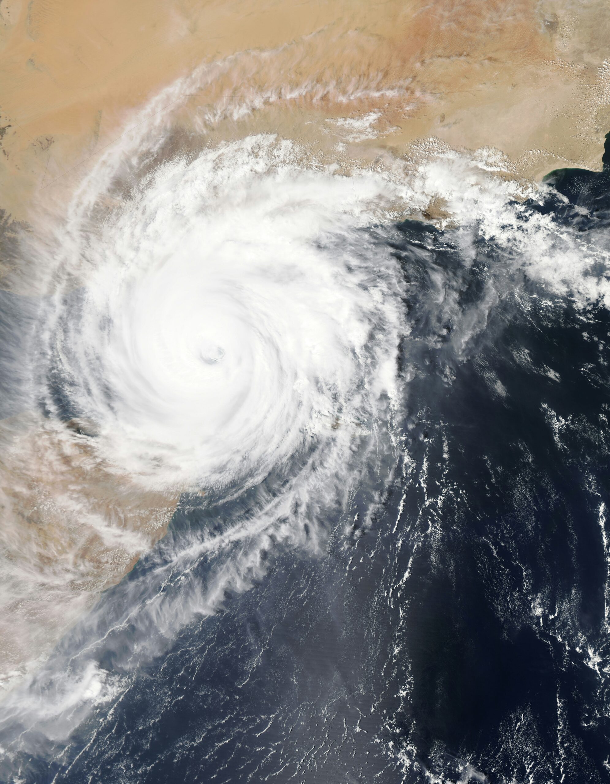
Saharan dust is difficult to understand from one observation alone, so forecasters use several tools together. Weather satellites are especially important because they can follow dust plumes across the ocean in near real time. Some satellite products highlight dry air and dust using infrared channels, while true-color imagery can show the pale brown tint of dust over darker ocean water.
NASA and NOAA observations have made the Saharan Air Layer easier to track than it was in the past. Satellites can show whether a plume is spreading west, thinning out, or approaching a tropical disturbance. Aircraft and balloon measurements add vertical detail, helping scientists understand how dry the air is at different heights. Forecast models then use those observations to estimate how the environment may change over the next several days.
This monitoring matters because hurricane formation is a chain of conditions, not a single trigger. A tropical wave leaving Africa may have rotation but not enough moisture. Another may have moisture but too much wind shear. A third may move into a window where warm water, low shear, and deep moisture line up. Dust tracking gives forecasters one more piece of the puzzle, especially during the part of the season when waves from Africa regularly cross the Atlantic.
Why this distant desert air matters
The Saharan Air Layer is a reminder that weather is global in motion even when its effects feel local. Dust lifted from one desert can cross an ocean, tint skies in another region, change air quality, feed ecosystems, and influence the atmosphere around developing storms. It does not control hurricane season by itself, but it can shift the conditions that decide whether a weak tropical disturbance fades or has room to grow.
For learners, the value is not only in memorizing the name of the air layer. It is in seeing how connected systems work. Heat over land can shape wind. Wind can lift dust. Dust can alter sunlight, moisture, and storm growth. A hurricane forecast is therefore not just about a swirl on a map; it is about the invisible structure of the atmosphere around that swirl.
When hazy summer skies arrive from across the Atlantic, they carry more than desert dust. They carry a story about distance, motion, and balance in Earth’s atmosphere. The same dry air that can make a sunset glow may also be part of the reason a storm struggles to organize far out at sea.


Add comment