Akshay Dinesh
A cool morning can make a familiar street feel strangely changed. Houses fade at the edges, trees lose their sharp outlines, and headlights seem to hang in the air instead of cutting through it. Fog can look mysterious, but the basic cause is ordinary weather: air near the ground cools until it can no longer keep all its water vapor invisible.
That moment depends on temperature, moisture, wind, clouds, and the shape of the land. A night after rain, a low field, a river valley, or a calm rural road can all give fog the conditions it needs. The result is not smoke and not exactly a cloud in the sky. It is a cloud at ground level, made of tiny suspended water droplets that scatter light and shrink the distance people can see.
Fog Begins When Air Reaches Its Dew Point
Air almost always contains water vapor, even when it does not feel humid. Warm air can hold more water vapor than cool air, so a parcel of air can become saturated simply by cooling. The dew point is the temperature at which that air becomes full enough for water vapor to start condensing into liquid droplets.
On many nights the ground loses heat after sunset. Grass, soil, pavement, cars, and rooftops cool first, then they chill the thin layer of air touching them. If that air cools to its dew point, some of the water vapor changes into droplets. When enough droplets form and stay suspended near the surface, the clear night turns into a foggy morning.
This is why fog is often linked to damp ground. Rain the previous day, wet soil, melting frost, and nearby water can all raise the amount of moisture in the air close to the surface. The temperature does not need to plunge dramatically. It only needs to fall far enough to close the gap between the air temperature and the dew point.
Clear Skies and Light Wind Make Radiation Fog More Likely
The common morning fog that settles over fields, neighborhoods, and valleys is often called radiation fog. The name comes from nighttime cooling. Under clear skies, the ground can radiate heat away efficiently, cooling the air just above it. Clouds act more like a blanket, sending some heat back downward, so thick cloud cover can keep the surface from cooling enough for fog.
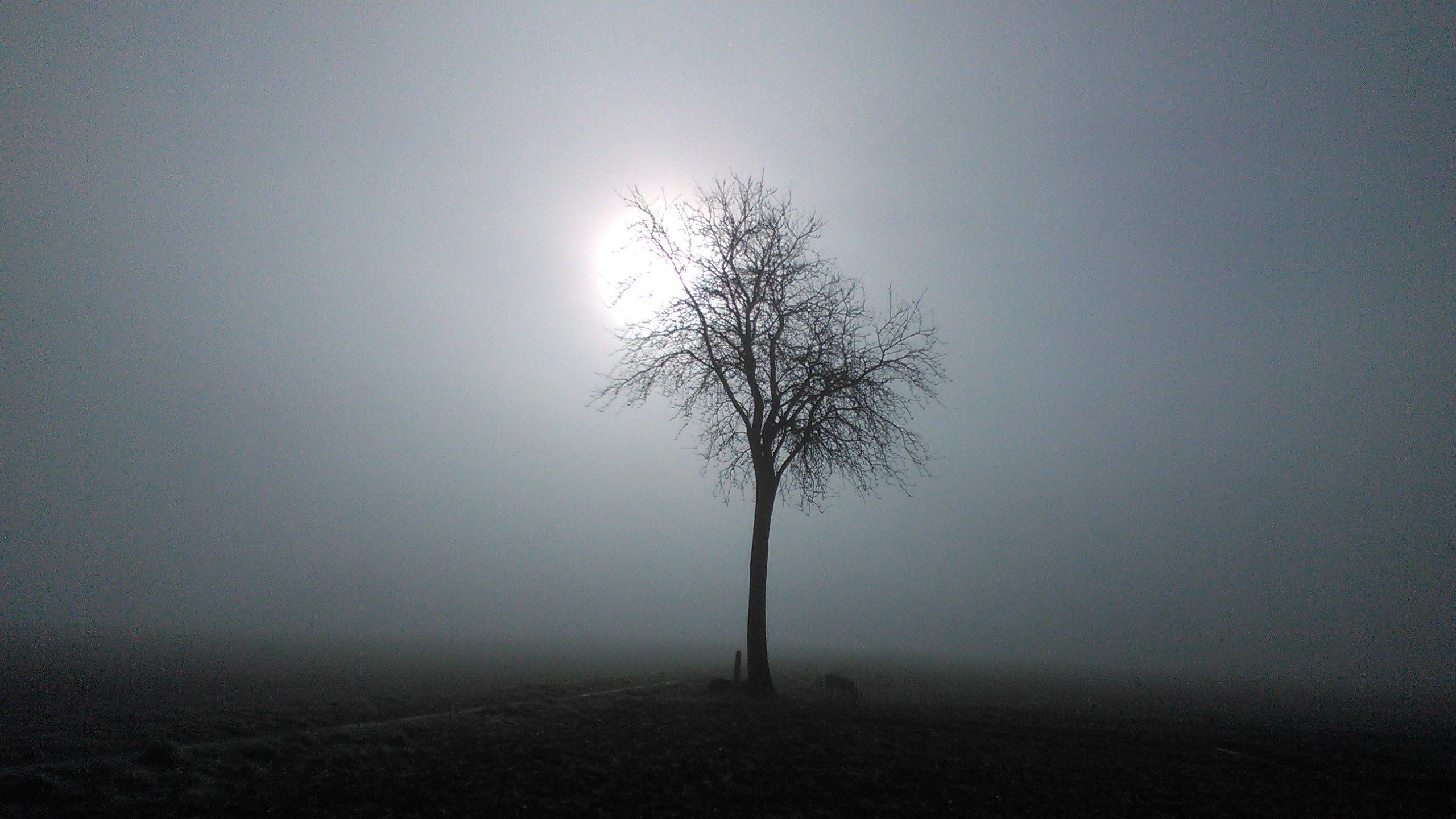
Wind matters just as much. Strong wind mixes cooler surface air with drier or warmer air above it, which can prevent saturation near the ground. Completely still air can allow only a very shallow damp layer to form. Light wind is often the sweet spot: gentle movement spreads the chilled, moist air without mixing it away too aggressively.
Radiation fog is especially common in fall and winter in many places because nights are longer, mornings are cooler, and the ground may stay damp. Early autumn can be a prime setup after warm days and cool nights. The air still has enough moisture from the warm season, but overnight temperatures begin dipping low enough to condense it.
Valleys, Rivers, and Low Spots Hold Fog Longer
Fog does not always spread evenly across a region. One road may be clear while the next dips into a pale, low cloud. That unevenness comes from local geography. Cool air is denser than warm air, so it can drain downhill and collect in low places overnight. Valleys, hollows, and basins often become pockets where chilled air lingers.
Water adds another ingredient. Rivers, lakes, wetlands, and damp floodplains supply moisture to the air around them. When nearby land cools quickly, that moisture can condense into fog, especially where air movement is weak. A river valley can therefore look foggy long after a hilltop has cleared.
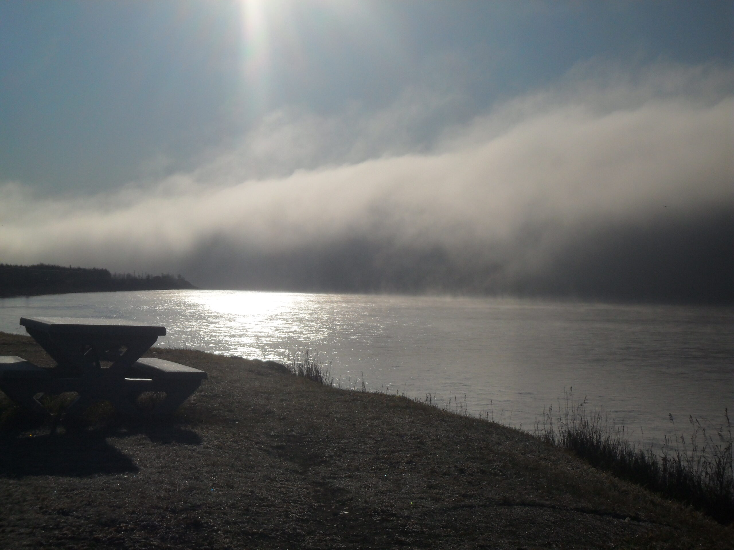
There are other fog types too. Advection fog can form when moist air moves over a colder surface, such as warm air passing over cool water or snow-covered ground. Steam fog can appear when cold air passes over warmer water, creating wisps that rise from lakes or rivers. Upslope fog can form when moist air is forced uphill, expands, and cools. The shared idea is cooling or moistening the air until saturation is reached, but the path to that point changes from place to place.
Why Fog Disappears After Sunrise
Morning fog often feels permanent while it is thick, but it can vanish quickly once sunlight reaches the ground. The sun warms the surface, and the surface warms the air above it. As the temperature rises, the air can hold more water vapor again. The tiny droplets evaporate, visibility improves, and the fog thins into patches before disappearing.
Mixing helps the process. As the ground warms unevenly, small currents stir the lowest part of the atmosphere. A breeze can pull in drier air or mix the fog layer upward, breaking it apart. That is why fog may lift into low clouds before clearing, especially when moisture remains trapped under a layer of warmer air above.
Not every fog bank clears at the same pace. Thick valley fog may survive for hours if cold air remains pooled in a low area. Coastal fog can persist when moist air keeps flowing over cool water. Winter fog can last longer when the sun angle is low and the ground warms slowly. The same fog that disappears from a sunny open field may remain in shaded low ground nearby.
Fog Changes What Visibility Really Means
Fog is more than a pretty morning scene because it changes how far people can see and how quickly they can react. The droplets in fog scatter light, so headlights, streetlights, and traffic signals can blur or glare. Bright high beams may reflect back toward a driver instead of revealing more of the road ahead.
The National Weather Service treats dense fog as a real hazard for drivers, mariners, and pilots because reduced visibility affects decisions that depend on distance and timing. A person walking near a road, a bus driver approaching a stop, a pilot lining up a runway, or a boat operator moving through a channel all need reliable visual cues. Fog removes some of those cues without removing the danger around them.
That is why fog forecasts often focus on visibility rather than simply saying that fog exists. A thin mist over grass may be harmless for most people. A dense fog bank over a highway is different. The same droplets that make sunrise look soft can turn a normal route into a slow, careful trip.
Reading a Foggy Forecast
A good fog setup usually has a few recognizable ingredients: damp ground or a nearby moisture source, light wind, clearing skies, and temperatures expected to fall close to the dew point. If the evening forecast shows the temperature and dew point nearly meeting overnight, fog becomes more plausible. If wind stays strong or clouds remain thick, the chance often drops.
Local conditions can still surprise a forecast. A school field, a river crossing, a shaded road, or a low stretch of farmland may fog over even when the wider area looks mostly clear. That is why morning observations matter. Fog is a small-scale weather event, and small differences in elevation, pavement, soil moisture, and wind can decide where it forms.
Fog makes the atmosphere visible by revealing water that was already there. It shows how close daily weather happens to the ground: in grass that cools faster than pavement, in valleys that collect cold air, in droplets too small to notice until there are millions of them. The next time a cool morning turns white at the edges, the scene is not weather magic. It is water vapor, temperature, and light meeting at exactly the right moment.