 Akshay Dinesh
The Caspian Sea looks like an ocean on a map, but it behaves more like a giant bowl. It has no natural outlet to the open sea, so its water level depends on a balance between what flows in and what leaves through evaporation. When that balance shifts for many years, the shoreline can move by kilometers, ports can become harder to use, wetlands can dry, and communities that have lived beside the water for generations can suddenly find the water farther away.
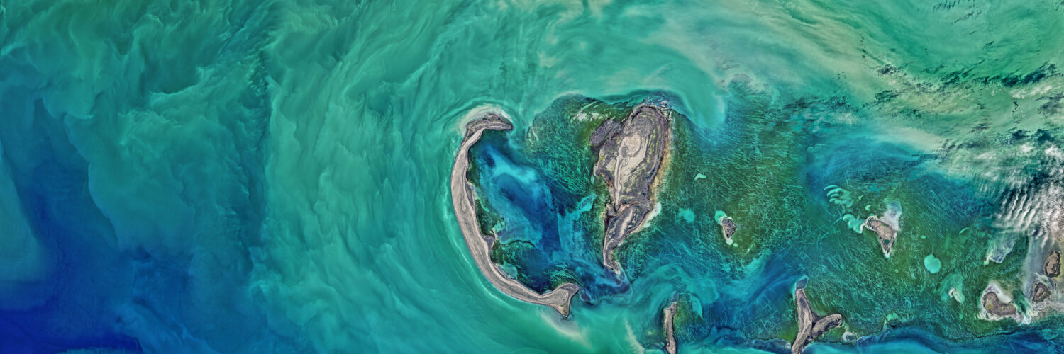
That is why the Caspian Sea has become one of the clearest examples of how geography, climate, rivers, and human water use can meet in one place. NASA Earth Observatory has documented newly exposed land around the shallow northern Caspian, while the United Nations Environment Programme has warned that continued decline could affect millions of people in the five countries along the coast. The story is not as simple as “less rain” or “climate change.” It is a water-budget problem, and every part of the budget matters.
The Caspian is a sea without an ocean outlet
The Caspian Sea sits between Europe and Asia, bordered by Russia, Kazakhstan, Turkmenistan, Iran, and Azerbaijan. By surface area, it is the largest inland body of water on Earth. It is often called a sea because of its size, salinity, waves, and long coastline, but hydrologically it is a closed basin. Water enters mainly through rivers and precipitation, then leaves mostly by evaporation.
This makes the Caspian different from the world ocean. If water is added to the ocean in one region, currents and global sea level spread that change across a connected system. The Caspian cannot share its extra water with the Atlantic, Arctic, or Indian Ocean. It rises or falls according to its own regional balance.
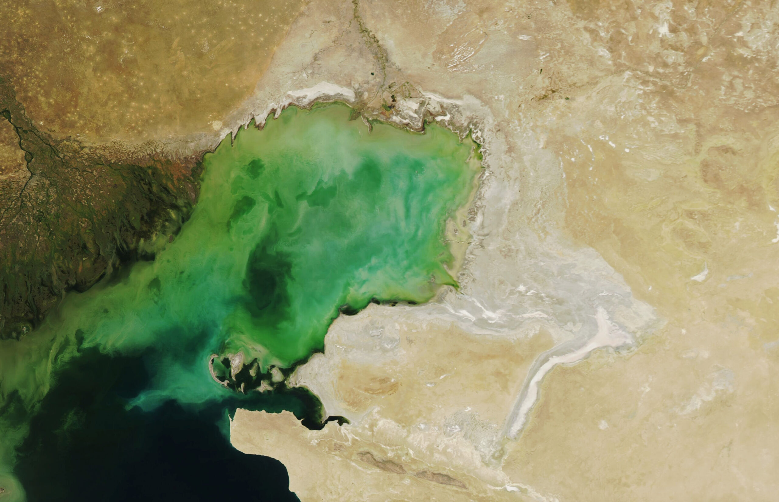
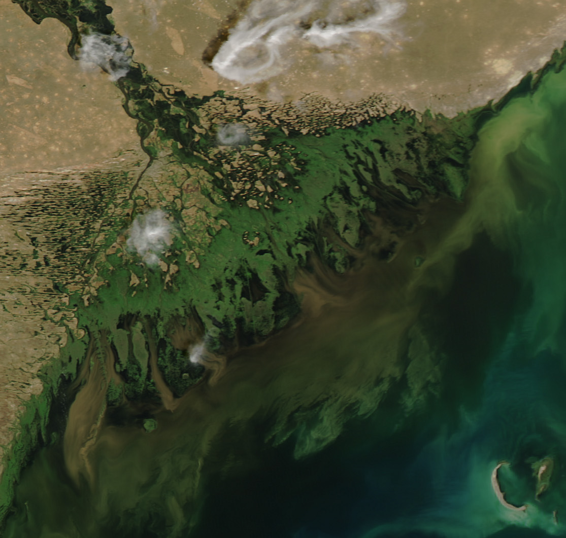
The northern part is especially sensitive because it is shallow. A small vertical drop can expose a large horizontal area of lakebed. That is why the retreat can look dramatic along the coast even when the measured water-level change seems modest. In places where water is only a few meters deep, a falling surface can turn former shoreline into mudflat, salt crust, or dry ground.
The Volga River does much of the filling
The Caspian has more than one source of water, but the Volga River is the most important. The Volga drains a huge part of western Russia before spreading into a wide delta and emptying into the northwestern Caspian. Because the river supplies such a large share of the sea’s inflow, changes in the Volga basin can ripple through the whole system.
River inflow can change for several reasons. Snowpack, rainfall, temperature, soil moisture, reservoirs, irrigation, and other water withdrawals all affect how much water reaches the sea. A wet period can raise the Caspian, while a long period of reduced inflow can help lower it. Recent research has pointed to reduced river input, especially from the Volga, as an important part of the current decline.
This is one reason the Caspian Sea is difficult to explain with a single cause. Climate affects the river basin, but human decisions also matter. Dams and reservoirs can change timing. Agriculture and cities can consume water before it reaches the delta. The result is not one dramatic cutoff, but a long adjustment in the amount of water that actually arrives.
Evaporation can outweigh incoming water
Evaporation is the other side of the Caspian’s water budget. Every day, water molecules leave the surface and enter the air as vapor. Warm air, dry conditions, wind, and large exposed water surfaces can increase the amount lost. In a closed basin, that loss cannot be replaced by ocean water moving in from somewhere else.
As regional temperatures rise, evaporation becomes a larger pressure. The United Nations Environment Programme has described rising global temperatures and the evaporation they encourage as a major force behind the sea’s decline. NASA Earth Observatory has also noted that warmer air can help continue the drop in water levels. The effect is especially important because the Caspian has such a broad surface area.
Evaporation also changes the chemistry of the water and exposed land. As water disappears, salts and minerals can be left behind. Pale crusts along former shorelines are more than a visual sign of retreat. They show that water has moved through a cycle of concentration, drying, and exposure. That process can reshape habitats and make some areas harder for plants, animals, and people to use.
Falling water changes habitats before people notice it
The ecological effects begin before a shoreline retreat becomes a headline. The northern Caspian supports shallow-water habitats, wetlands, fish, birds, and winter ice used by Caspian seals. Sturgeon, famous for their role in the region’s caviar history, depend on access to river systems for spawning. If water levels fall near deltas, channels can become shallower, warmer, saltier, or harder to reach.
A 2025 study in Communications Earth & Environment warned that declines of only several meters could seriously disrupt ecosystems, including habitats used by endemic Caspian seals and sturgeon. The danger is not only that less water exists. It is that the shape of the coast changes, and many living things depend on very specific coastal conditions.
Shallow northern waters are especially vulnerable because a small drop can remove large areas of habitat. Wetlands can disconnect from open water. Former nursery areas for fish can become too shallow or too dry. Birds that feed in one kind of shoreline environment may find the food web changing beneath them. The Caspian’s biodiversity is tied to water level in a very physical way.
Ports, fishing towns, and oil infrastructure feel the retreat
For people, a shrinking Caspian is not only an environmental concern. It is also a practical geography problem. Ports are built for a certain shoreline and depth. Fishing boats need access to water. Industrial facilities, roads, pipelines, and coastal settlements are planned around where the water is expected to be.
When the sea retreats, the distance between communities and usable water can grow. A harbor that once had enough depth may need dredging. A fishing area may become harder to reach. Newly exposed land may not be stable or useful right away, especially if it contains salt flats, mud, or damaged wetland soils. In the northern Caspian, where the slope is gentle, this retreat can stretch across broad areas.
The Caspian also matters because it is shared. Russia, Kazakhstan, Turkmenistan, Iran, and Azerbaijan all have interests in its water, fisheries, shipping routes, energy infrastructure, and coastal ecosystems. A changing shoreline can therefore become a regional issue, not just a local one. The Tehran Convention, signed by the five coastal countries, exists because the sea’s environmental health cannot be managed well by one country alone.
The larger lesson is about closed water systems
The Caspian Sea helps explain why not all water problems look the same. In many coastal places, the main concern is ocean sea-level rise. Around the Caspian, the central concern is the opposite: a huge body of water is losing level because inflow and evaporation are out of balance. Both problems can be connected to climate, but they work through different geography.
Closed basins are especially revealing because they respond directly to local and regional water budgets. The Aral Sea, Lake Urmia, and other inland waters have shown how quickly ecosystems and communities can change when water withdrawals, warming, evaporation, and river changes combine. The Caspian is far larger, but its size does not make it immune to the same basic rules.
There is still uncertainty in exactly how fast the Caspian will fall in coming decades. Different models use different assumptions about future warming, precipitation, evaporation, and water use. But the direction of concern is clear enough to matter now. A sea that once seemed too large to shrink is showing that even enormous landscapes can change when the balance of water shifts year after year.
The shrinking Caspian Sea is not just a distant environmental story. It is a lesson in how rivers, climate, land use, habitats, and human planning depend on one another. A coastline is not a fixed line drawn once on a map. In a closed basin, it is the visible edge of a living water budget, and that budget is changing.